Tag: Trip Report

West Baldpate Trip Report

Panoramic from the summit of West Baldpate.
The Baldpates from the A.T.
Warm and sunny down low.
Still winter up high.
Chilly on top!
The summit of Old Speck from West Baldpate.

The Maine A.T. Land Trust’s latest Next Century hike took place over President’s Day weekend and featured a hike up West Baldpate Mountain (3,680 feet).  The snow depth in Bethel, the nearest measuring station, was 79 inches and there was likely more than that in Grafton Notch.  We hopped out of the car, strapped on the snowshoes and headed out with temperatures in the mid-30’s.

Our group was small (four total!) and we progressed quickly since the trail up to Table Rock had been broken out the day before.  The snow was wetter than is typically experienced at this time of year, and it was hard going nonetheless.  Everybody warmed up rapidly and there was some idea that maybe we should have worn shorts and less layers.  Despite the conditions, we made great time.  After the junction with the Table Rock side trail we were pleasantly surprised to find that the Appalachian Trail to the Baldpate summits was also broken out.

This proved to be critical as we reached the col alongside of Hedgehog Hill – here there were snowshoe trails through the open woods where a previous group struggled to find the trail since many of the white blazes (typically at eye level on trees) that mark the Appalachian Trail were buried by the deep snow.  We were able to stay mostly on the trail and reach the summit in three hours.  There, the warm temperatures at the lower elevations were replaced with snow showers, biting winds and bitter cold.  Lunch would have to wait until we retreated from the summit.  After a two hour hike down, we completed the hike in good order.  It was another great day on the Appalachian Trail in Maine.

Check our calendar page for our March hikes, which will be posted shortly!

Great Maine Outdoor Weekend Four Ponds/Spruce Mountain Hike

Taking a break.
Photo courtesy of Terri Marin. Great shot!
Making time.
Bemis and Elephant Mountains on the A.T.
The group.
Blue sky, deep snow.
Light.
Spruce woods.

The Maine Appalachian Trail Land Trust had a great hike as part of the Great Maine Outdoor Weekend, a series of events held twice a year focused on Maine’s outdoors and connecting people to the natural wonders of Maine.  The location for the hike, the State of Maine Four Ponds Public Reserve area through which the Appalachian Trail winds, was carefully chosen because it is not a heavily traveled area in the winter, the scenery is spectacular (as you can see from the photos) and the terrain is mild.

Since the Height of Land parking lot was not plowed, the group parked in a turnout up the road, and headed south along Route 17 to the A.T. crossing.  Weather conditions on the road were bitter, with temperatures below 10 degrees and with gusty winds coming off Bemis Mountain and across the open expanse of Mooselookmeguntic Lake.  Fortunately, once we entered the woods heading up Spruce Mountain, the winds were mitigated by the trees and everybody warmed up with the effort of the short climb.  Trail conditions couldn’t have been better for a snowshoe hike – there was a packed base of about three feet of snow, covered by a foot or so of fresh powder.

The conditions made for some spectacular sights and a great experience in the Maine woods.  We stopped for lunch where the A.T. winds along Four Ponds Mountain along the northern edge of Long Pond, and due to increasing winds and falling temperatures, we all decided to turn around.  Everybody agreed that this made for a great experience on the way back so there were plenty of photo opportunities and time to talk.

Thank you to the Maine Outdoor Coalition and everybody who participated in the event!  See you in the fall for the next GMOW!

Old Speck Trip Report

Heading out.
Plenty of rime.
Just below the summit.
The void.
Lunch on top.
Views to the east…
Tower, with rime.
Rime.
Best view of the day.
Snowing back at the trailhead.

Maine A.T. Land Trust’s latest Next Century Hike was up Old Speck Mountain in the Mahoosucs.  A winter favorite, Old Speck is the 5th highest mountain in Maine and arguably the easiest 4,000 footer to climb.  The roundtrip distance is 7.6 miles – not too bad by Maine standards – but more importantly, the route is below treeline until you reach the cleared summit area.  It’s a fairly safe winter hike if you are adequately prepared.

Three of the four attendees met at the Grafton Notch parking area promptly at 8am.  The fourth and final attendee, Bob, was not technically part of the group but since he knew we were coming we invited him to come along with the Maine A.T. Land Trust group.  Conditions were great upon heading out – temperatures were in the mid 30s with no wind.  It was cloudy, but since two people forgot their sunglasses this was ok.  Despite the nice day, the group encountered only two other hiking groups for the entire day.

As the group ascended, the snow become drier owing to the colder conditions at higher elevations, and there was more rime and now on the trees.  Snowshoes were not needed since the trail was packed out.  Traction aids were necessary but the trail was not as icy as it was last March for a previous land trust hike.  Since the group was small we made great time and reached the summit in exactly three hours.

After a quick lunch, with much sharing, Bob headed over to Speck Pond on the unbroken trail to scout out for fishing season.  Bob is an L.L. Bean guide and says that fishing for brook trout in Speck Pond is exceptional.  The three remaining hikers headed down, reaching the parking lot two hours later for a total trip of five hours.  They saw only the two solo hikers and, more surprisingly, a couple skinning up the trail to backcountry ski down from Speck Pond.

It was a great day out on the A.T. in Maine – if you want to join us for a hike, check out our events calendar.  Next up – Four Ponds for the Great Maine Outdoor Weekend!

Caribou Mountain Trip Report

Heading out.
On the road to the trailhead.
Entering Caribou-Speckled Mountain Wilderness Area
Speckled Mountain.
Quick summit shot before succumbing to frostbite!
View of Maine’s AT.

The Maine Appalachian Trail Land Trust had our first Next Century Hike of 2017, up Caribou Mountain in the Caribou Speckled Mountain Wilderness area of the White Mountain National Forest in Maine.  Caribou Mountain is not on the Appalachian Trail but there are great views of much of the A.T. landscape from the Presidential Mountains of New Hampshire, all the way up to the mountains in the Rangeley area.

We had a total of six hikers for this trip up the Caribou Trail from West Bethel.  The temperature at departure at about 9:30am was -5 F but winds were light and everybody was ready to get out on the trail.  Some wore snowshoes and took them off, some kept their snowshoes on for the duration of the hike, and one hiker barebooted the entire way.  The trail had been broken out when there was deep powder, but since then it had sleeted and snowed so it was packed with a crust on top.  Since it was so cold, and the snow was crunching so loudly, we made good time on the way up.  We did not see any other hikers and the trail down to the Evans Notch side of the mountain (on Route 113) was not broken out at the junction with the Mud Brook Trail.  This was not a surprise, given that 113 is closed to vehicles in the winter.

We reached the summit at about 12:30pm and stayed for about five minutes.  The wind had picked up and Louise’s jacket thermometer read 5 F (though it was probably more like 0 F).  We headed back the junction and had a nice snack-oriented lunch while standing around in a circle.  The trip down was largely uneventful, though with the cold and deep snow fatigue was starting to set in.  Fortunately, somebody thought of the idea of stopping at the Norway Brewing Company on the way home, and everybody revived.  Since the Maine Appalachian Trail Land Trust wishes to support local Maine businesses whenever possible, the four Maine-based hikers had a nice snack and beer there on the way home (thanks to Mike Morrone, land trust volunteer, for paying!).  Next time we’ll get the New Hampshire hikers to come too!

Check out our calendar of events and sign up for our upcoming hikes on Maine’s AT!

Table Rock Trip Report


On top of Table Rock.
Frozen already.
Buddies.

By Deb Carroll

The dashboard thermometer in my car read 14° as I made the left turn onto the road that leads to Grafton Notch. Being so excited to see my friends, I forgot to look at the temperature when I got that the trailhead.  So let’s just say it was cold… Really cold. And windy.

Within a few minutes of arriving at the parking lot the four of us were bundled up, wearing our packs, and heading for the trail.  A fresh layer of snow – about three or 4 inches of fresh powder over several inches of base – had fallen the night before.  Although someone had been on the trail in previous days and done the hard work of packing the base, we were the first people out on that particular day.

Once we got into the woods, the wind all but stopped. We walked along the Appalachian Trail through the lovely winter landscape and took the second right turn, almost a mile in, onto the blue blazed side trail that led to Table Rock.  We were surprised that the skies were relatively clear when we eventually emerged onto Table Rock.  Old Speck was visible, beautiful, and covered with snow. The wind wasn’t as bad as we had expected, but it was still cold.  We lingered on the rock’s exposed the ledge for a few photos and a few laughs, and then headed back down the mountain.

Although there were two cars in the parking lot other than ours, we didn’t see anyone else on the trail, and so we assumed that they were climbing Old Speck.

The 2.6 mile round trip hike to table rock was a great way to spend a crisp but sunny mid-December morning. It was a great day for the first Maine Appalachian Trail Land Trust Next Century winter series hike.

See you on the trail!

Baldpates Trip Report

The group.
Heading up to East Baldpate.
West Baldpate, from East.
Great climbing!
Summit of East Baldpate.
Fall foliage south of Grafton Notch.
View of West Baldpate with Old Speck in the rear.
Group shot!

Maine A.T. Land Trust had our latest (and final of the season!) hike up the Baldpates in Grafton Notch on Saturday and as you can see from the photos, it was spectacular and almost every way.  The weather, although not sunny, was warm enough and the rain held off until the evening.  The fall foliage was at peak and despite the predictions of prognosticators that this year there would not be much in the way of good color (due to drought conditions), there was plenty.

The group met at the Grafton Notch parking area and hit the trail at about 9:30am.  Most of the group had climbed the Baldpates at one time or another (like a “failed” attempt last year), but everybody was looking forward to climbing these lesser traveled peaks that are often overshadowed by Old Speck, just across Route 26 to the west.  One of the group, Sue, is working on becoming a trip leader for the Appalachian Mountain Club and this was a practice hike of sorts for her.

We made good time to West Baldpate (3,662 feet) and headed down to the bog area between the peaks.  This is one of the highlights of the hike, as there are views in all directions and the terrain is unique.  After the bog, we reached the steep ledges on the final ascent to East Baldpate (3,812 feet).  It took everybody a few minutes to adjust to this open, exposed terrain, but it was more exciting than scary.  We reached the summit at about 1pm.  There were great views in all directions and though there was a chill in the air the lack of sunshine was a welcome feature of autumn.

On the way back down, we encountered several groups going up or down, and everybody remarked at how great an experience hiking the Baldpates is.  It was a great way to end the warm-weather of our Next Century Hikes program!

Stay tuned for our updated calendar for the fall and winter season!  Make sure those snowshoes are operational by December.

Pleasant Pond Mountain Trip Report

Trailhead sign.
Yogi marches on.
Board member Deb Carroll and longtime MATLT hiker Yogi!
The group!
Boots!!!

By Deb Carroll

On Sunday, September 25, the Maine Appalachian Trail Land Trust joined forces, once again, with my other favorite (NH based) hiking group.  For most of us, our hike up Pleasant Pond Mountain was preceded by a day of whitewater rafting, so our collective spirits were high.  11 women, some seasoned and some inexperienced hikers, met in Caratunk at about 9:30AM and hit the trail shortly thereafter.

Directions to the trail head for Pleasant Pond Mountain can be found in the Maine Mountain Guide and are pretty accurate, with one exception. As you get close to the trail head, don’t take the obvious right hand turn onto the decently maintained dirt road.  Rather, keep going another hundred yards or so until you get to a rutted right turn with a brown AT parking lot sign on the tree.  The trail to the top of Pleasant Pond Mountain is just 1.6 miles long and follows the Appalachian Trail the entire way.  It’s a 3.2 mile, “out-and-back” hike, with 1,077 feet of elevation gain.  Even with one novice hiker in our group, for whom this was a “first time on the AT” experience, the trip took only about 2.5 hours. It was cold, so we chose not to stop at Pleasant Pond for a swim.

We found the trail to be in excellent condition, though well-trodden due to frequent use.  Although there were some leaves falling from the trees, as evidenced by the lack of color change we found that most trees had yet to realize that autumn had arrived.

Surprisingly, this late in the year, we ran into a 6 thru hikers – with names like “Falcon” and “Brother Blood,” a couple and a lone young lady – still making their way north to Katahdin.  Overall, though they were pleasant and conversant when engaged, they looked tired.

Reaching the moderately treed and lichen speckled summit, we found just a small cairn marking the top.  The views to the south and west, however, were extraordinary for the effort expended to earn them.  With rain in the distance, and a cool autumn wind swirling about, we didn’t linger long on top.

Berry Pickers’ Trail – Great Maine Outdoor Weekend

Finishing up the sign post.
Dave Field puts on the finishing touches.
On our way!
Lunch!
Upward.
The junction with the A.T.
The Saddleback group makes its way to the summit.

The Maine Appalachian Trail Land Trust had a GREAT outing for the Great Maine Outdoor Weekend on Saturday, September 17th.  The weather was perfect, we had a great (very large!) group and we accomplished our goal of getting up the first signs for the Berry Pickers’ Trail.

We met at Edmunds Market in Phillips and proceeded to break into groups according to planned hiking agendas for the day.  One group was planning to go up to the summits of both Saddleback and The Horn, one was going to accompany Dave Field on a loop hike over Saddleback to Eddy Pond and back to the car spot on the Fly Rod Crosby Trail, and one was just going up to the junction with the Appalachian Trail between Saddleback and The Horn, where the Berry Pickers’ Trail ends.

After re-meeting at the ATV gate on the Fly Rod Crosby Trail – which is a multi-use trail, allowing hikers, bikers, ATV riders, cross country skiers and snowmobilers – we proceeded up to the actual trailhead of the Berry Pickers’ Trail, which is located at a bridge crossing Winship Stream.  Betsy and Bud, who live in the area and have used some incarnation of the Berry Pickers’ Trail for thirty years, met us on their fat tire bikes!  We – actually one volunteer (thanks Rob!) – carried a post to put up at the trailhead, with a sign that has the following text.

sign-textSince there were 19 hikers who were all excited about the opening on this trail, we had many hands to make the work light.  Dave Field dug the post hole with some help from Deb Carroll, Maine A.T. Land Trust board member.  Hikers Kimberly, Charlie and Terri helped gather stones to put around the post once it was up. When it was standing, Dave Field read the text and put the sign board up.  Applause!

Back to the hiking, where we proceeded in a long line up to the ridge to Saddleback Mountain.  People went at different paces, but everybody was having a good time and meeting new people.  Betsy and Bud had lunch with the big group and went back down to their fat tire bikes.  We made it to the A.T. junction at about 1pm and Dave Field took out another, identical sign board, which he then hung at the intersection of the A.T. and Berry Pickers’ Trail.  Mission accomplished!

At the junction, everybody took in the views and then proceeded on their different hikes.  One large group headed up Saddleback, where five individuals went down to Eddy Pond.  Nine would backtrack and then head over to The Horn, before backtracking again down the Berry Pickers’ Trail.  And a last group lingered at the junction spot for a long time, watching the others head up, before heading back down.

It was a great day on the trail and we want to thank everybody for coming out for the Great Maine Outdoor Weekend and helping us to finish the work on the Berry Pickers’ Trail.  And most of all, thanks to Dave Field and Maine Appalachian Trail Club for trail work to get it open.

Check our website for updates on our next hike up Pleasant Pond Mountain on September 25th!

The Crockers and Redington

Bigelows.
Herd path.
Two Debs!
Strange tree…
Finding the way.
On the trail from South Crocker to Redington.
The route from CVR to the Crockers and Redington.

By Deb Carroll

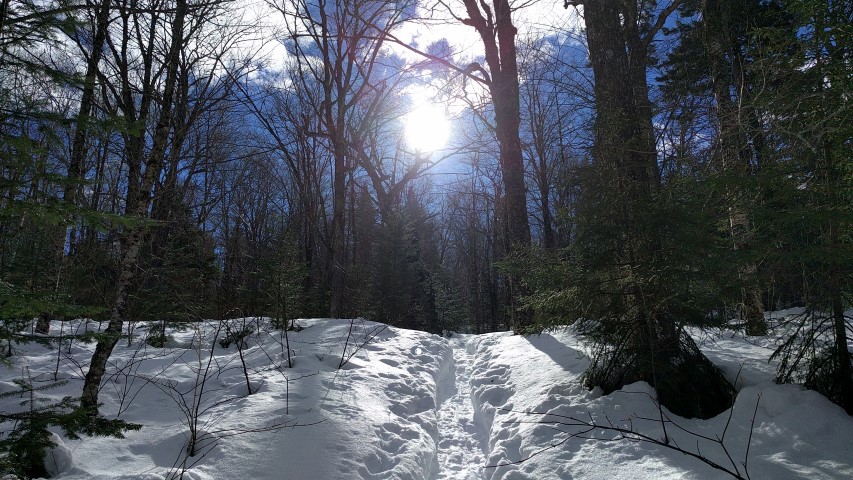
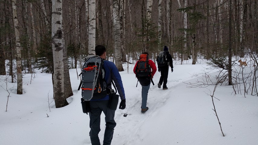
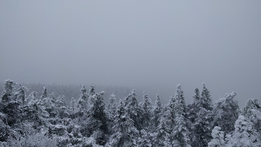
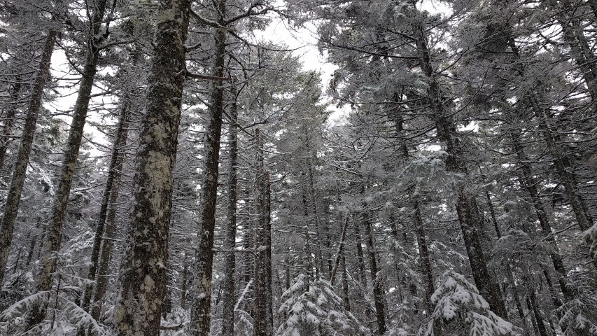
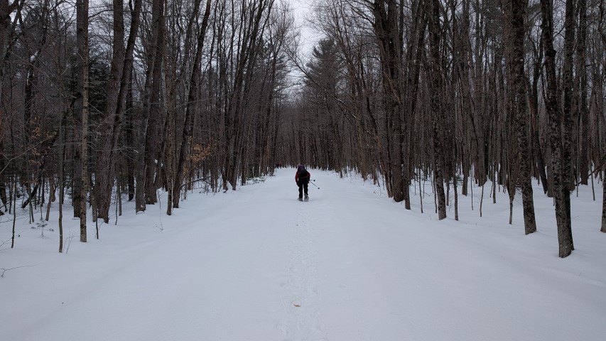
A hike along the Maine Appalachian Trail, and the side trails which link the AT to surrounding peaks, is most often measured in terms of mileage, elevation gain/loss, and hours or days spent on the trail.  Hikes, however, can also be measured in the progression of flora, leaves, mosses and berries as the weather and seasons change, the number of north or southbound thru hikers encountered, the sounds and sightings of wildlife, and the moments of joy shared with hiking companions.

Sunday, August 6, 2016, was a day in which all of the above were covered thoroughly, making for a full and happy day on the trail.

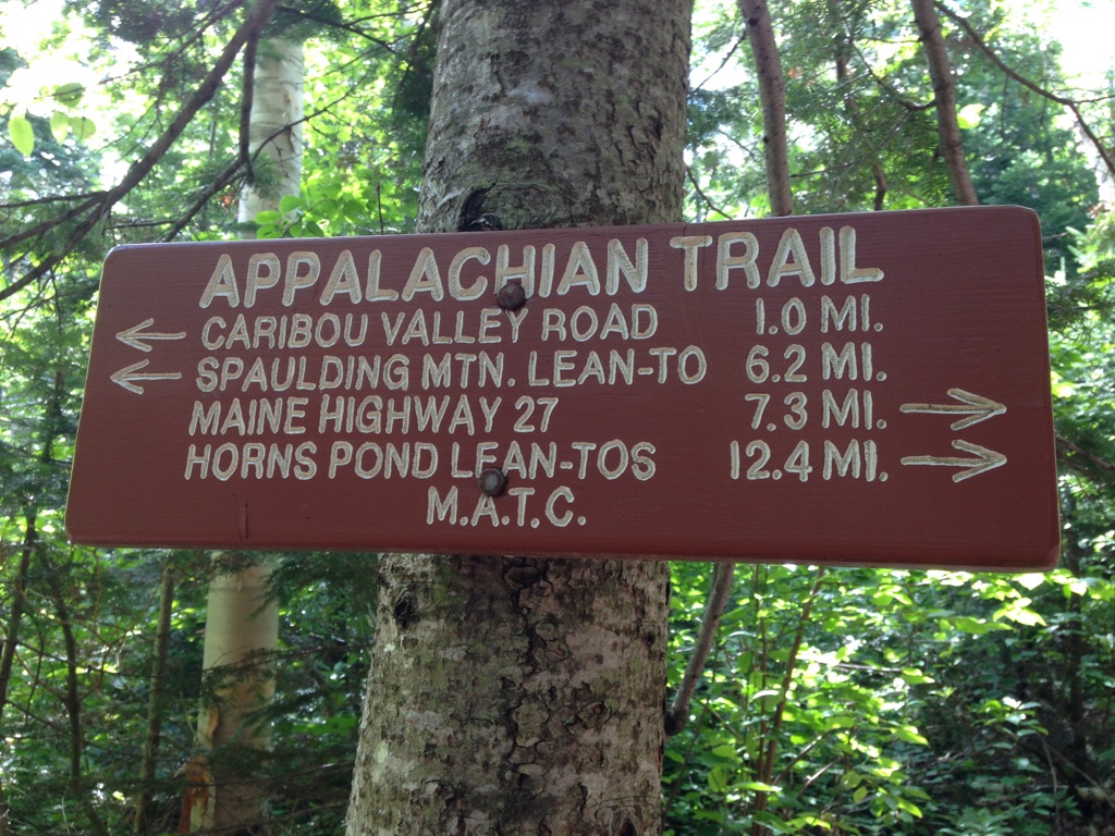
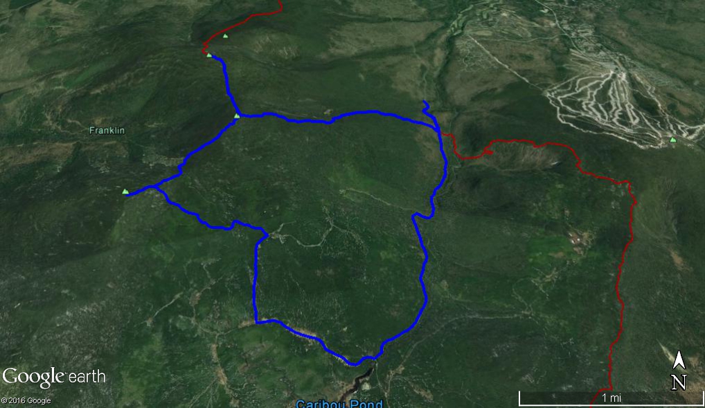
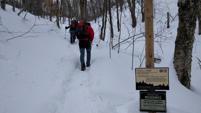
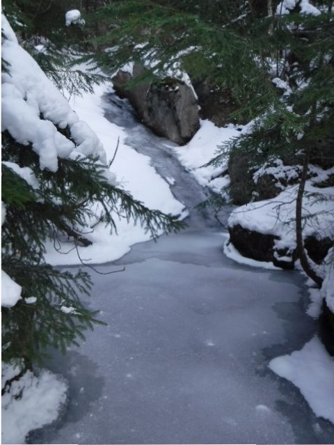
Caribou Valley Road “CVR” in Carrabassett Valley, Maine, intersects with the AT between Spaulding and South Crocker mountains.  CVR is a rough road that is impassable in winter and early spring, and gnarly even in the best conditions. It is an unmarked side road on the left side of Route 27, about 1 mile north of Sugarloaf Mountain Resort.

To find the trailhead on CVR, drive several miles until you reach a gate. Park there and put your boots on. Setting out on foot, you’ll cross a metal bridge and walk a half mile or so further along CVR.  The spot where the AT crosses is marked, but it’s easy to miss, so keep your eyes open for a small cairn and white blazes. Taking a left at that intersection leads to Sugarloaf, Spaulding and all points south, while a right turn will take you north, toward the Crockers.

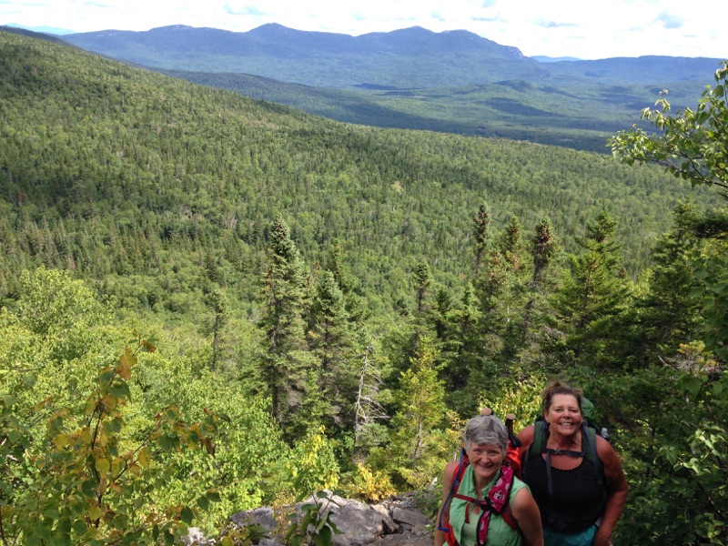
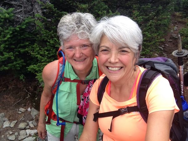
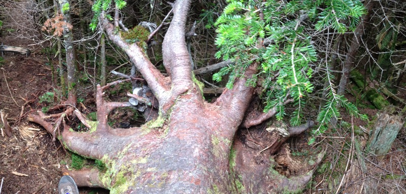
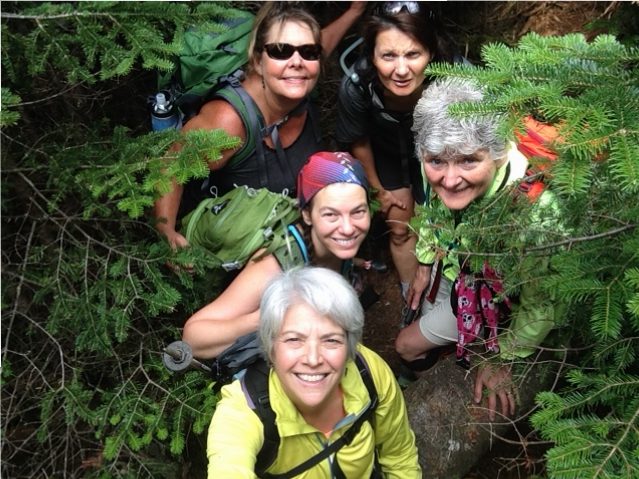
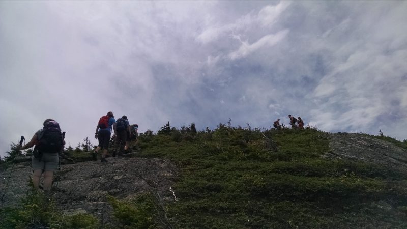
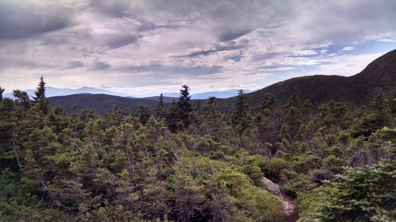
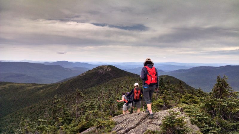
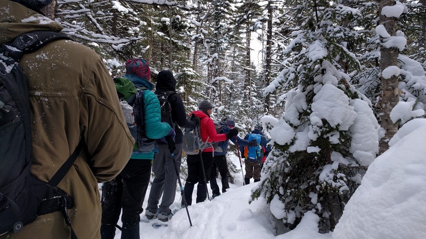
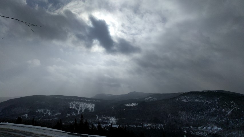
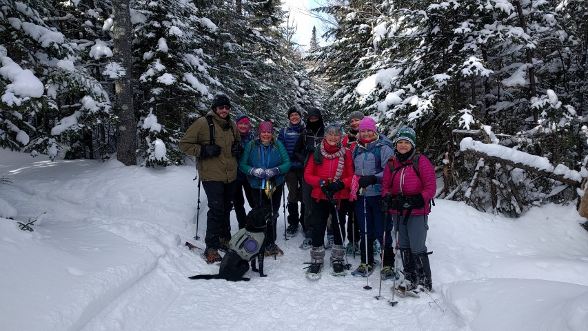
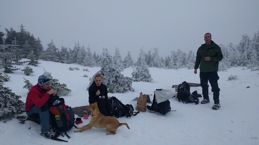
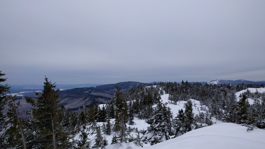
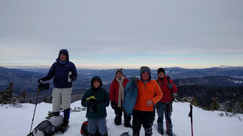
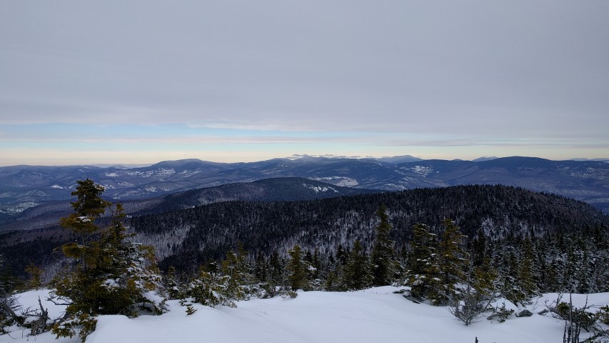
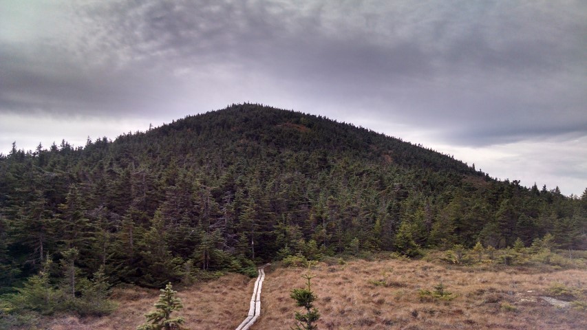
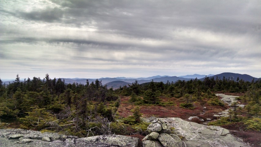
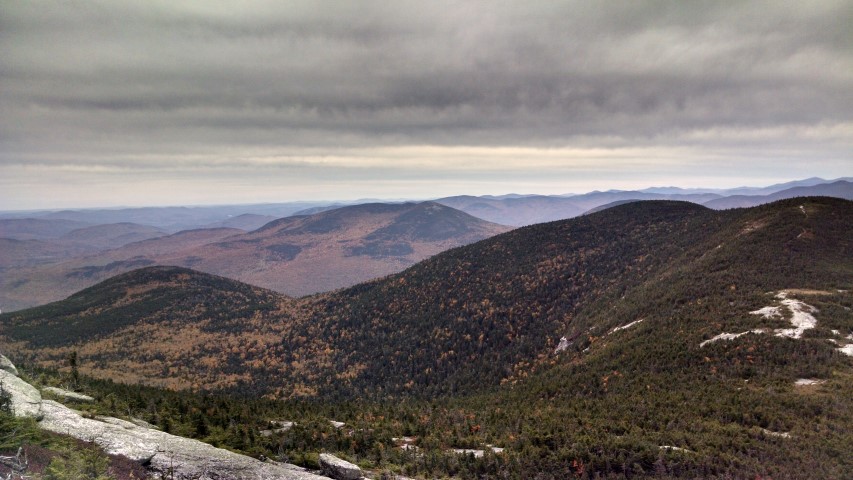
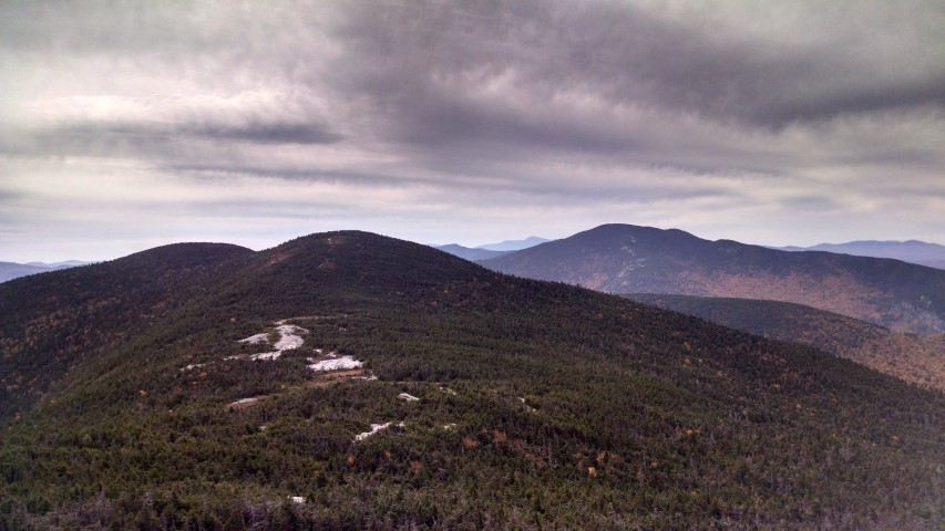
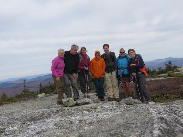
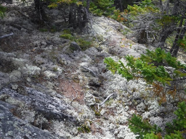
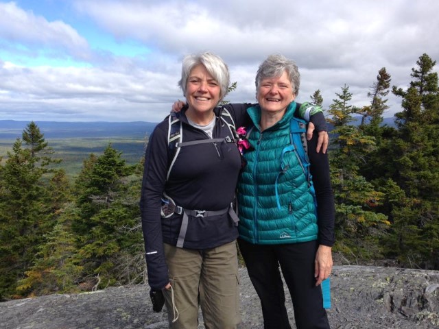
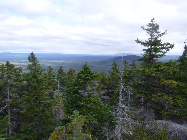
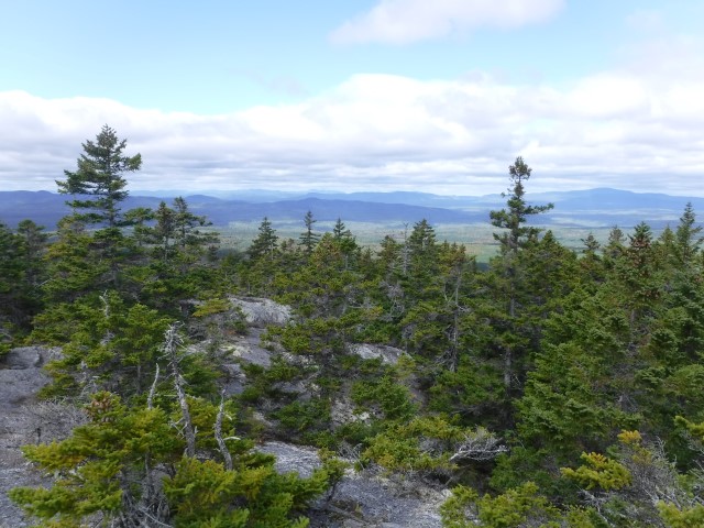
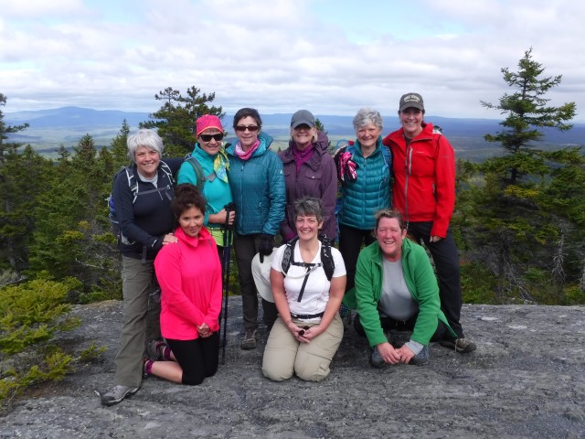
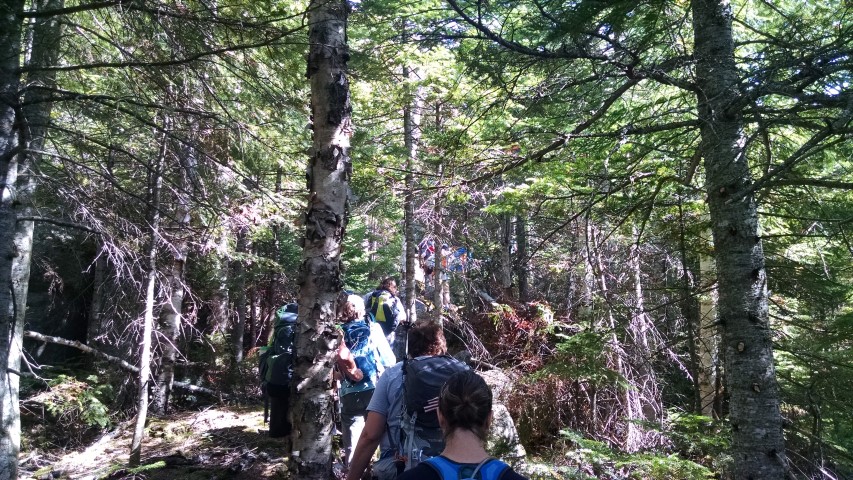
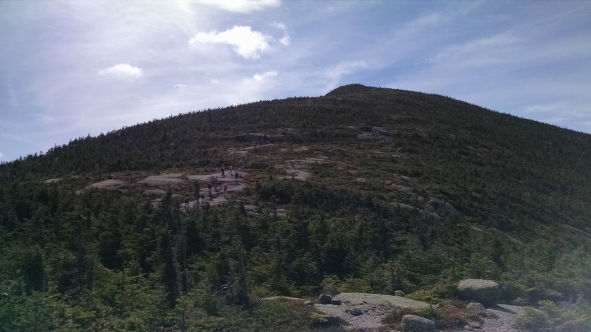
For our MATLT hike up South Crocker, North Crocker and Redington, our group of 5 women left the parking lot at 9:15AM.  The hike to the highpoint of South Crocker wound upward, gradually getting steeper and crossing several rock slides and a wonderfully healthy hanging bog, as we got closer to the summit.  The summit of South Crocker is heavily wooded, with a man-made viewpoint just a few steps to the left of the AT offering views of Spaulding and Abraham. The destruction caused by the recent lightning strike and forest fire on Middle Abraham was still quite evident.

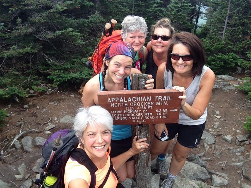
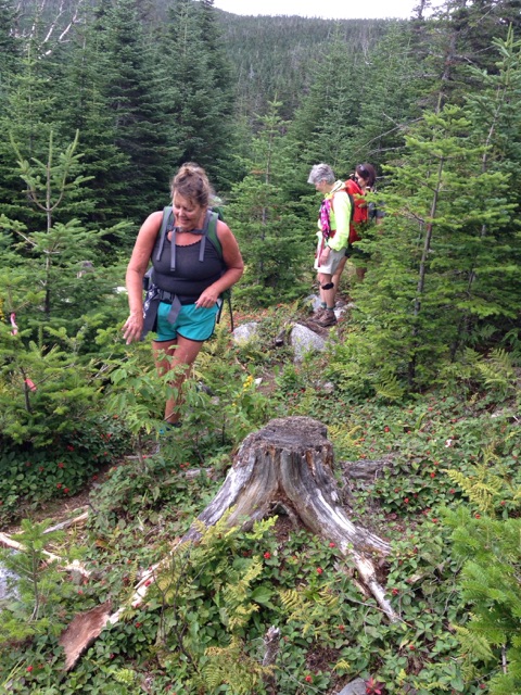
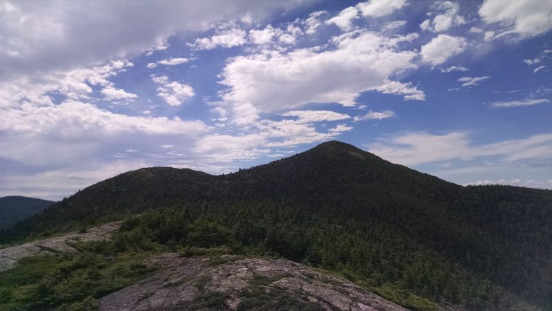
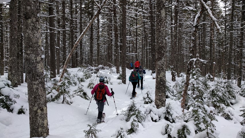
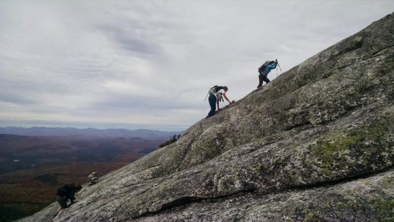
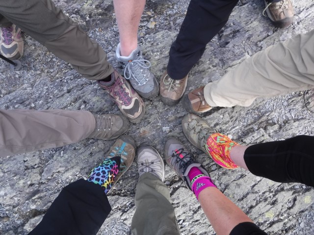
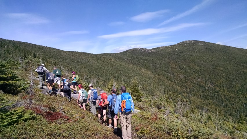
We continued on to the summit of North Crocker, just 1 mile further along the AT. After snapping a few photos and some fun trail shenanigans on this wooded summit, we returned to South Crocker to start our bushwhack to Mount Redington, one of Maine’s 14 4,000 footers.  To quote a hiker who we met (for the 2nd time that day at the summit of South Crocker) as he was returning from the summit of Redington, the trail to Redington “is the best unmarked trail he’s ever been on.”  This was our experience as well.  The trail to Redington veered to the right side of the side trail that led to the viewpoint on South Crocker, less than 20’ from the viewpoint.

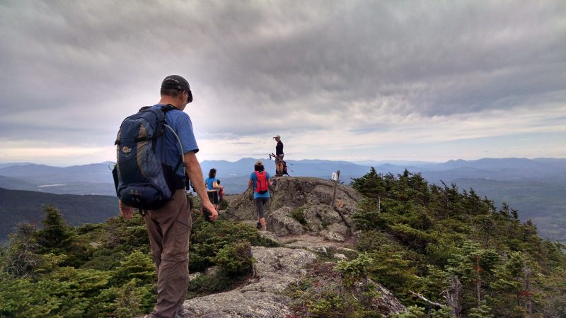
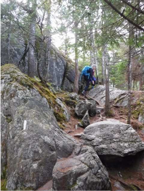
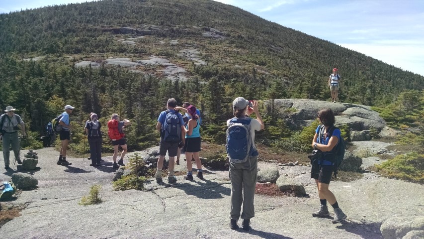
Although the Redington side trail was very narrow and unimproved, with blowdowns and some seemingly unnecessary twists and turns, it was marked with pink and orange ribbons, relatively well trodden, and was, for the most part, easy to follow.  After 1.2 miles we emerged in the clearing at the top of Redington.  The canister, which marked the true summit, was off to the side of the clearing on a path marked with blue ribbons.  Inside of the canister we found and signed the log book, adding our names to the list of those who had also found their way there.  Although the markers on each summit say otherwise, as the result of relatively recent updated surveys, the summit of Redington, like the summit of Spaulding, now measures more than 4,000’.

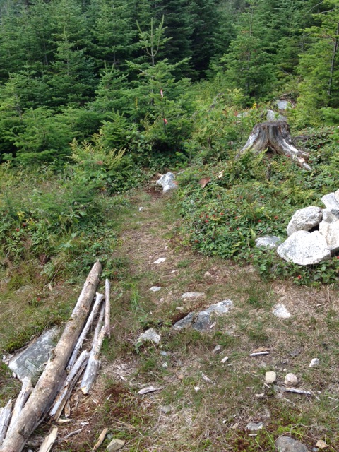
On the way up, one sharp-sighted woman in our party had noticed a side trail a short way from the summit of Redington. After checking maps and compass, we ascertained that this was likely the trail that would take us down Redington and back to CVR.  This trail proved to be somewhat more difficult to follow as it was even narrower than the trail up.  After a mile or 2, the trail emptied onto what appeared to be either an ATV trail or an old logging road.  Whatever they were, they were in bad shape.  Using our maps and compass, as well as GPS technology, we were able to make our way along these roads until we found the Carrabassett River and CVR.  Although we may have walked an extra 2 or 3 miles, we elected to play it safe and follow these rough “roads” all the way rather than chance a possible bushwhack through thick woods with no trail whatsoever.

Looking left as we walked along CVR, a quarter mile or so shy of where we originally joined the AT and entered the woods, we came across a side trail that might lead up ATV trails/logging roads to the trail we had taken from the summit.  Perhaps, next time, we’ll reverse our route and head up that way.

We emerged from the woods after nearly 11 miles, tired but with great joy and pride in what we had accomplished, and made our ways home.
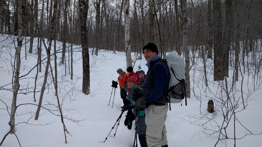
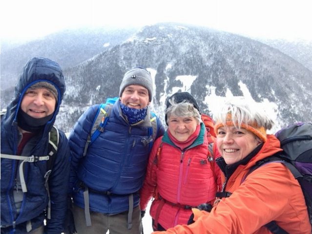
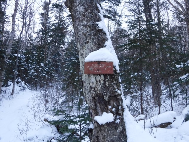
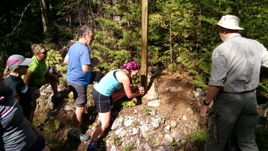
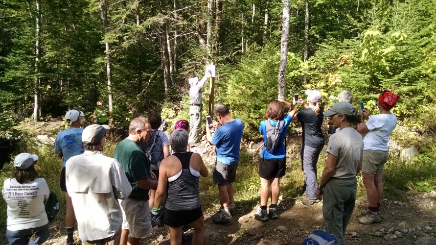
Goose Eye Mountain Hike

Ascending the ridge of the Wright Trail.
Views west into the Presidentials.
Summit of the West Peak of Goose Eye.
Descending the long ridge of the Wright Trail.
North peak of Goose Eye Mountain.

The Maine A.T. Land Trust hosted one of our semi-monthly Maine Hikes on the Appalachian Trail this past Sunday, up Goose Eye Mountain.  This peak in the Mahoosucs – the second highest in the area to Old Speck – is reached via the Wright Trail and the Appalachian Trail, and then a short spur from the A.T. to the West Peak (the highest of three peaks on the mountain).  According to the excellent Mountains of Maine, the Wright Trail was named for a local writer who contributed a number of articles on the region to AMC’s journal Appalachia.

The weather looked like it would hold, but the day started with one attendee getting lost on the way to the trailhead in Ketchum, north of Newry, near Sunday River Resort.  Even for Maine, the Mahoosuc Public Reserve Unit lands have confusing and/or non-existent signage which makes it difficult for hikers to find the trailhead.  The trailhead itself has no sign indicating which trail it is for!

Our group hit the trail just after 10am and proceeded up the Wright Trail.  Before reaching the final crossing of the beautiful Goose Eye Brook, two members of the group were stung by some kind of bee or hornet right on the trail (more on this later).  At the final stream crossing, the old north branch of the Wright Trail can still be seen with faded blue blazes on the trees, but the group continued on the main branch of the trail.  The northern branch of the Wright Trail has been closed for a few years.

The trail continues steeply from the brook until coming out at treeline on the mile-long ridge of Goose Eye Mountain.  The group was heading for the highest peak which is furthest to the west, at approximately 3,860 feet.  Along the way, we encountered three thru-hikers including Legs.  The ridge traverse is spectacular (and there were some blueberries left) but we were looking forward to lunch and it was with some relief that we reached the summit at 2pm.  After lunch, the group headed down and made good time all the way to the Goose Eye Brook crossing at the old junction.  Shortly after, yet another member of the group was stung by a bee/hornet near the same location as the others.  If you are allergic to insect stings, please be aware that there are bees/hornets on the Wright Trail between the big rock and the stream crossings.

The group reached the parking area at 5:30pm, making it a total time out of 7.5 hours.  The weather actually improved along the way and everybody had a great time!

Join us next month for our NPS 100th Anniversary hike!