By William L. Plouffe, Board President
Fulfilling the Maine AT Land Trust’s mission to enhance protection of lands surrounding the Appalachian Trail in Maine requires collaboration with others; non-profits, governmental agencies, corporations and individuals. To that end, Board member Tony Barrett and I recently took AT related field trips with representatives from some of those partners.
In August, we joined the Trust for Public Land, the Appalachian Mountain Club and Trout Unlimited on a site inspection of Bald Mountain Pond and Moxie Bald North Peak. After driving over ten miles of dirt roads, we launched canoes and kayaks from the State owned boat launch at the south end of Bald Mountain Pond and paddled north. Bald Mountain Pond has an essentially undeveloped shoreline, clear water and great depth that provides habitat for one of the very few Arctic Char fisheries in New England. On this clear day we took in the views of Moxie Bald and other peaks that border the pond and listened to a pair of loons. After a two mile paddle we pulled out at the Moxie Bald Lean-To and headed up the AT to the North Peak side trail. From the open summit of North Peak there are expansive views of Bald Mountain Pond and of the route of the AT both north and south. As of now, the majority of the shoreline of Bald Mountain Pond and a portion of North Peak, with old growth woodlands, are owned by Plum Creek. If they could be acquired for conservation they would be a great addition to AT experience; the type found in few places outside of Maine.
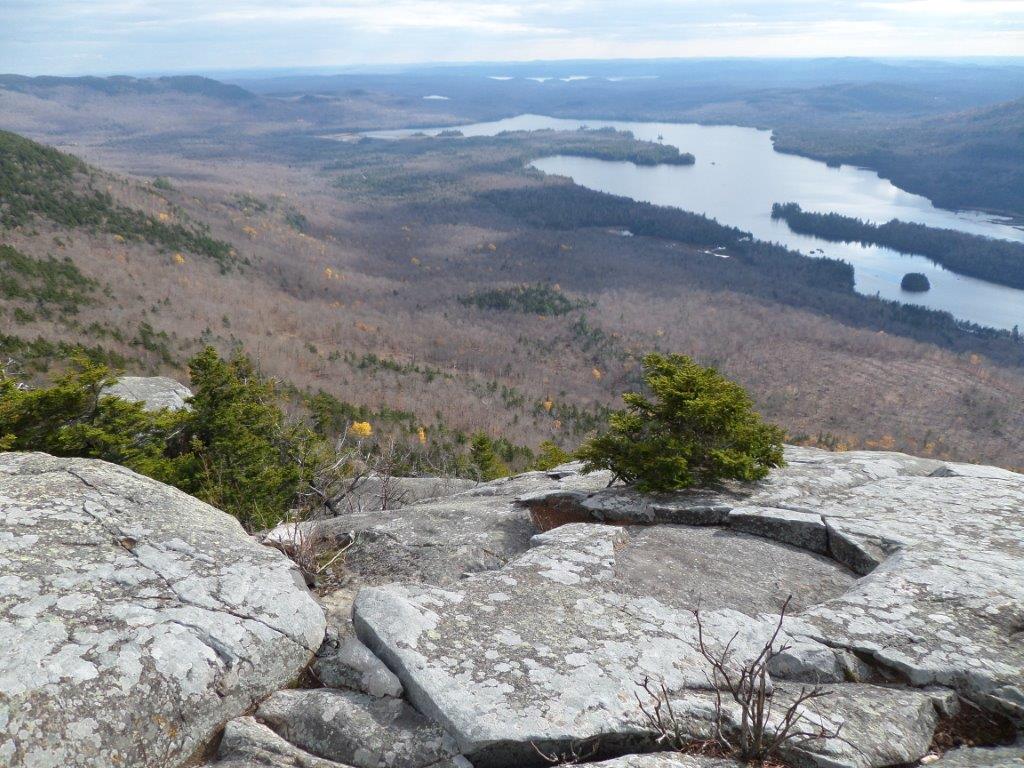
In October, Tony and I were part of the annual AT Partners Hike sponsored by the Maine Appalachian Trail Club. We were joined by Appalachian Trail Conservancy, National Park Service and Maine Department of Agriculture and Conservation. MATC President, Lester Kenway, led us on the AT as it follows Long Pond Stream to Slugundy Falls and then climbs steeply to Barren Mountain. Lester discussed the long running “debate” in the AT community about stream crossings in Maine, which are notoriously difficult. Should bridges be built? Should alternative routes that avoid the worst crossings be offered to hikers? Should the crossings be left as is as part of the adventure? MATC’s Overseer of Lands, David Field was also along and provided many historical anecdotes about development of the AT in Maine. While standing at Barren Ledges looking across Lake Onawa to Boarstone Mountain, Dave related the story of a dispute between Myron Avery and the Moore family, owners of Boarstone, over the correct spelling of the mountain’s name; Boarstone or Borestone. Things apparently got pretty intense and in the end Avery’s request for permission to have the AT linked to the mountain by a side trail was denied. To this day, the MATC map uses “Boarstone” and the DeLorme Atlas uses “Borestone.”
Having Maine AT Land Trust Board members out on the AT with partner organizations is not only very important but also a way to leverage the work of out one person staff. Besides that, it’s great fun!