
By Louise Jensen
A postponed hike from a rainy Saturday to a hot and humid Sunday left only 2 hikers to travel up to the Bigelow Preserve in Western Maine. The State of Maine website describes the Preserve: Located in western Maine just east of the village of Stratton about 40 miles north of Farmington, Bigelow Preserve includes over 36,000 acres of public land. The preserve encompasses the entire Bigelow Range, which includes seven summits. The highest of these at 4,150 feet is West Peak, one of only 10* Maine summits over 4,000 feet in elevation. Bounded on the north by 20,000-acre Flagstaff Lake, the preserve offers many opportunities for outdoor recreation.
The hike was a loop featuring 2 peaks this day, West Avery and South Horn, with a side visit to Horns Pond. We hit the trail just after 9 am and already the heat and humidity were rising steadily. Despite the conditions, we made it to Avery Col by noon, traveling via the Fire Warden’s Trail, the shortest route to reach Avery and West Peak. The last mile up to the col is a steep one, but we took our time and once there, we ate and relaxed on one of the tent platforms at the Avery Col campsite.
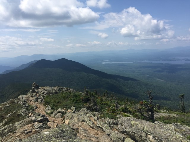
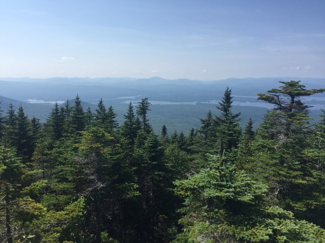
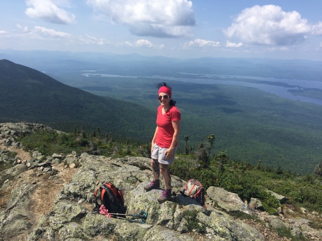
Sufficiently fueled and rested, we soon set out on the AT for West Peak, only .4 miles away. Hikers descending from the summit promised us that we would finally find the cool breezes and lower temps that eluded us all morning and we were not disappointed. A refreshing breeze (we even layered up a bit!) and hazy but oh so spectacular 360 views greeted us upon our ascent: Flagstaff Lake, Rangeley Lake, the Horns peaks, Avery Peak, Little Bigelow Ridge, Sugarloaf Mountain. The Bigelow Traverse along the AT is considered by some to be one of the most scenic hikes in Maine, and this hiker is in total agreement. We spent a considerable amount of time soaking in the magnificent views, taking pictures and chatting with hikers (not many through hikers this day). We even admired the rather unusual piece of hiking attire sported by a young woman hiking with a nice group of Canadian backpackers: a life vest! “Safety first”, she said. I guess no one was going to drown in Horns Pond today!
We still had a long way to go so we headed over to South Horn. We descended below tree line along a quiet and beautiful section of the trail. It was lush and green, with some easy footing, a relief from the rocky and bony pathways we hike so often in Maine. We ascended to the small conical summit of South Horn where we met the Canadian group again and took in a splendid view of Horns Pond, our next destination. We did not linger long and began our steep descent toward the Pond, passing up a trip on the spur to the North Horn as we still had a few hours of trekking ahead of us. In about a half mile or so we made it to the Pond where we took a short break, soaked feet, and admired this peaceful and lovely body of water nestled high up in the mountains. The peaceful part soon ended as our Canadian friends arrived and proceeded to strip to their undies for a refreshing dip. We contemplated doing the same as it was still hot and humid but we were heading out and they were staying the night. Note to self: next time pack a bathing suit (or at least an extra set of undies!).
We completed our loop hike by turning left off the AT and descending gradually on the Horns Pond trail, passing by a beaver pond and through a stand of spruce, and then continuing down among the hardwood trees to Stratton Pond Rd. Along the way we met one of the MATC Ridge Runners who was on his way to the Horns Pond Campsite to check in on our Canadian friends and another group camping for the night. We finally arrived at the parking area just after 6 pm, tired but happy after 12 plus miles of hot, humid, beautiful and amazing hiking.
* There are 14 peaks in Maine listed as 4,000 footers.