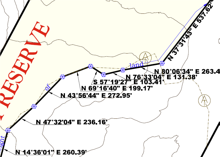
One of the values of the Grafton Forest Wilderness conservation easement is the protection it will provide to the Appalachian Trail itself, but this can be complicated. The above image of the survey map shows what we mean when we note this fact. On this map, the A.T. – the actual trail you are walking on in the Grafton Notch area in Maine – is denoted by the brown/beige dashed line with the famous “AT” symbol laid over it. When Grafton Notch State Park was created in 1963, it was assumed that the A.T. was within the white area shown on this map. That would mean that the trail was owned by Maine State Parks and was therefore open for public access forever. When we undertook the Grafton Forest Wilderness project with Northeast Wilderness Trust, they commissioned a boundary survey before acquiring the land (shown in yellow above) from a timber company. To everybody’s surprise, the A.T. treadway was actually located on the timber company land.
Northeast Wilderness Trust purchased the property without any restrictions, and by now adding a conservation easement to this land they own, we can apply guarantees of public access to the A.T. If you hike up to Old Speck Mountain from the parking lot in Grafton Notch State Park, you will still pass from that area into land owned by Northeast Wilderness Trust. But once the land is protected by a conservation easement, your right to continue into their land will be guaranteed. Northeast Wilderness Trust is a fellow conservation organization and would never do that! But enshrining rights of the public to the Appalachian Trail is extremely important to ensure that one of the nation’s foremost outdoor recreation resources is open to everybody forever.