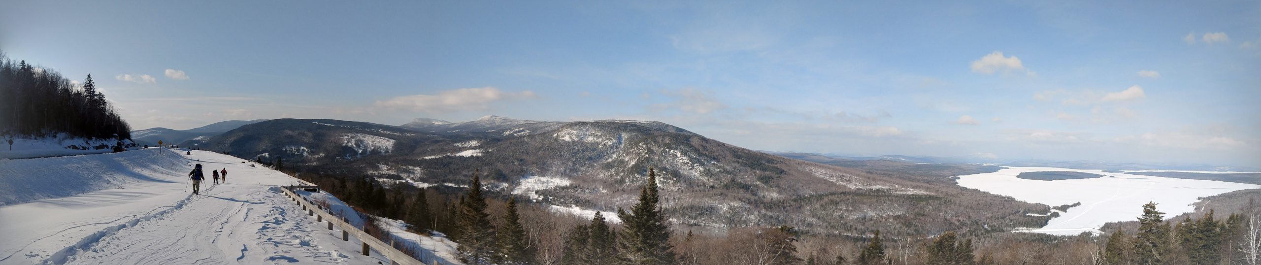
Maine A.T. 2020 Conservation GIS
In 2004, the Maine A.T. Land Trust published a report called Land Acquisition Priorities: Preliminary Analysis of The Trail from the New Hampshire Border to Baxter State Park. It was a comprehensive guide meant to be used by conservation practitioners focused on lands in the A.T. region of Maine. The organization was barely two years old when it was released but the ambitious title has been borne out in the decade and a half since. The publication was used as a guide to priority lands by this land trust and several other conservation organizations working in the A.T. region. It was cited in federal grant applications, scientific publications, on websites, in newspapers, and more. Most importantly, the Maine lands highlighted as priorities for conservation around America’s most famous trail have been protected. Where in 2004 there was very little protected land in the High Peaks, today there are an additional 25,000+ acres. White Cap Mountain, the highest peak in the 100 Mile Wilderness, was fully protected in 2017. Bald Mountain Pond was just conserved in 2019. The publication’s goal was to drive land protection for one of the most important areas of the Appalachian Trail and in that it was extremely successful.
While the Maine A.T. Land Trust was busy catalyzing conservation of these areas, the development and widespread availability of GIS data revolutionized how land conservation takes place. Paper maps, compasses, cameras and airplanes have been replaced by GIS mapping, GPS handheld units, smart phones and digital photography, and drones and LIDAR. A few years ago, we started gathering GIS data on Maine’s Appalachian Trail region. We talked to conservation partners to assess what their needs were as we entered a new era for protection of our natural and scenic resources. We built out an electronic database argued in meetings about what was in and what was out.
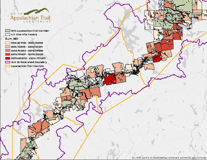
As Maine’s bicentennial approached and we closed the book on one of the priority projects from the 2004 report, the Maine A.T. Land Trust began using the data to highlight priority areas. In 2004 this work was done with paper maps, institutional knowledge and thoughtful analysis. In 2020, we have augmented these approaches with very precise quantitative data that is connected to every single parcel of land – all 3,317 of them – within one of either side of the A.T. in Maine. This data measures:
- Scenery Along the Treadway
- Views Beyond the Corridor
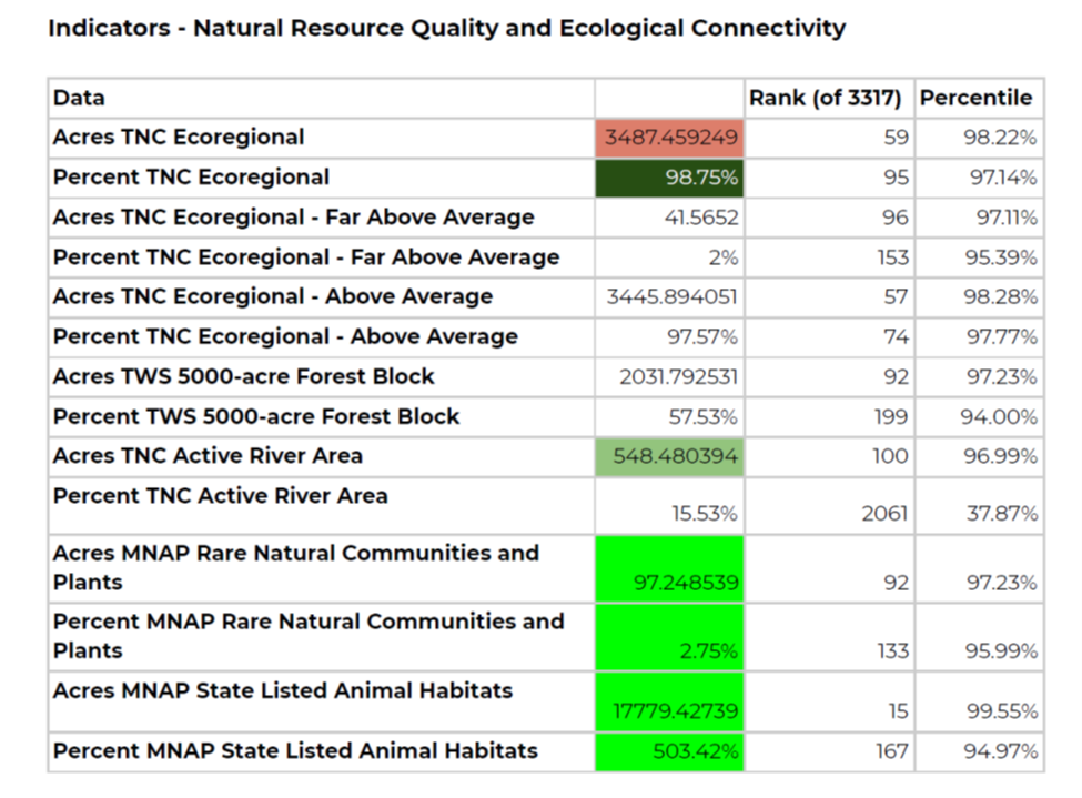
- Natural Resource Quality and Ecological Connectivity
- American Heritage
- Visitor Experience
The goal in creating this Maine A.T. 2020 GIS portal was to examine all of these parcels of land to determine where the next priority areas will be for Appalachian Trail conservation in Maine. The greater goal, however, is to use the priority areas and underlying data to help catalyze conservation efforts across this landscape. The A.T. region in Maine comprises some 4 million acres; knowing where to start, or where the greatest concentration of conservation value might be, can be a daunting exercise. We now have a tool that attaches numeric values to these thousands of parcels of land, so we can rank them, assess them, see which are valuable in terms of acres and which are valuable in terms of percentage.
This tool was designed to be used by any conservation organization working or intending to work in the Maine landscape near the Appalachian Trail corridor. At this time the data reports we create to assess individual or aggregate parcels are created for partners at no charge, just at their request. The Maine A.T. Land Trust is excited to now be sharing this work for those who need it and look forward to advancing landscape-scale conservation with the Maine A.T. 2020 program!
If you would like to see a demonstration of the Maine A.T. 2020 Parcel Prioritization Tool, please contact us at info@matlt.org.