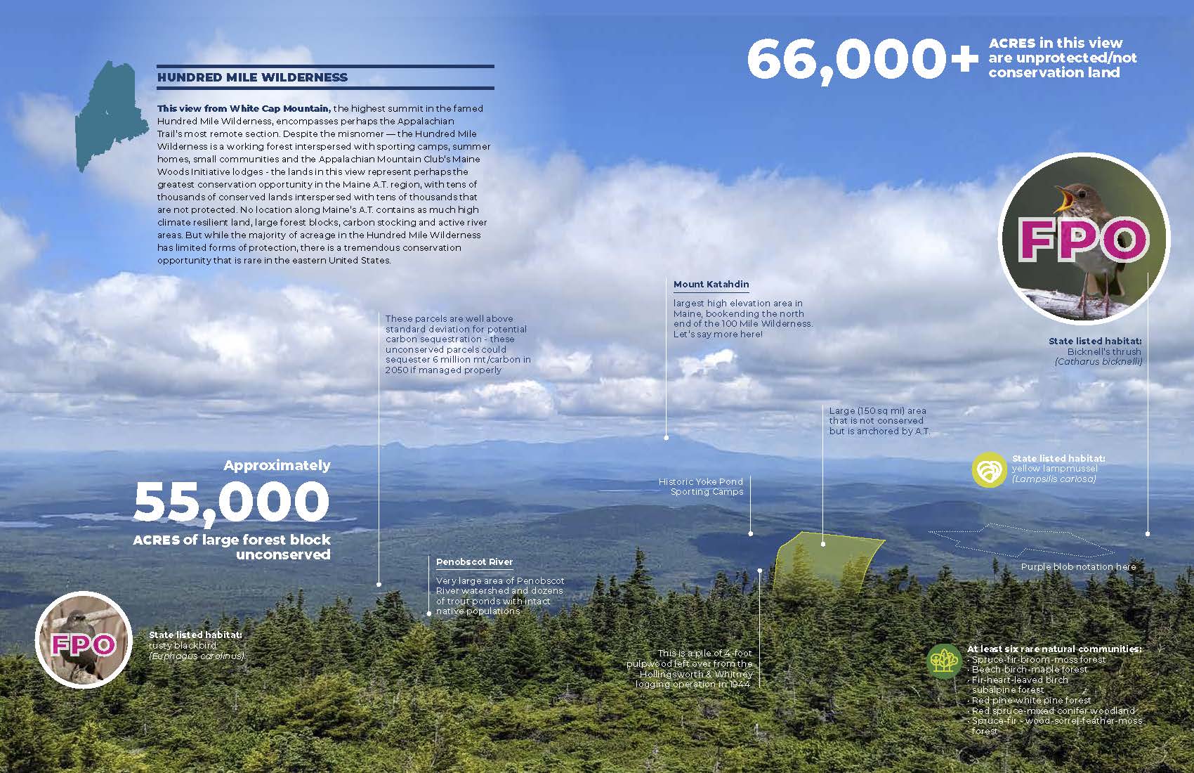
First created in 2020, MATLT’s innovative mapping tool will be getting a refresh and will feature image outputs in 3D! The MATGIC tool (Maine Appalachian Trail Geospatial Information for Conservation) focuses on ecological values in the landscape and is now trying to assess data from a human perspective. This view is looking north from the summit of White Cap Mountain towards Katahdin, over the Hundred Mile Wilderness. What makes this a special landscape? Why does it look like this? What are the ingredients of a healthy ecosystem and a recreation destination?
Later this summer, MATLT will be publishing a report with this information on about a dozen of these views. For now, you can catch up on the Maine A.T. 2020 report for background on where this data comes from and how we made it look so awesome.