Category: Events

Sugarloaf/Spaulding/Abraham Tripleheader Hike

Spaulding and Mount Abraham (with smoke on the middle peak).
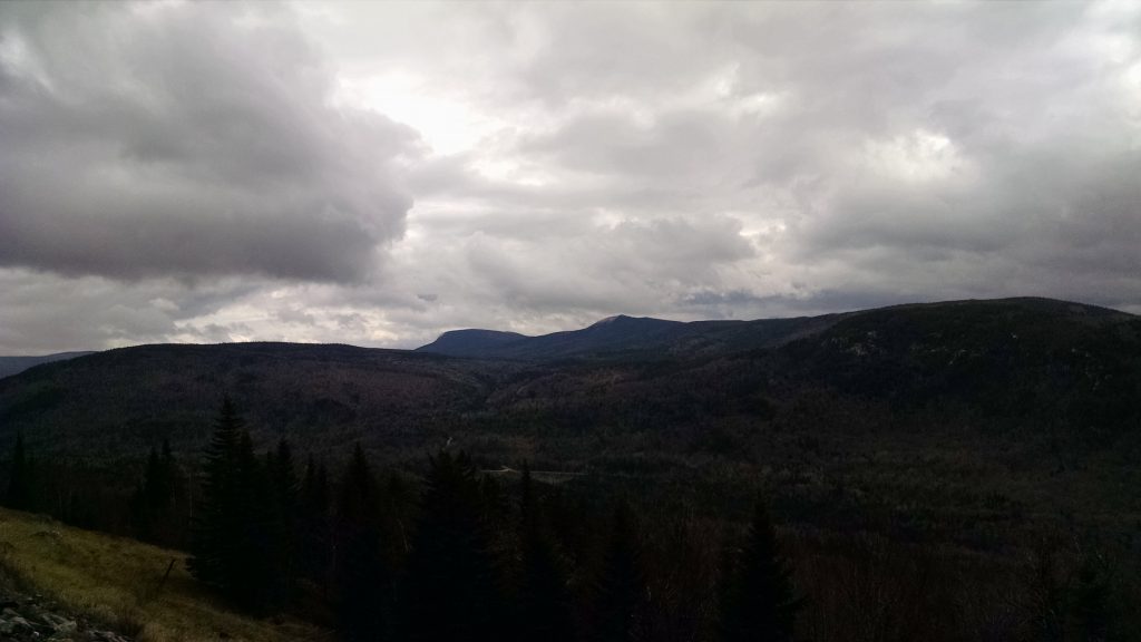
Redington Pond Range over the shoulder of South Crocker.
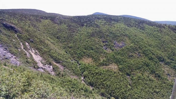
Ravine on flank of Sugarloaf, with Spaulding poking above.
The approach to Mount Abraham.
Summit of Abraham.
Helicopter dumping water on Abraham forest fire.

By Deb Carroll

We chose the weekend after the summer solstice for the occasion of the Maine Appalachian Trail Land Trust’s Spaulding Option Hike, which at a minimum meant hiking up Spaulding Mountain but there was the option for an overnight with two more peaks.  The plan was to spot cars at the Mount Abraham Fire Warden Trail trailhead, and then proceed to the Caribou Valley Road A.T. crossing in another car.

After meeting in Kingfield, we spotted one car in the small parking lot about a half mile from the Mt. Abraham trail head. We proceeded down West Kingfield Road and found Rapid Stream Road, the road to the trailhead, to be marked with somewhat rough and inaccurate signs, but we made it there so they got the job done. After the hike out, we discovered that the 2 new bridges between the parking lot and the trailhead were in excellent shape and the roads dry and smooth enough for most any vehicle. Next time, we decided, we would drive all the way to the trailhead.

Caribou Valley Road is just under a mile north of the Sugarloaf Access Road and is not well marked. Look for the steep grade sign and a left turn onto an unmarked dirt road which turns back sharply. After about 5 miles of rough road we came to a locked gate and a small parking lot where we began our hike.  Though the road does continue, it is not passable by car and so we walked the half mile or so to the place where the Appalachian Trail crosses CVR. It’s tough to spot, so if you’re taking this route keep your eyes open for a small cairn on the right and white AT blazes just off the road. We entered the woods on the left side of CVR.  Once on the trail we travelled on a moderate grade for a mile or so when the trail began to get steep and rocky. After 2.3 miles, we arrived at the spot where a side trail would take us .6 miles to the summit of Sugarloaf, our first 4K of the weekend.  According to the Maine Mountain Guide book, Sugarloaf, at 4,237’, is the 3nd highest mountain in Maine and boasts the best views in Maine, second only to Katahdin.

Although with beautiful blue skies the views were, in fact, quite grand, we found the most significant characteristic of the landscape to be the 27+ acre forest fire on the summit of Middle Abraham, the location of a MATLT easement, 4 peaks to the south of where we stood. In a phone call to the Maine Warden Service (yes, we had phone service up there), Simon Rucker, Maine Appalachian Trail Land Trust’s Executive Director, learned that the blaze had been sparked by lightening several days prior and had flared up again that morning. As we watched, helicopters circled dropping fire suppressant materials.  The helicopters would circle overhead for the rest of our trip.

Descending back to the AT, we said goodbye to Simon, who was not spending the night, at the junction, and 4 of us made our way across the high ridge and up to the summit of Spaulding Mountain, elevation 4,010’.  That evening found us making dinner and setting up camp at the Spaulding lean-to with several other groups, including a colorful group from the Montreal Outdoor Adventure Club.

After a great night’s sleep and a good breakfast, we followed the AT for 1.1 miles to the junction of the Mt. Abraham side trail, and after another mile or so of walking in lovely, dense forest, we emerged rather abruptly onto a large talus field mixed with some of the most pristine alpine garden areas I’ve ever seen.  The approach to the summit of Mt. Abraham is in wonderful condition with flowers blooming, thriving greenery, and short but healthy evergreens, and the views were magnificent under a blue sky.  At the 4,049’ summit of Mt. Abraham, looking toward Middle Abraham which was now just 1 peak away, we watched a helicopter circle and drop materials onto what we presumed to be hot spots on the far side of the mountain. As the helicopter made its way back to Kingfield to pick up additional materials, 2 spots on the scorched mountaintop began smoking. Though we saw no additional flames, judging by the continual sound of 2 helicopters tag-teaming as we made our way toward the trail’s end at Rapid Stream Road we understood that the danger had not yet passed.  The total mileage for day 1 was just over 6 miles. The 2nd day’s mileage totaled approximately 7.

Look for details regarding the next Maine Hikes trip in July, up Puzzle Mountain in Grafton Notch.

Maine A.T. Land Trust Day at the Ballpark!

Three land trust employees man the table.
Entering to win…
WINNERS!

The Maine Appalachian Trail Land Trust had our annual day at Hadlock Field for the Portland Sea Dogs game!  We gave away twenty tickets and had the customary hat raffle, giving away one hat per inning to a lucky entrant.  As you can see from the pictures above, one guy one in the 2nd inning and then his daughter won in the 8th!

Thanks to the Sea Dogs and U.S. Cellular for making the outing possible.  One of the most important aspects of land conservation is community outreach, and this event is purely about getting out there and meeting people in a fun environment.  It makes it all the easier when you’re hanging out with great people in a great venue.

Old Blue Mountain Hike

Old Blue Mountain (left) and Elephant Mountain (right).

The next Maine A.T. Land Trust hike will be up Old Blue Mountain (3,600 feet) from South Arm Road in Roxbury on June 11th at 10am for National Trails Day.  To reach the trailhead in Black Brook Notch, drive east on Route 120 out of Andover, and then take a left on South Arm Road approximately a half mile outside of town.  Go 7.7 miles north on South Arm Road to reach the Appalachian Trail crossing.  There is a small area on the right side of the road that has parking for 3-4 cars, so we will be car pooling.  That information will be sent out if you RSVP.

The hike is only 2.8 miles to the summit of Old Blue from the parking area, but the initial ascent out of Black Brook Notch is very steep.  There are rungs on the rocks in one area, but after this initial climb of 900 feet in just over a half a mile, the trail level become more gradual for another mile and a half.  The final half mile is again steep to reach the summit of Old Blue where there are good views in all directions among the stunted spruces.

The estimated time for this hike is 5 hours total (up and back) over a distance of 5.6 miles (up and back).  You must RSVP for this hike so we can rideshare and in case of cancellation due to weather or other circumstances.  We are also going to be providing some food so we need an accurate headcount!

To RSVP, please head over to the event listing and enter your name and email.  You can also email us at info@matlt.org or call us at 207-808-2073.  This should be a great hike!  Come along!

Spruce Mountain – First Hike of the Season!

Maine Appalachian Trail Land Trust’s first of many warm season hikes will be on Sunday, May 15th – destination, Spruce Mountain.  This 2,530-foot summit is very close to the famous Height of Land overlook (see map above), which is where we will meet at 10am in the parking area.  We can proceed to the summit of Spruce Mountain and then down the backside to series of remote, high-elevation ponds within the Maine Bureau of Parks and Lands’ Four Ponds area.

This is a very moderate hike and we can choose to make it shorter or longer, depending on ability, conditions and interest.  It is a great way to get out on the A.T. in Maine without having to navigate woods roads or climb steep mountains.  In any case, total mileage will be about 3 miles with the only ascent/descent involving approximately 300 feet of elevation gain on either side of Spruce Mountain.

You must RSVP for this hike by emailing us at info@matlt.org or by calling 207-808-2073.  Sign up soon – we will limit the group to ten hikers!

2016 Maine A.T. Land Trust Hikes Calendar

Heading up the last leg.

So we can all plan our summers more efficiently, without further ado, here is our schedule for the 2016 hiking season!

Spruce Mountain – May 15

Old Blue Mountain – June 11

Sugarloaf and Spaulding Mountains – June 25

Puzzle Mountain – July 9

Goose Eye Mountain – July 30

National Park Service 100th Anniversary Hike (TBD) – August 25 or weekend directly after

Saddleback Mountain via Berry Pickers’ Trail – September 18

Pleasant Pond Mountain – September 25

White Cap Mountain – October 8

These day trips are part of our Maine Hikes program to get people out on, and interested in, the Appalachian Trail landscape in Maine.  All of the hikes are led by staff or trained volunteers and there is no cost.

These dates are subject to change, but we plan to adhere to them as much as possible.  It is likely that we will be squeezing more hikes in between these dates, too.  As we get closer in time to each hike, there will be an extensive post with information about time, trails and terrain.  We will also be populating our events calendar on our website shortly so you can access the information and share with your own calendar.

We look forward to seeing you all!

Great Maine Outdoor Weekend Mount Abraham Hike

thumbnail_l

Our Great Maine Outdoor Weekend hike is set – Mount Abraham won the poll by a landslide so we will be heading up there on Saturday, September 27th at 9:30am.  You MUST RSVP for this hike either by emailing us at info@matlt.org or by RSVPing here at our Facebook page.

We will be posting lots of info about the fascinating ecological highlights of Mount Abraham, the mountain’s history, and Maine A.T. Land Trust’s work there over the past ten years.  A great place to start is the Maine Bureau of Parks and Land’s Management Plan for the area.

And of course we will be posting full directions and updates on the weather as we get closer to the date.  Don’t forget that we will have a limited supply of the wonderful GMOW posters to give away at the trailhead.


Introduction to Hike Peaks Region Hike – August 31

We’ve finalized our date for the hike – Sunday, August 31st at 9am.  Normally our hikes are just for members who have donated in the past, but this will be open to all.  Meet in the parking area off East Madrid Road at the trailhead of the Perham Stream Birding Trail.  The location is roughly across from 658 East Madrid Road in Phillips.  Take Route 142 North from Phillips and then take a left on East Madrid Road.  The parking area is on the left side right after you cross over Perham Stream.  Please refer to the map below but continue north of the pin to the area opposite the large farmhouse, just across the stream.  RSVP on Facebook or by emailing us.


Maine A.T. Land Trust Events Summer 2014

Now that summer is here, we are planning a few members-only hikes for later in the season.  Don’t worry if you aren’t a member yet – all you have to do is head over to our support page and give as little as $1 to be eligible to attend.  There will probably be:

  • An “Introduction to the Hike Peaks” hike, led by Kirsten B. Burbank of the Sandy River Land Trust and Carson Hinkley, a Madrid resident whose family has lived in the town(ship) continuously since the early 1800’s.
  • A hike/bushwack up the new Berry Pickers Trail to the Saddleback Mountain ridgeline, which will be an official Appalachian Trail Side Trail when completed.  At this point the trail has not been fully cleared, so this one might get pushed into the early fall.  We are very excited to have this trail opening up an additional route to access Saddleback Mountain.

Check back here soon for updates on these hikes.