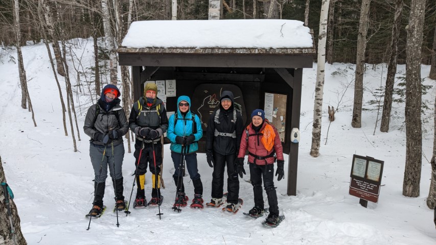
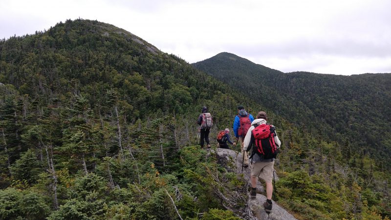
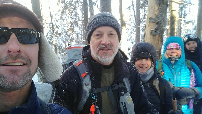
Starting out!
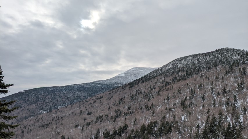
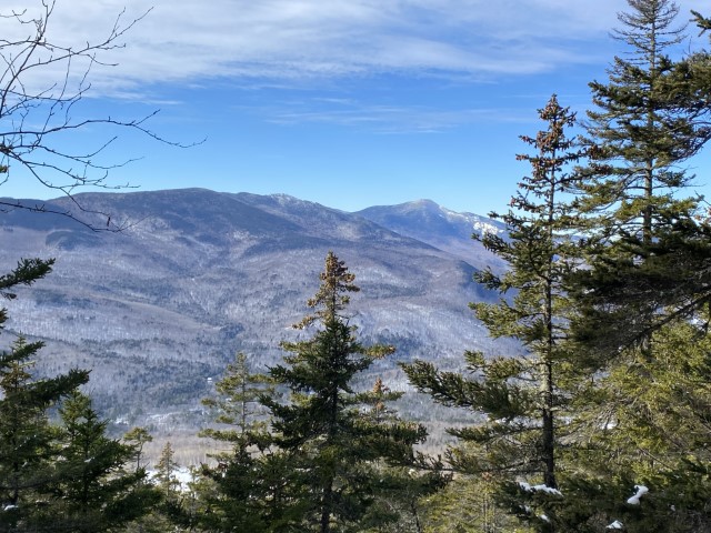
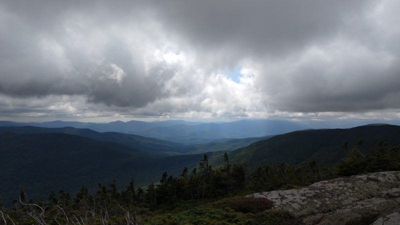
View of Old Speck from top of the Eyebrow.
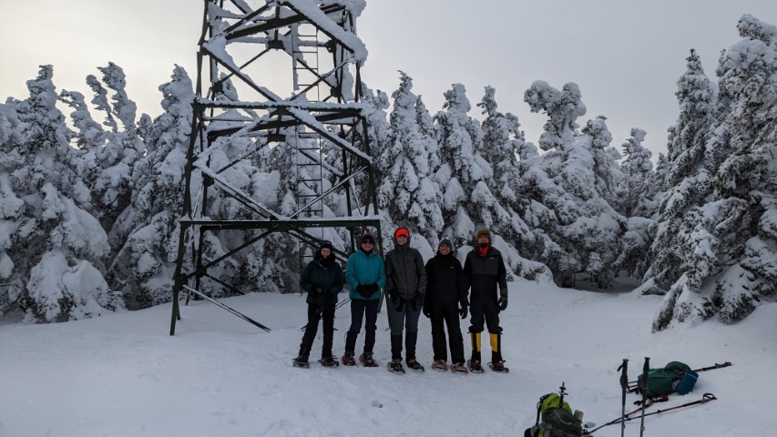
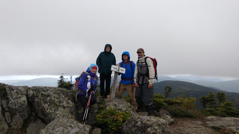
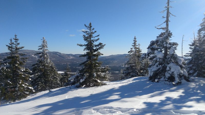
Summit scene, with fire tower.
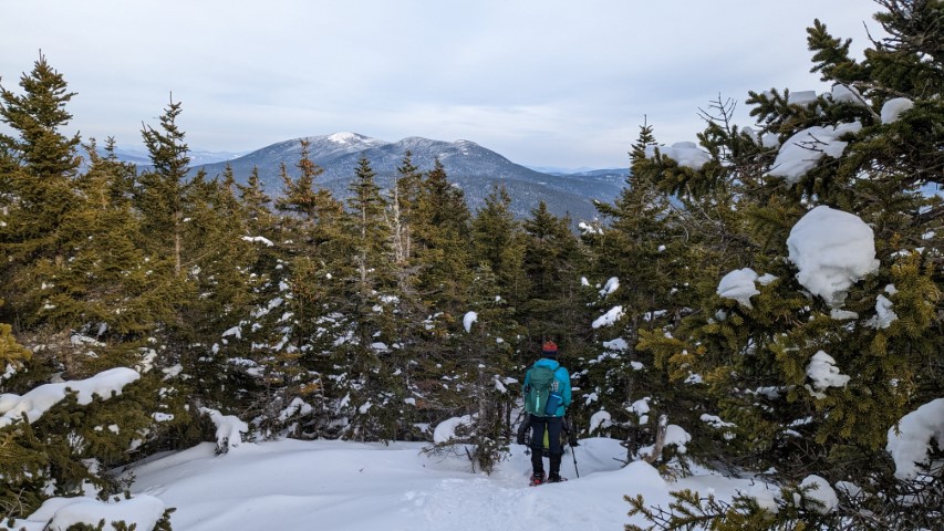
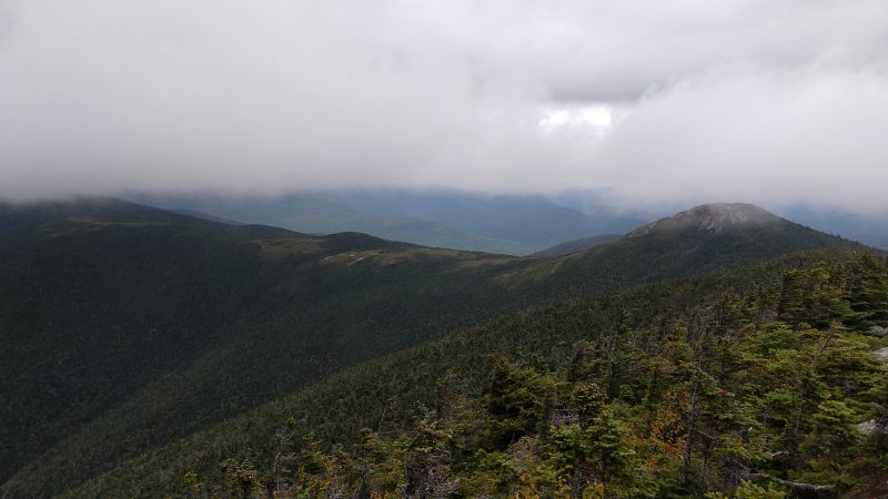
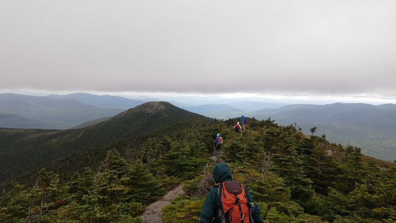
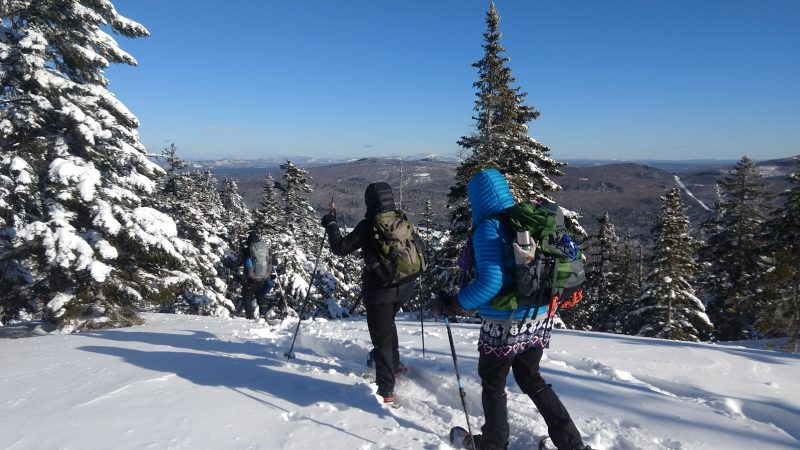
Baldpate Mountain in the distance on the descent.
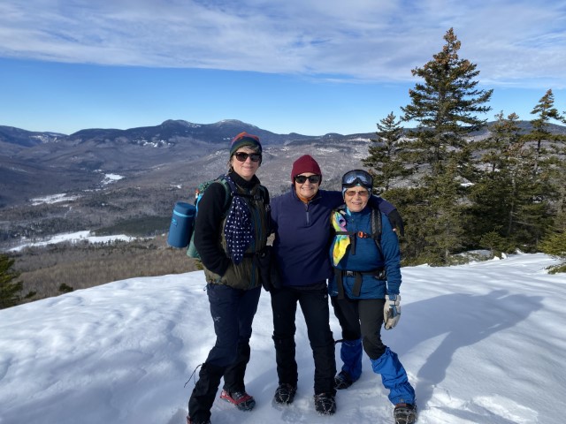
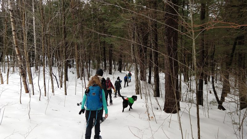
Oh Snap! Old Speck hike, postponed until after a record-breaking cold-snap, a success.
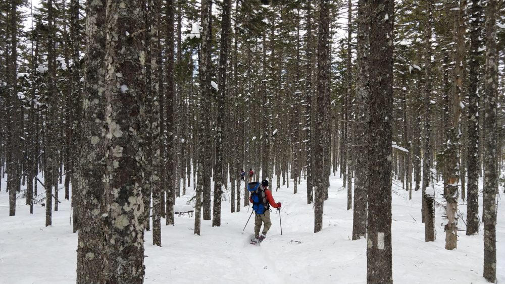
Record-breaking low temperatures would not stop a group of six hikers from ascending Old Speck on Sunday, February 5, 2023. In fact, it was the cold snap on Saturday, February 4, the originally scheduled hike day, that convinced trip leaders to reschedule the trip to occur 24-hours later. Four individuals from MATLT and two community guests gathered at the parking lot around 9 am and trekked throughout the slightly-below freezing morning until they summitted the A.T. Old Speck trail just before 2 pm. About halfway through the ascent, the group was very close lands of the South Tract of
the Grafton Forest Wilderness Preserve project. In 2023, MATLT continues to work with the Northeast Wilderness Trust to acquire a forever wild conservation easement to ensure permanent protection of this landscape, though the preserve was not visible through the dense and fluffy snow blanketing the thickly forested mountain.
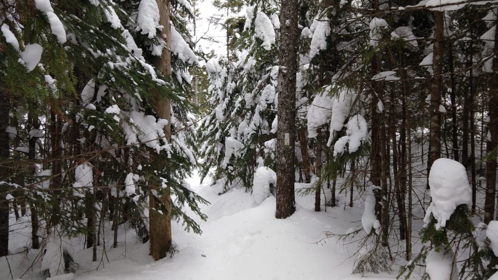
Snow-shoes were required the entire way up and down the mountain. All had a challenging but happy time – brightened by plenty of amusing bum-sliding on the way down. Most of the trail was slightly packed by perhaps a half-dozen other hikers, but rare moments without snowshoes were met with frequent steps into one-two feet of unpacked snow. Frequent snack
breaks and layer adjustments were warranted due to the length of the hike, which purports to be 7 miles total but was tracked on several smart watches as closer to 9 miles. At the top, hikers posed for some photos, rested briefly,
and opted not to climb the incredibly dangerous and icy fire tower. As the group neared the parking lot, sunset approached but headlamps were not necessary. All were incredibly relieved to step onto solid ground (asphalt) and remove their snowshoes. The two vehicles which carried the hikers departed and all made it home safely that evening. Though tiring, this hike was a success and those who were new to MATLT’s community hikes program appeared interested in continuing to participate.
MATLT’s first community hike of 2023 and of the winter season was scheduled for Saturday, January 14, but the weather a few days before and the day of was less than ideal. Fortunately, everyone agreed to postpone the hike and it was worth the wait. Sunday proved to be a sunny, almost bluebird sky kind of day, with moderate temperatures and although a bit windy, nothing to stop three happy hikers from summiting Puzzle Mountain in Grafton Notch.
Puzzle Mountain is part of the Stewart Family Preserve, named after Bob Stewart, who donated the land to the Mahoosuc Land Trust for permanent protection from development. The Puzzle Mountain Trail, part of the Grafton Loop Trail, ascends from route 26 and continues to the open summit of the mountain after passing several ledges with great views of the Bear River Valley, the Mahoosuc Range and the Presidential Range. About 0.1 miles before the summit, there is a sign for the Woodsum Spur trail that branches toff o the right. As expected, the spur was not broken out so was not on our itinerary.
The views from the ledges and the summit were beautiful as promised, but the ascent was slow. Although, micro-spikes were adequate, there was a light covering of crunchy snow that kept us marching along at a slow to moderate pace. Once at the top, and after some obligatory pictures, we sat behind the summit cairn to get out of the wind and enjoyed our lunches. A few other hikers summited while we ate but did not hang around for long. One very friendly hiker did stick around just long enough to take our group picture for which we were grateful. Of course, we returned the favor.
We did not leave the summit until after 2 PM as our ascend was not exactly timely but the trail on the way back was now packed down from our tracks and those of the other hikers. This made for a quick decent and we were down in just over two hours. As we headed down over the ledges, we were treated to the same lovely views but with that late winter afternoon sunlight that is easily more beautiful than any other time of year.
The sun was starting to set as we pulled out of the parking lot, and we were treated to a beautiful sunset. The perfect ending to just about a perfect hiking day.
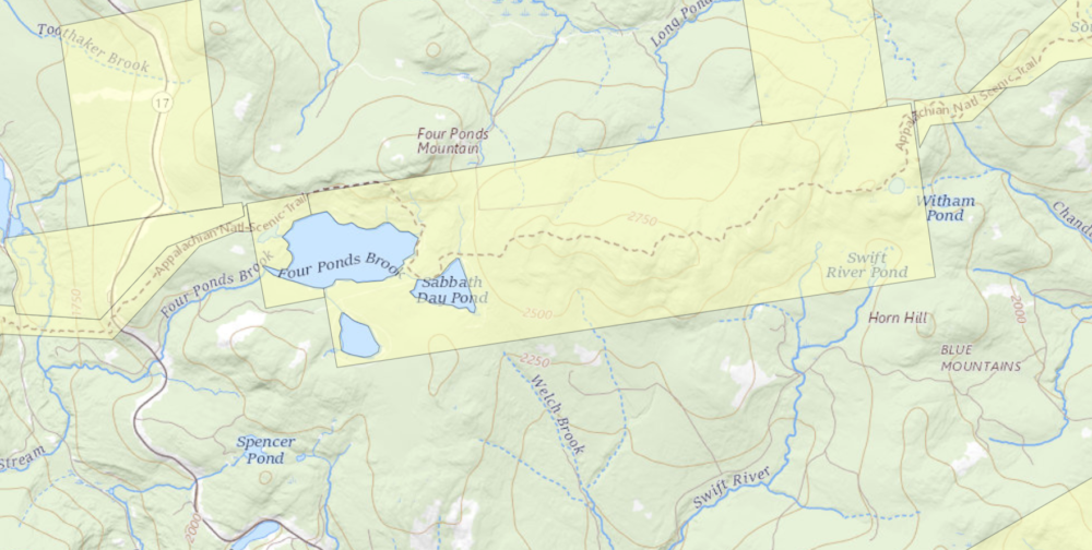
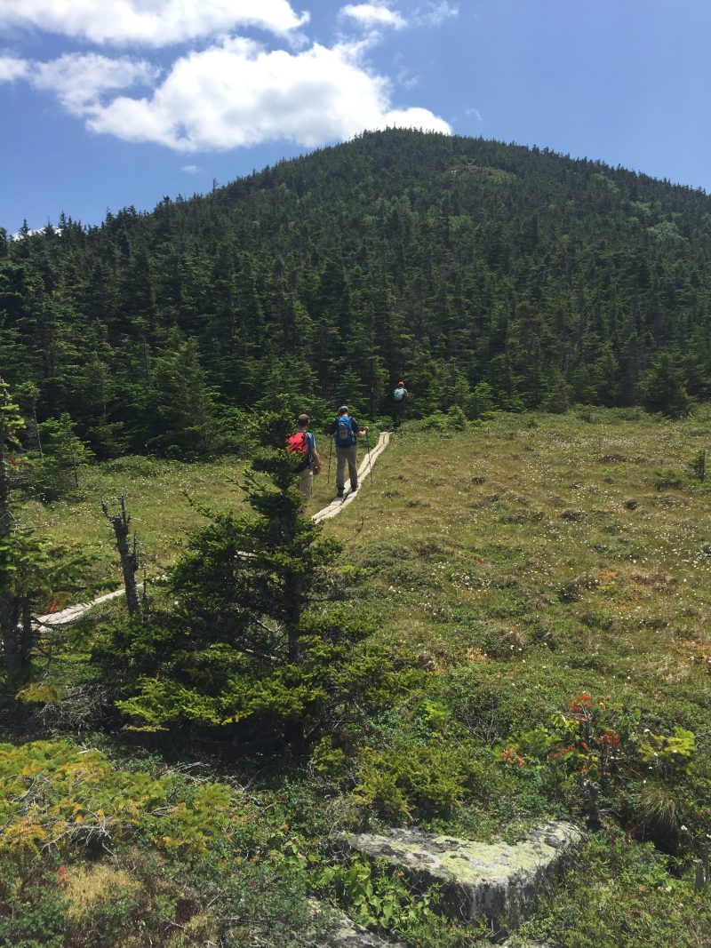
One of the hidden gems of the Appalachian Trail in Maine, the Four Ponds area is generally not well travelled in either summer or winter (except for thru-hikers). Due to the tranquil aspect and beautiful forest scenery, the hikes in this area never fail to disappoint. The location on a high plateau provides for some rugged terrain and the snowcover is generally deeper than other lower elevation areas, too.
The Maine Appalachian Trail Land Trust has been guiding hikes for the public to the Four Ponds area for years, and its popularity has only increased. The terrain is not steep like many sections of the A.T. and access to the trail here is from a public road (Route 17). For this hike, we had four people meeting up on a Saturday morning, with the temperature hovering around zero but with light winds.
On the A.T. heading into the Four Ponds unit off Route 17.
We strongly encourage hikers to prepare for even lower temperatures than they might expect, since this tends to be a snow and cold section. The group for this hike was experienced and well-prepared – though temperatures would rise nearly 40 degrees by the end of the day! We set out from the Height of Land parking area on Route 17, which is the Rangeley Lakes Scenic Byway. During the winter the parking lot – generally filled with cars during all hours summer – is not plowed, and you have to park approximately 1/4 mile north, in a snowmobile parking area on the right side of Route 17. On this day, there was a small plowed area that fit two cars and we parked there. Take care walking by the road!
The A.T. is just south of the parking area and we entered the woods after negotiating the ice-covered rocks by the side of the road. Four Ponds does contain named mountains like Spruce Mountain (2,530 ft) and Four Ponds Mountain (2,925 ft) but these are relatively low and there is not significant elevation gain or loss on the section of the A.T. to Sabbathday Pond. The trail immediately off Route 17 contains the steepest portion of the hike, gaining a few hundred feet of elevation in just a few tenths of a mile, but thereafter meanders up and down over knolls and these small mountains. There hike is initially through an open mixed spruce-hardwood forest where the A.T. can be difficult to find in winter since you can’t see the footbed of the trail. Our group lost the trail for about fifteen minutes before pressing on anyway and finding the trail pretty quickly thereafter.
Spruce forest on the slopes of Spruce Mountain.
The forest type then changes to a dense spruce-fir forest that in winter is tunnel-like and very quiet. Sounds are muffled by the deep snow and all is quiet. Normally you can hear snowmobiles on nearby trail networks, but on this day there were none. We proceeded on towards the first of the “four ponds” – Moxie Pond. First, we pass through one of the sublime areas of the A.T. in Maine, a forest of great beauty that is one of the highlights of the Four Ponds trek.
Lovely forest.
The forest surrounds Moxie Pond and Long Pond further on, which is the largest in the area, and for the third time in recent years we were treated to sets of Canada lynx tracks on the unbroken trail in front of us. We stopped for lunch on the shore of Moxie Pond.
Moxie Pond.
At lunch, we assessed our progress and decided that we’d turn back. Winter hikes prior to daylight savings have a short window where it’s safe to be out, and we were having a great time just taking it easy being out in the woods. On previous winter trips we have made it to Long Pond and in the summer reaching the beach and lean-to at Sabbathday Pond is a fairly moderate hike (3.6 miles). Having to break trail in snowshoes with four feet of snow on rugged terrain takes longer, and we were happy to turn around at about 1.8 miles.
One of the nice safety features of this hike is the fact that there’s a flat snowmobile trail bailout route (which is a woods road in warmer months that provides access to camps on the southern shore of Long Pond). A hiker in our group was having some issues with boots causing discomfort and we decided to do him a favor and use the snowmobile trail for the portion of the return trip west of Moxie Pond. It is easy to follow, flat and mostly downhill back to Route 17, where you have to walk along the road to get back to the parking area. We chatted with a few passing snowmobilers on the way out, and were back at the cars by 2:30pm.
Join us for our next hike on March 21st to Little Bigelow Mountain!
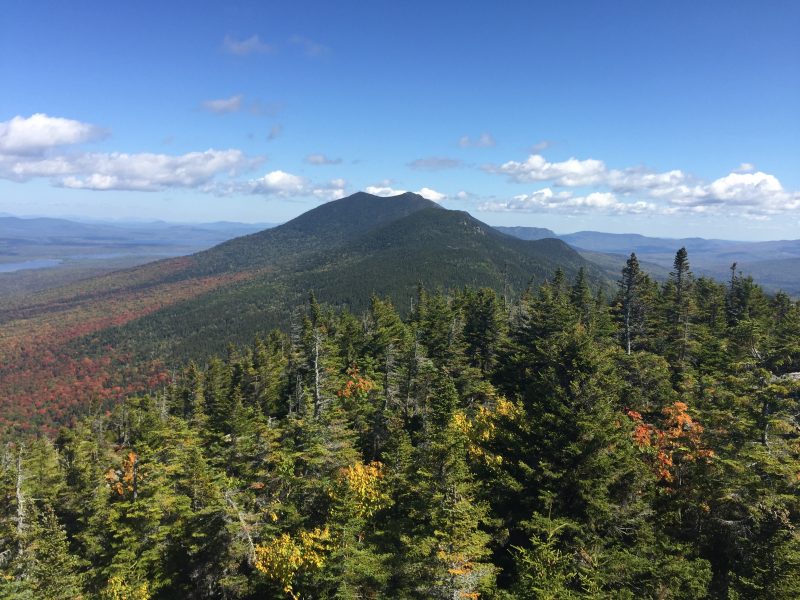
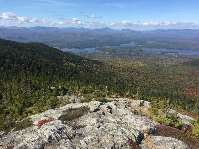
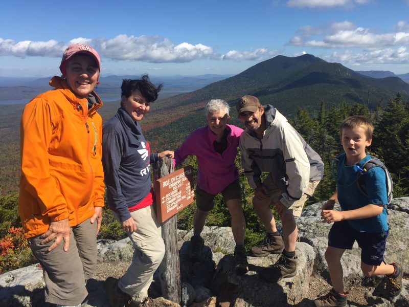
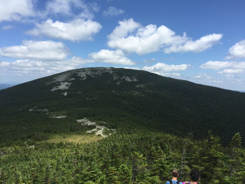
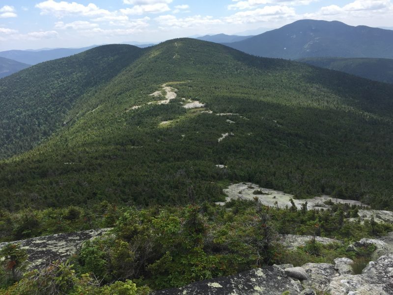
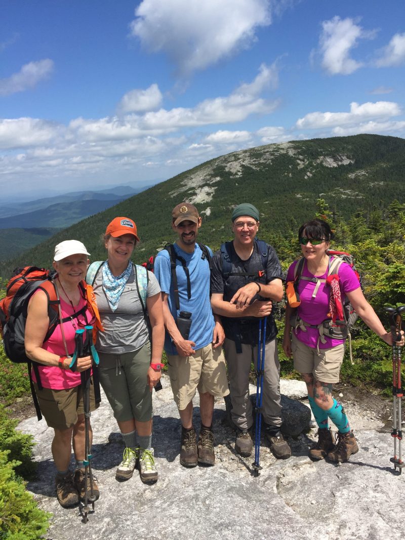
Our most recent community hike was to Cranberry Peak, part of the Bigelow Range located in the Bigelow Preserve in western Maine, just east of the village of Stratton. The 36,000-acre Preserve was established in 1976 by public referendum, and is managed by the Maine Bureau of Parks and Recreation. The Bigelow Mountain Range with its six high peaks is found entirely within the Preserve. Cranberry Peak is the Westernmost of those peaks, topping out at around 3,194 feet.
We had ideal weather for hiking: warm late-summer temperatures and beautiful, blue-bird skies. The summits were in the clouds as we traveled to the trailhead but weather forecasts predicted blue skies on the high peaks and that is exactly what we got. Four hikers came out this day, all the singing praises of the weather gods. We made an up-and-back trek on the blue-blazed Bigelow Range Trail totaling about 6.4 miles.
The trail starts out fairly flat but soon makes a steep climb to an area called Arnold’s Well. There is a side trail to take you to the ”Well” but we skipped that opportunity to continue on to the summit. Soon we came to another short side trail leading to “the Cave”, but we saved that for our trip back down. The trail continues steeply, much of it over open ledges and finally reaches the summit. 360 views of Flagstaff Lake and the major peaks awaited us there. It was cool and breezy but not cold, and soon we sat down for lunch along with a family with 2 young kids and 2 Norwegian Elk Hounds. The 5 year old just made her first “big peak” hiking debut and was clearly on her way to becoming a lifelong hiker along with her older brother. We initially met this family in the parking lot and then encountered them on our way up as they were turning back thinking they either missed a trail or the summit was just too far ahead. We assured them they did not have far to go and that they would
be rewarded with magnificent views when they got there. Just like us, they were not disappointed by the vistas from Cranberry and were grateful we encouraged them to continue on.
After about 45 minutes or so we headed back down, with 3 of us making the 200-foot side trip to “the Cave”. The Cave is a large overhanging slab of rock that you can easily climb up into. After a few goofy photos, we rejoined our other hiking companions and completed our trek down. Another day well spent in Maine’s High Peaks!
Let’s go!
Getting ledgy.
Bogs on A.T. towards Mahoosuc Notch.
Summit!
North Peak, showing A.T. thruhiker.
Sun’s out!
By Louise Jensen
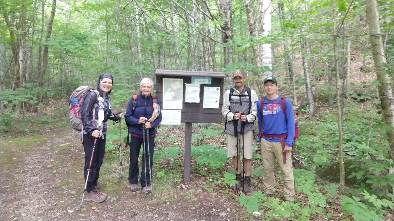
Goose Eye Mountain with its two peaks, in the Mahoosuc Range is one of the Maine A.T. Land Trust’s most popular community hikes, and one of the most strenuous. Five of the original ten sign-ups chose to ignore the weather forecast of 40% chance of rain, and head to the hills. The group gathered at the Wright Trail trailhead, a scenic trail that begins off Bull Branch Road in Ketchum that is located on a branch of the Sunday River. Bull Branch Road is also home to a popular swimming area called Frenchmen’s Hole.
The day started off cloudy, chilly and even a bit humid, but luckily for us, the rain held off, although leftover clouds from the edges of hurricane Dorian threatened from time to time. We traveled along the trail where it follows the Goose Eye Brook, passes a designated campsite at about 2.5 miles and then crosses the brook. The trail continues to ascend with some very steep and rough up-and-down sections and eventually takes you onto open ledges. Even with the clouds and mist that dogged us most of the day, we still had some pretty amazing views, especially on our return trek.
We eventually summited on to the West Peak (the main summit) where it was cool, damp and breezy so we layered-up before hunkering down to eat lunch. Despite the clouds overhead, we were still awarded great panoramic views of the Presidentials and the surrounding peaks in the Mahoosuc Range. We did not linger to long as the sun continued to elude us although we could see it shining in the distance. As we made our way back, the skies started to clear and we were treated to some clearer views of Mahoosuc Notch and the surrounding landscape. Back at the trailhead, the sun came out and the temperatures warmed up but no one lamented the fact that we had less than perfect weather; we were all completely delighted to have the opportunity to hike one of Maine’s amazing mountain peaks.
East Baldpate
West Baldpate
VICTORY
The bog in question…
By Louise Jensen
The Maine Appalachian Trail Land Trust hosted its first community hike of the season to Baldpate Mountain in Grafton Notch. There are two summits: the somewhat wooded West Peak at 3,662 feet and the wide-open and beautiful bald East peak at 3,780. This rugged hike, complete with bog planks, ladders and open bald ledges starts on the east side of ME Route 26 and follows along on the Appalachian Trail heading northbound.
Five hikers participated this day, two who had not hiked the Baldpates before and were promised a bit of a wow factor. It was a warm, slightly muggy and a little-bit-buggy day but the skies were clear and really, it was an almost perfect day to be on a hike in the Maine mountains. We started out around 9:25 or so, stopping briefly from time to time to sip water, have a quick snack or sometimes chat with AT thru hikers, many of whom are finally heading through Maine. Along the way we took the .2 mile detour to visit the Baldpate lean-to.
We soon arrived at the West peak and sat down just beyond the summit to eat lunch and admire the views looking Northeastward toward the East peak. After lunch, we gathered our things, took some pictures and headed off to the East peak.
No hike can be complete without a minor mishap or two and this day was no different. There is a small boggy area below the summit of the East peak where the bog planking has long since disintegrated. Over the bog are some scrawny tree branches serving as some pretty anemic plank substitutes. Two of our hikers took a nice step into bog while trying to negotiate the “planks”. One ended up with a soggy and completely mud- covered boot, but a dry sock and a plastic bread bag (hiker hack to keep the foot dry from the inside of a wet boot) saved the day.
Up the East peak we went and the wow factor kicked in. The views as you climb up or down from the East peak never disappoint, especially on a clear day like we had. We hung out on top of the open summit with its 360° views and after awhile reluctantly headed back down. The descent was uneventful – no bog mishaps – and we reached the parking lot safe
and sound and quite satisfied with our day’s hike.
On a brisk February morning, a group of intrepid women gathered in Portland to organize the carpool up to Height of Land, 30 miles north of Rumford, where out trek would begin. Also joining us was Simon Rucker from Maine Appalachian Trail Land Trust who would be one of our two guides for the day. We left Portland around 7:30 in two vehicles. One car made a brief stop at the Lewiston Park and Ride to pick up Mark (our other guide) and his trusted canine companion Benton. After a brief pit stop in Rumford for humans and dog, we arrived at the parking area at Height of Land around 10am. Another car with 4 more LAC members joined us there, and we all headed out at 10:20. The view to the Northwest, over Mooselookmeguntic Lake and beyond was clear and beautiful! With snowshoes on, we hiked south along Route 17 for approximately .4 miles to where the AT crosses the road. Here, we headed north on the AT. Right away, the trail went steeply up Spruce Mountain, through deep, soft snow. Several of us took turns breaking trail, which was hard work, but served to warm us up! After the strenuous uphill, the trail leveled out, and we had to make a few detours around some blow downs. We saw moose tracks and scat along this section. The snowpack that we were on top off was at least 3 feet deep – you could tell by the white blazes on the trees that mark the AT – they were about 2 feet above the snow and these are usually just above eye level in the summer! There was another climb, and then we went down and crossed a well groomed snowmobile track. From here, we trekked along a gentle down hill, and then a level section which had very deep snow with uneven terrain. At one point while Gillian was in the lead, one of her snowshoes went in so deep she become stuck in the snow. It took two of us about 10 minutes to dig her out. There were Gray Jays at one point, and one that landed on an outstretched hand! Eventually we arrived at the north shore of Moxie Pond and around 1:15. Here, we stopped for about 30 minutes for a standing room only lunch, and a group photo. Everyone was staying warm and dry, and there were plenty of hand and foot warmers to go around. Simon and Gillian had plenty of yummy snacks to share.
The return trip was much faster than the way in – we were following a nicely packed trail and made excellent time, returning to the parked cars around 3:15pm. There was a gentle snow falling as we hiked out, and when we reached Route 17, the view was completely clouded over and a strong wind was blowing across the road. I estimate our total mileage was around 4.5 -5 miles round trip.
I went to bed that night with a perfectly drowsy and happily satisfied feeling after my first day out with The Ladies Adventure Club!
Scenes from the hike.
Heading up in the sun.
Selfie
Great views northward along the A.T.
Bright and cold.
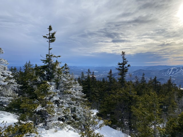
Little Bigelow is such a nice hike – great terrain, awesome views, deep woods – that this latest Maine Appalachian Trail Land Trust hike was full months ago. Then, early last week, the forecast started taking shape. A few people decided early on to drop out and seek alternate plans. A few days later, the forecast seemed rock solid: it would be cold, but the big issue would be the bone-chilling winds. A few more people dropped out. A core group of five decided to proceed with the hike and pay it by ear, knowing that the conditions would be chilly.
And they were right. The coldest spot was probably the parking area on East Flagstaff Road when everybody was gearing up. It was about 0 degrees and would remain there for the rest of the day. The group was adequately covered and layered so everything went pretty smoothly in the sunny woods. There was a fresh foot and a half of snow to be broken through, on top of a few feet that was already there, so it was not a speed hike.
At higher elevations past the junction with the A.T. shelter side trail, conditions were much colder and the winds had yet to diminish. Despite adequate footwear and even toe warmers, feet started getting cold and not warming up. Everybody knew at that point that we’d at least reach the open ledge below the summit of Little Bigelow, but not the peak itself.
Heading out
Fueling up
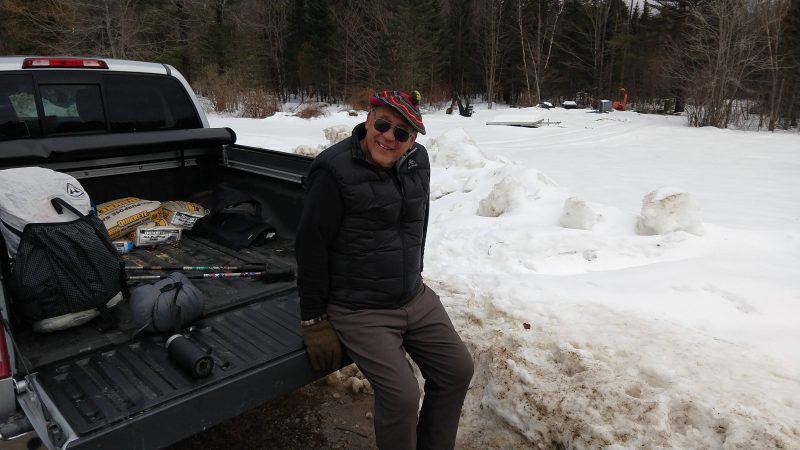
Landowner Richard Duplessis
The latest Maine Appalachian Trail Land Trust hike was up Caribou Mountain in the White Mountain National Forest. We had a nearly-full hike of nine and everybody was ready to hit the trail. It’s been a cold fall/early winter and conditions have been snowy in the mountains since mid November, but our hikes were scheduled before that so we’ve been wanting to get out too!
Unfortunately, conditions were not ideal for this hike and the group did not reach the summit. The snow was soft and the trail was unbroken so the group was slowed down considerably. One hiker started feeling under the weather about halfway up and she was accompanied back to the cars with a trip leader. The rest of the group kept going but spent too much time trying to find the trail since, as per Forest Service policy, the trails in the Caribou-Speckled Mountain Wilderness Area are not blazed very well.
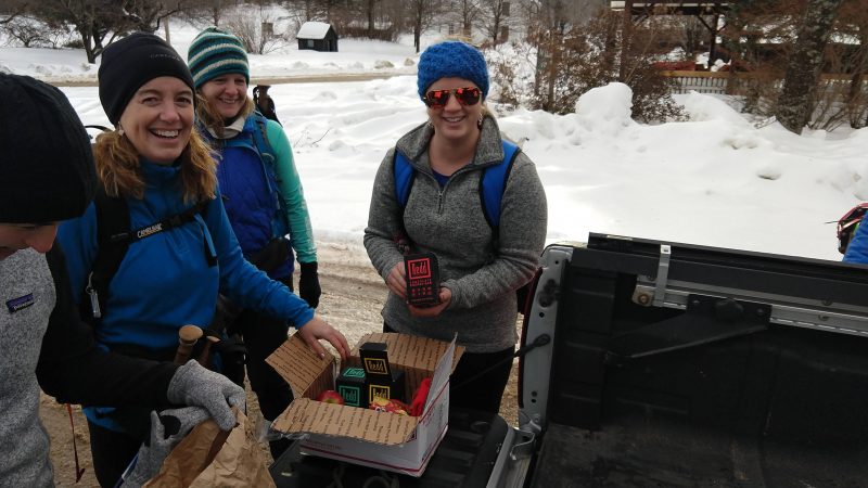
It was still a nice day to get out with some great people. We met the owner of Pooh Corner Farm, Richard Duplessis – it is through their generosity that hikers are able to park on their driveway in winter! AND, thanks to our community partners for this hike (Rosemont Market & Bakery and REDD) we had some awesome munchies to fuel up with. Stayed tuned for our next hike up Little Bigelow Mountain!
Maine Historical Society folks along with some A.T. regulars.
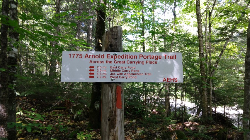
Route towards the Appalachian Trail.
Middle Carry Pond, where the expedition crossed the pond.
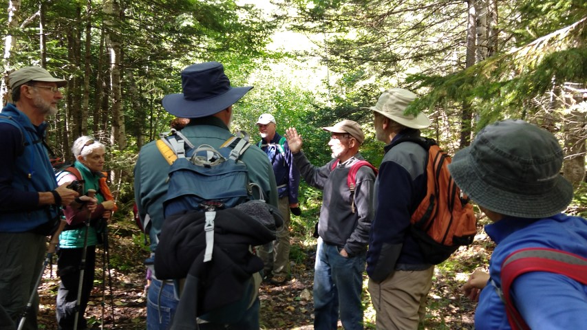
Norm tells it like it was.
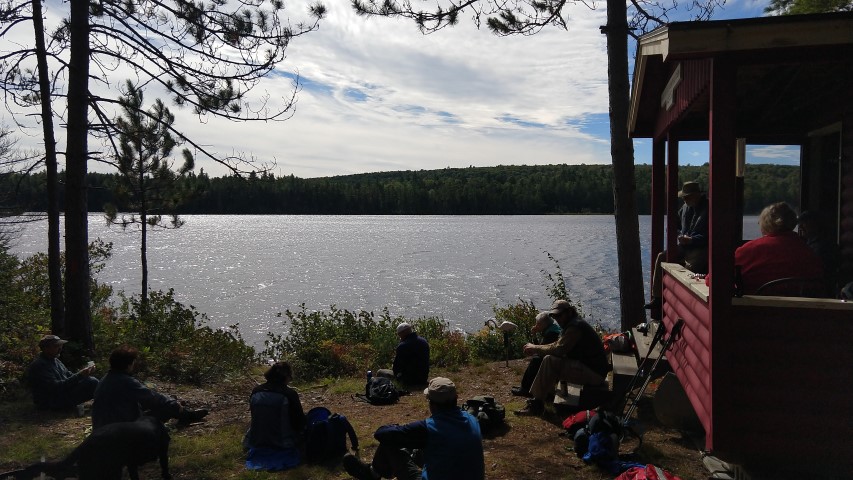
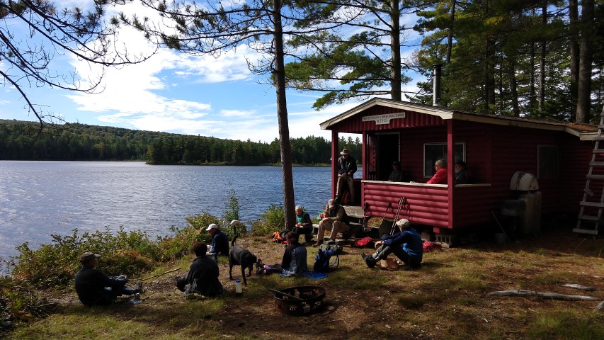
AEHS cabin on Middle Carry Pond. Members can use it!
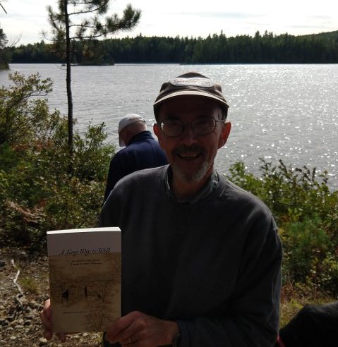
AEHS guide Norm Kalloch with his new book, “A Long Way to Walk”.
The Maine Appalachian Trail Land Trust’s latest community hike was a good one: a partnership outing on the Arnold Trail with both the Arnold Expedition Historical Society and the Maine Historical Society. In the fall of 1775, Colonel Benedict Arnold led a detachment of 1,100 American soldiers through the Maine and Canadian wilderness in what was intended to be a coordinated, secret attack on the British army fortified in Quebec City. The overland route would follow a Native American trade route along the Kennebec and Chaudiere Rivers, using the Great Carrying Place Portage Trail through the Carry Ponds. About 600 soldiers made it through the wilderness, encountering horrendous storms, flooding, disease and starvation before reaching the St. Lawrence River across from Quebec City.
The area between the Carry Ponds, between Flagstaff Lake and the Kennebec River, is home to both the Appalachian Trail and the Great Carrying Place Portage Trail. Both string the ponds together like a necklace and both use the original route of the Arnold expedition as a footpath in places.
We headed out at 10am, planning to reach the area between East Carry Pond and Middle Carry Pond. It was a beautiful day with temperatures of about fifty degrees at the start and warming up throughout the day. Most of the group participants were members of the Maine Historical Society but there were a few A.T. attendees. Norm Kalloch, AEHS board member and a resident of West Carry Pond, has been gracious enough to lead a hike for us annually, providing great insight into a landscape that in some ways has changed, but in many remains as it was in the time of the American Revolution. Norm’s knowledge of the area and the history is amazing and he truly makes this hike the great event it is.
The group made it to the AEHS cabin on Middle Carry Pond by lunchtime, and after a quick stop at the hospital site, headed back to the cars. It was a great day out in the field to see all that the Maine Appalachian Trail region can offer – not just the A.T., but history, partnership and dedication to Maine!