Tag: Trip Report

Caribou Mountain with Ladies Adventure Club of Maine

By Stacy Alvarez, LAC Member

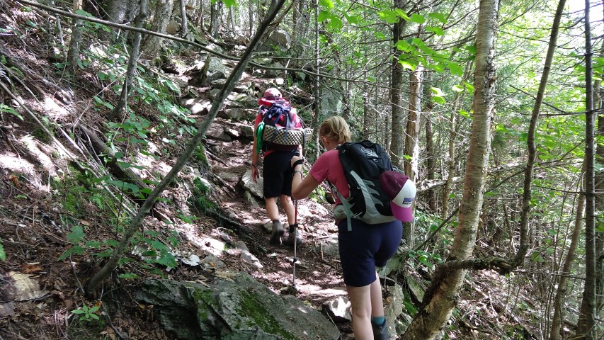
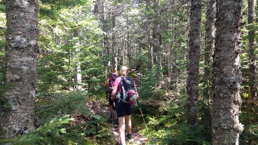
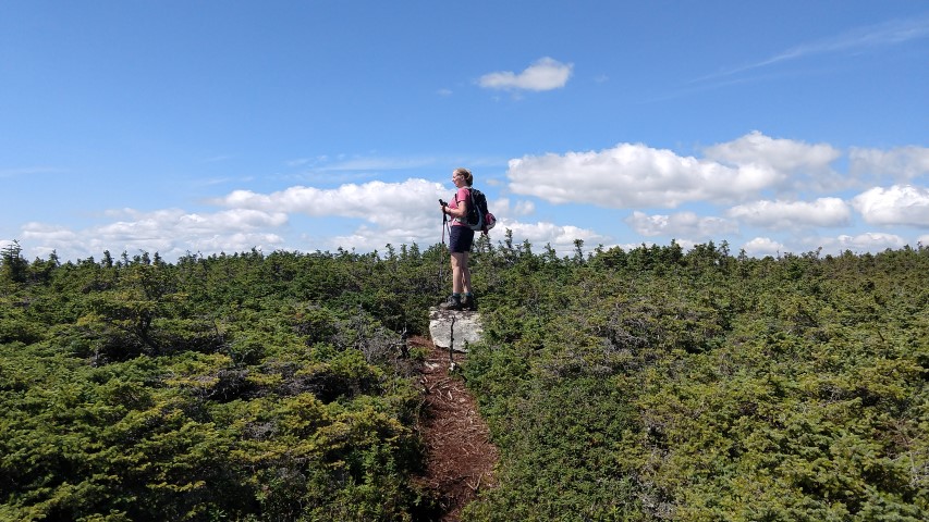
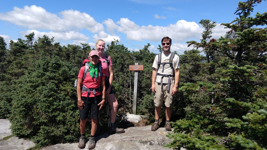
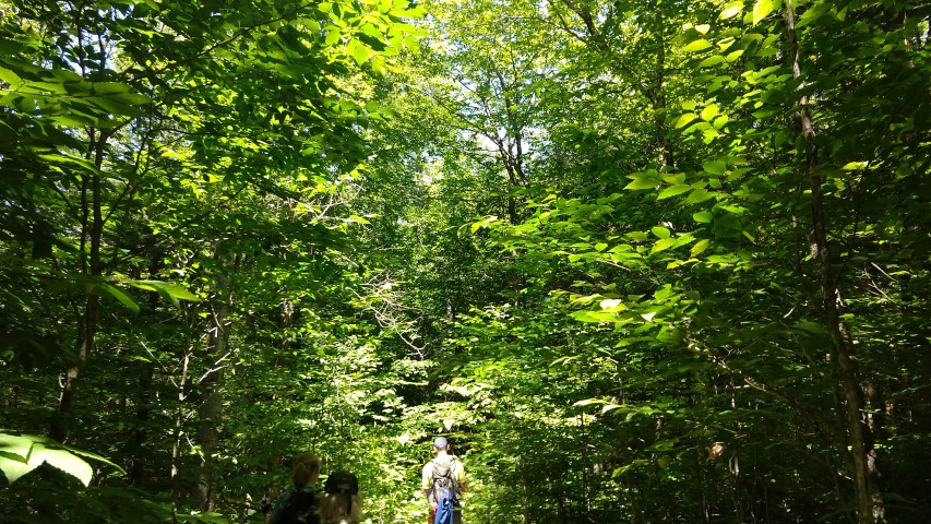
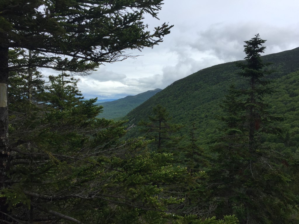
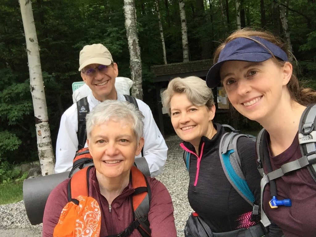
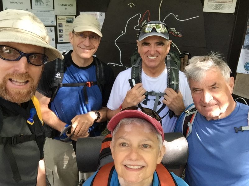
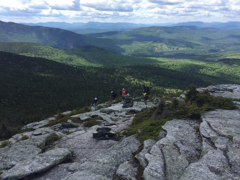
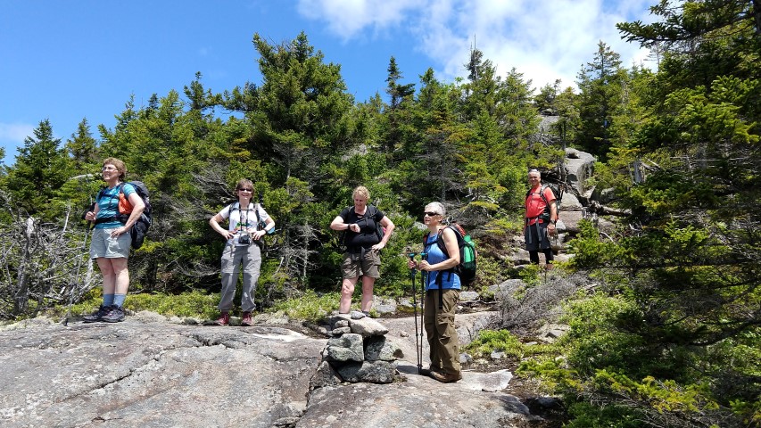
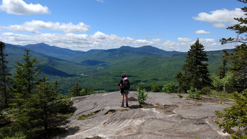
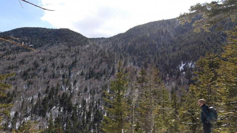
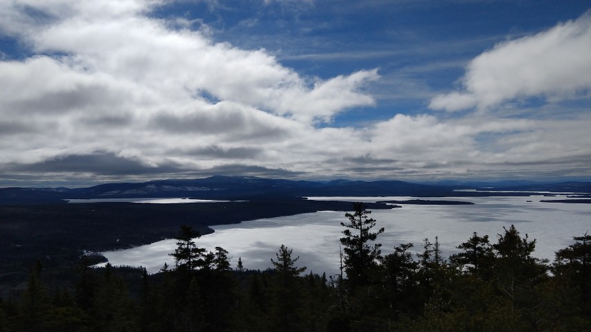
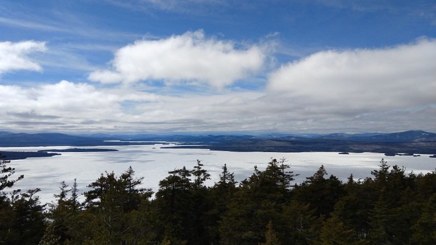
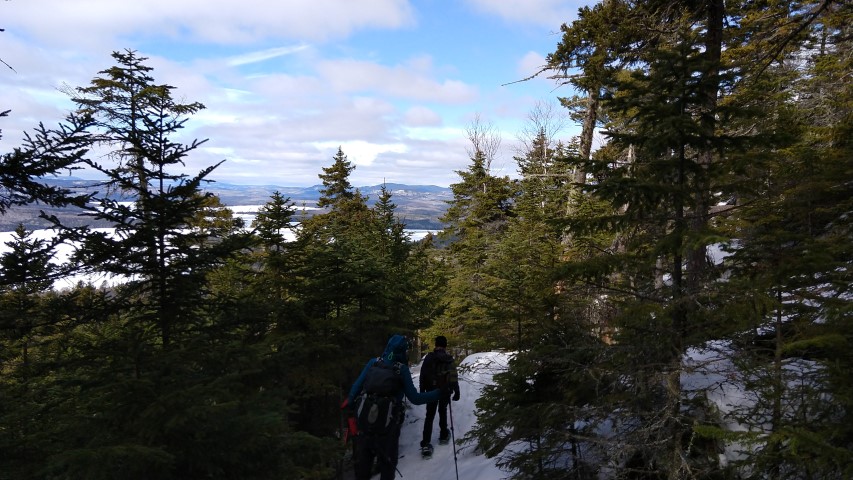
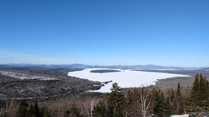
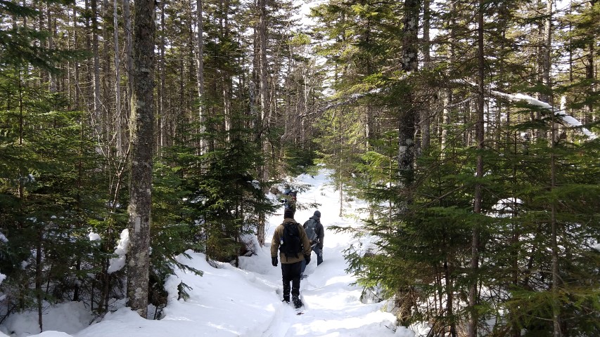
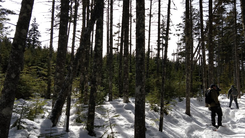
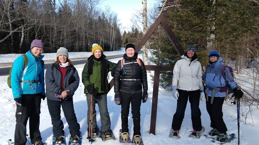
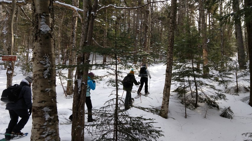
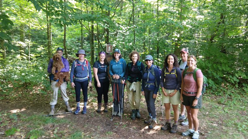
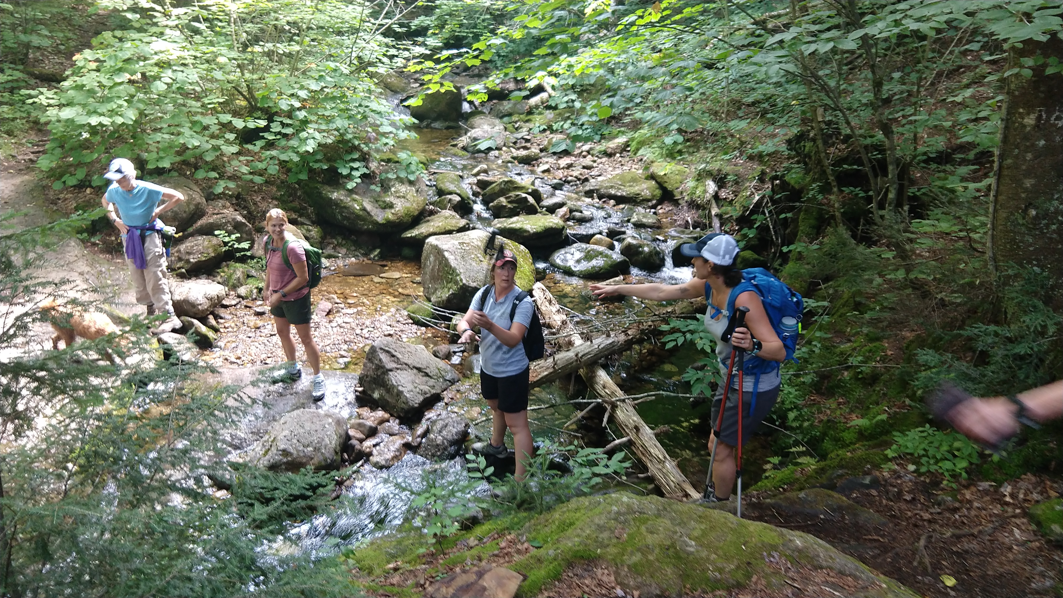
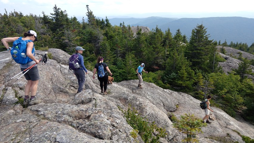
Saturday, August 25th proved to be the perfect day for hiking Caribou Mountain.  Nine LAC adventurers with their knowledgeable guide Simon Rucker (Maine Appalachian Trail Land Trust), and trail dog Callie, hiked the Caribou Trail to the summit.  The trail crossed several brooks and streams that tested our balance while we traversed over the rocks, like we were playing nature’s version hopscotch. The soundscape of the forest was alive with rush of water flowing over the rocks.  The trail climbed steadily to the summit affording us many rest stops (thankfully!) to enjoy the tranquility of the Caribou-Speckled Mountain Wilderness.

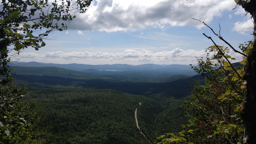
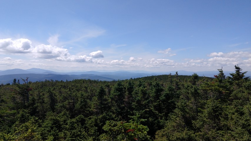
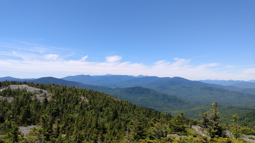
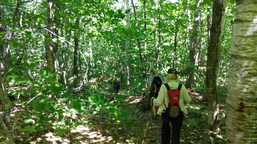
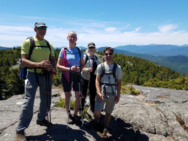
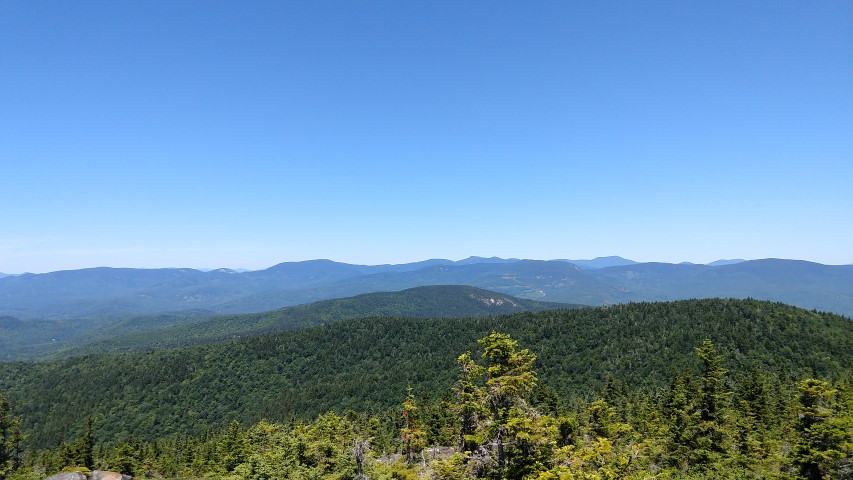
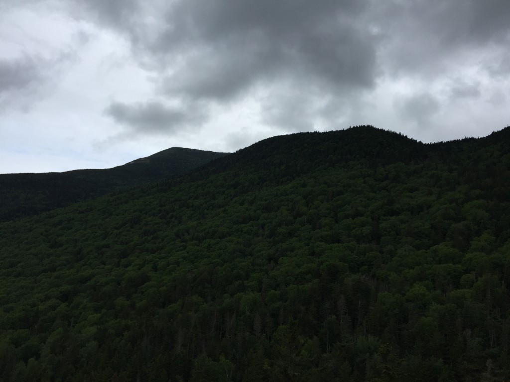
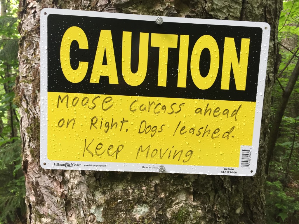
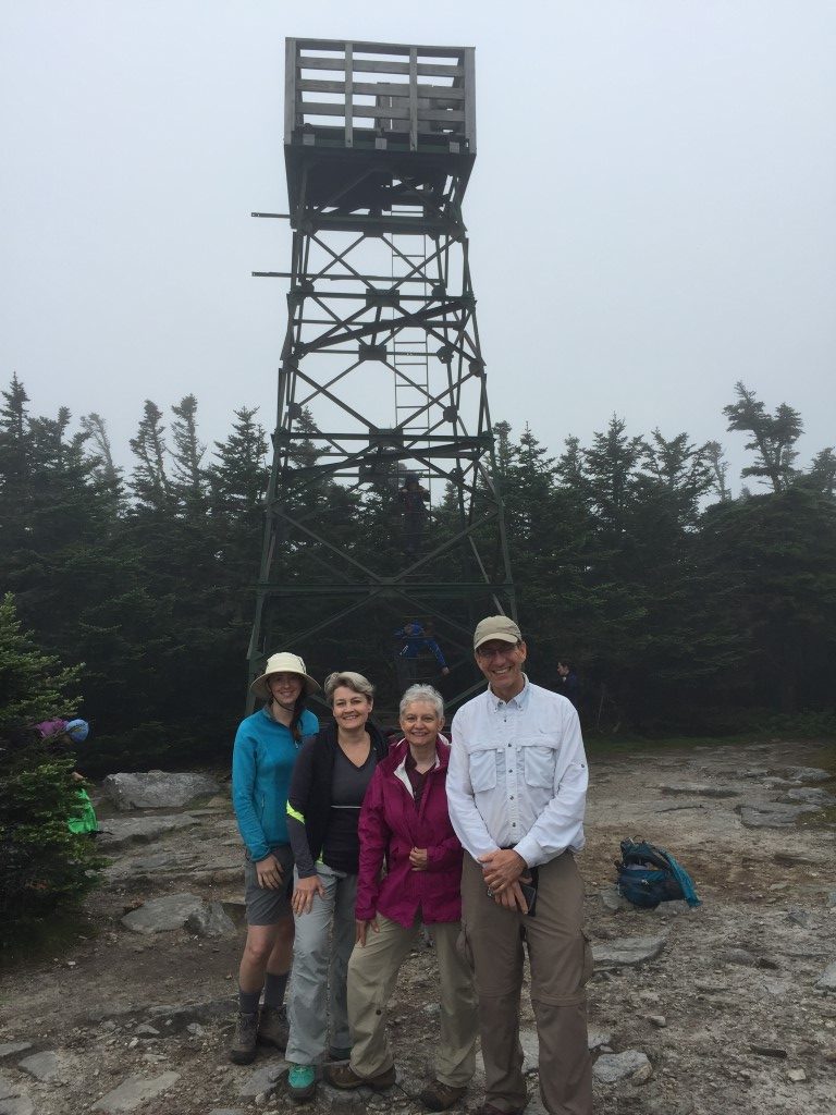
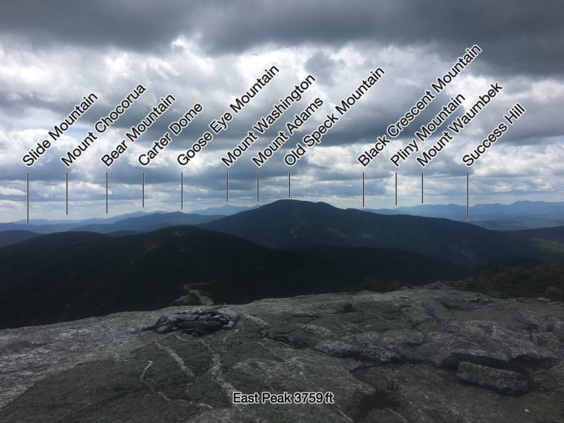
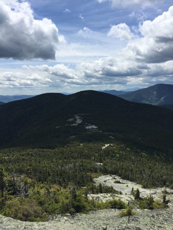
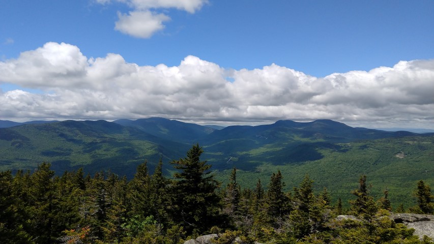
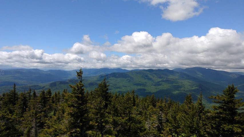
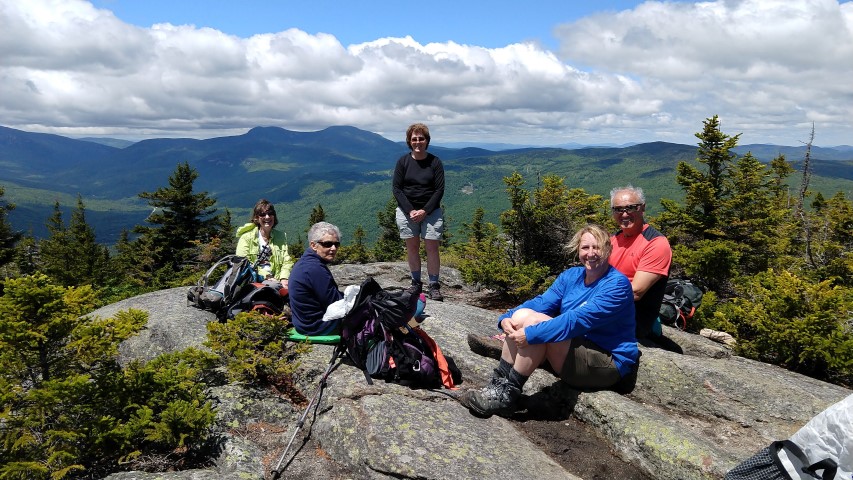
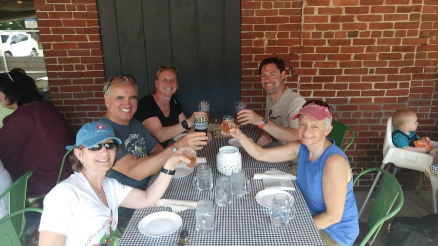
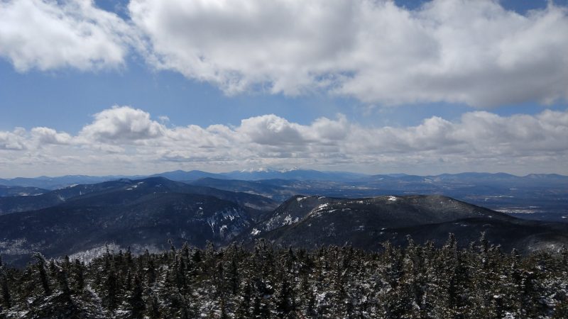
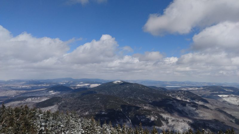
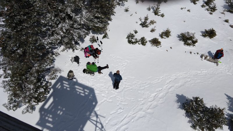
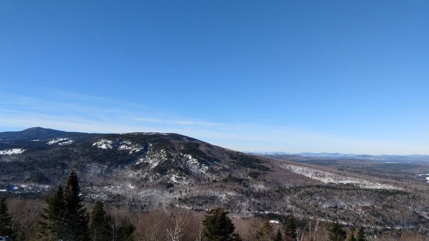
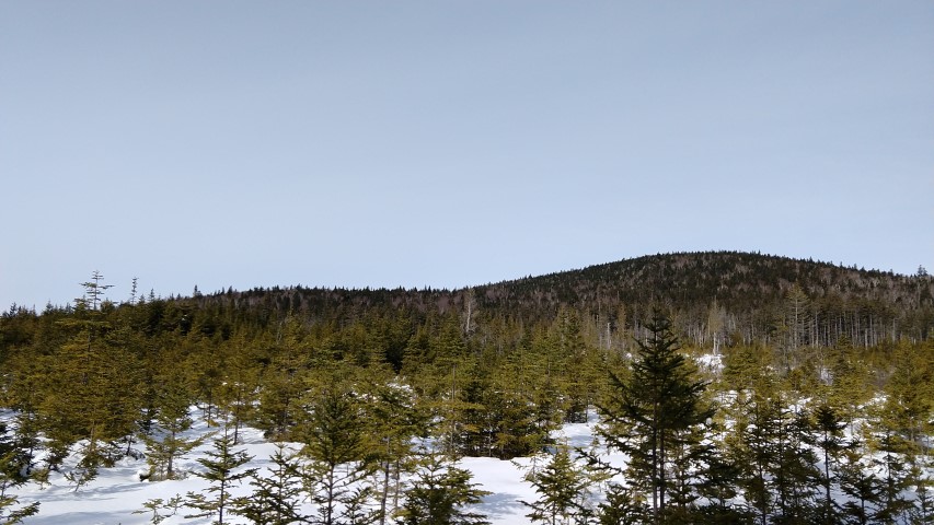
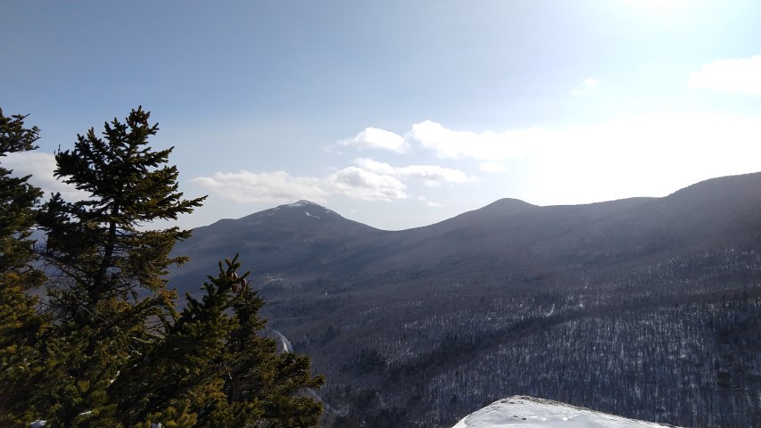
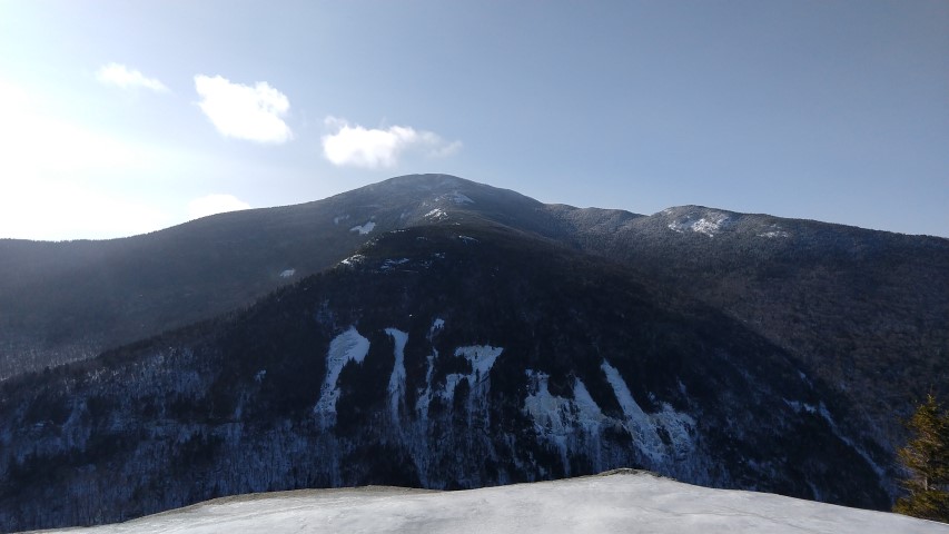
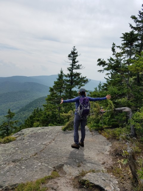
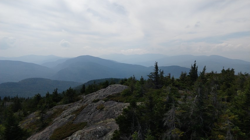
At the summit (2850 ft.), we ate our lunches and were treated to the gorgeous sweeping views of the surrounding mountains.  Simon pointed out each by name, including Mt. Washington. We took the Mud Brook Trail back down the mountain that was indeed, at times, muddy, much to Callie’s delight!   We were awed by the many varieties and colors of mushrooms we saw along the trail, never tiring of the diversity. Every step confirmed that this was a wonderful day to be in the forest, and every laugh confirmed we were in excellent company!  We all agreed that hiking Caribou Mountain was the ideal way to end the summer.

To find out more about the Ladies Adventure Club of Maine and join up for some other adventures, visit https://ladiesadventureclubmaine.com/

Old Blue Mountain Trip Report

Steep trail up from Black Brook Notch.
Snow Valley down to Telstar.
Flat spruce woods on the top of the notch.
Blue hazy mountains to the west.
The viewing rock.
Woo!
Trail magic???

The latest Maine Appalachian Trail Land Trust community hike was up Old Blue Mountain in the vicinity of Andover, Maine.  After exiting Grafton Notch the A.T. heads through a series of lower mountains and notches before reaching Black Brook Notch.  This valley features a dramatic down one side of the notch (Moody and Sawyer Mountains) and an equally dramatic ascent up the other side – Old Blue Mountain.

Our small group started from South Arm Road, where the A.T. very steeply ascends the notch wall for about half a mile before flattening out.  The views down Black Brook Notch into the Ellis River and Snow valleys show the sparsely populated Andover region.  Many A.T. hikers stop in Andover and stay over at a local hostel and get some delicious food at The Little Red Hen (where this group stopped as well!).

We continued up the trail towards Old Blue, sometimes heading up, sometimes down but mostly staying flat.  After another 1.5 miles the trail again ascends up the steep-ish side of Old Blue, finally reaching the flat summit area at about 2.8 miles from South Arm Road.  The summit is dominated by low spruce forest of about 3-6 foot trees, so your view will depend on how much you can look over their tops!  To the north, the A.T. continues on, skirting Elephant Mountain’s flank and then proceeding up Bemis Mountain (location of the next A.T. shelter).  Well to the north, taller hikers can see Mount Abraham, Saddleback Mountain and others in Maine’s High Peaks region.  To the west are the most dramatic views of Grafton Notch, the Mahoosucs and beyond to the White Mountains.

Our descent was relatively quick, as the steep parts of the trail have been masterfully constructed with stone steps by the Maine Appalachian Trail Club.  At the base, a well-known trail magic purveyor had set up and had several A.T. hikers with him for the evening!

Join us for our next hike up the Crockers on September 9th!  All of our community hikes are free and open to all.

Caribou Mountain Trip Report

White Mountains
Heading up through lower-elevation deciduous forest
Bright sun low and high.
Wooo
Mahoosucs

The Maine Appalachian Trail Land Trust had our latest community hike up Caribou Mountain in Evans Notch on a beautiful Saturday.  Our community hikes are designed to get people of all abilities out on the A.T. landscape and Caribou is a great one, winter or summer, due to its accessibility – it’s not too steep and not too far from most people.  At the same time it’s a great hike!

We started off on a beautiful day – sunny, 0% chance of rain, low humidity.  The trail up Caribou from Bog Road starts on old logging roads administered by the US Forest Service since the land is in the White Mountain National Forest.  The mature forest canopy is mostly comprised of hemlock, maple, and birch, and the trail is open and inviting.  For the first half of the approximately three miles of trail, the ascent is gradual up to a ravine between Caribou and Gammon Mountain, just to the north.  After crossing into the Caribou-Speckled Mountain Wilderness area, the trail intersects with the Mud Brook Trail and both merge and head south to the summit of Caribou Mountain.

The forest abruptly transitions from hardwoods to spruce and fir, and suddenly we were in the boreal forest of mountaintops in the great north woods.  We came out on the summit area – complete with fragile alpine vegetation – and had views in all directions of some of the most spectacular mountain terrain in both New Hampshire and Maine.  Directly to the west we could see the Carter-Moriah Range, with the Presidential Range looming directly behind them.  The Mount Washington Observatory was clearly visible.  To the south we saw the Baldfaces, scarred and rocky in the sunlight, and the triangular pyramid of Kearsarge North.  To the south, crossing the border into Maine, we saw Speckled Mountain nearby and the lakes ringing Pleasant Mountain and the ski slopes.  To the north lay the Mahoosucs, Old Speck, the Baldpates and then just to the east, trailing away to the horizon, the High Peaks area of the Crockers and Sugarloaf – next week’s community hike – could barely be seen.

All of our community hikes are free and open to the public.  Our trip leaders will make sure you have a good time and get out on the A.T. landscape.  If you’d like to come along, please sign up here or contact us with any questions!

Old Speck Trip Report

Gloomy.
Sunday River Whitecap
The group!

The latest Maine A.T. Land Trust community hike was up Old Speak in the Western side of Grafton Notch.  According to the Maine Mountain Guide, Old Speck, at 4,170 feet, was named for its speckled appearance formed by its large areas of exposed rock and tree cover and to distinguish it from other speckled mountains in Maine.  For a long time it was thought to be the second highest peak after Hamlin on Katahdin but now it is known as the fourth highest following Hamlin, Sugarloaf and the north peak of the Crockers.

Despite the prediction of a cloud-covered summit and the possibility of rain, four of us headed up the AT in damp, cool and humid conditions. Soon after starting out we came to the trail junction for the Eyebrow, an eyebrow-shaped cliff  below Old Speck where the trail loops around to rejoin further up the AT.  This was not part of the day’s plan, not to mention it would be slippery and have no views. Another day perhaps. As we traveled along and starting ascending the stone steps heading to the falls on Cascade Brook, we encountered a most awful stench and soon saw a sign indicating that there was a dead moose carcass just off the trail. The maggots lining the footpath and the truly overwhelming odor was not enough to stop two curious members of the group from taking a look. Rest in peace my moose friend.

As we continued on we met quite a few through hikers both north and south bound. One pair, heading northbound (also known as NOBO) who had joined up along the way, were known as “Fish Out of Water” and “Prof”.  “Fish” is a marine biologist from California so the lack of ocean views on this journey made him feel like, well, a fish out of water! “Prof” is a young man who started smoking a pipe and was told he looked professorial (he ditched the pipe soon after). They were happy to answer the usual annoying questions from day hikers and even posed with us for pictures.  Good sports!

Summiting found a quite few other day hikers either enjoying lunch or climbing the fire tower where they could only imagine the view they were missing.  It is truly spectacular on a clear day.  We took our customary group photos, hunted for the “geo” survey marker (short for geodetic) hidden in the bushes on a rock by a cairn – and then headed back down.

Descent was uneventful – there were a few more through hikers and day hikers along the way. Although rain was predicated for the late afternoon, the sky actually started to clear a bit and we were able to get a few glimpses of the mountains from the ridges – Sunday River Whitecap stood out quite nicely. All in all, we were quite happy with our hike. It’s not always about the view – just wandering companionably through the Maine woods with fellow hikers is just as meaningful.

Baldpates Trip Report

Photo courtesy of Phil Coyne.

By Louise Jensen

The Maine Appalachian Trail Land Trust hosted its second community hike of the season to Baldpate Mountain in Grafton Notch. There are two summits: the somewhat wooded West Peak at 3,662 feet and the wide open and beautiful East peak at 3,812 feet.  According to the AMC Maine Mountain Guide, these peaks were also known as Saddleback and Bear River Whitecap. This rugged hike, complete with bog planks, ladders and open bald ledges leads up the AT and starts on the east side of ME Route 26.

The morning was cool, crisp, clear and breezy when four guys and a gal met up in the parking lot in Grafton Notch State Park. Two of five had not hiked the Baldpates before and were promised that it would be more than worth the effort. In fact, we stopped at the trail junction for Table Rock, a short rugged side trail with a sign indicating fantastic views, and the question was raised whether we should spend the time to go see them.  Although the views from Table Rock are pretty impressive, the views to come would clearly outshine those from Table Rock so we continued on and left Table Rock for another day.

It took well over three hours to reach the summit. Along the way we took a .2 mile detour to visit the lean-to and have a quick snack. We took time to photograph the one lone (and more uncommon) white lady slipper next to the trail and the alpine flowers along the boggy areas. Continuing along, the wind picked up dramatically as we ascended over the open ledges to summit the East peak. As promised, the views did not disappoint. To the southwest you could see as far as Mount Washington and looking northeast you could see as far as Sugarloaf.

Lunch was spent enjoying the views (and in a few cases napping) on the eastern end of the summit where it was warmer and less windy.  Soon it was time to leave, and reluctantly we headed back down the ledges where the wind had picked up even more and buffeted us around!  Fortunately, no one flew off the mountain and upon our return to the parking lot we decided to meet at the Sunday River Brewing Company. We enjoyed a nosh and a beer and reflected on our awesome hike to the Baldpates.


Puzzle Mountain Trip Report

Old Speck and the Baldpates in the clouds.
Any minute now…
View towards the Presidential Range.
Lunch!
Grafton Notch.
Beer afterwards at Norway Brewing Company!

The Maine A.T. Land Trust’s latest community hike was up Puzzle Mountain on a beautiful Saturday in Grafton Notch!  This mountain (which has three summits) is one of the true hidden gems in Maine’s Appalachian Trail landscape.  The peak is 3,133 feet high but due to the location there are large areas above treeline and the final 3/4 mile or so is on rock ledges that give the mountain a true alpine feel.

We stopped at Rising Sun Bakery, picked up a few stragglers and headed out! Temperatures were in the low 70’s and the weather, a bit cloudy and humid at the start, only got better as a front passed through and dried things out.  We had a group of seven and we reached the summit in just about two and a half hours, where we enjoyed a great lunch from Rosemont Market and spectacular view of the surrounding mountains.  We could see the higher peaks of the Mahoosuc Range (including the Baldpates, destination of next week’s hike), the string of peaks among the Rangeley Lakes (Old Blue, Bemis Mountain), and all the way up to Saddleback Mountain and Mount Abraham).

After descending, we all agreed it was a great day and celebrated with a drink at one of the finest breweries in the A.T. region, Norway Brewing Company.

Join us for our next hike on Saturday, June 9th up the Baldpates!  Sign up here and you can reserve a spot and a free lunch!

Old Speck Trip Report

Old Speck ahead
Warm sun enabled layer shedding.
The Mahoosuc Range and the Presidentials beyond.
The Appalachian Trail north into Maine.
Lounging around.

The Maine Appalachian Trail Land Trust ended the winter hiking season with a spectacular April hike to the summit of Old Speck Mountain in Grafton Notch.  By this time of year, many people in Maine are experiencing winter fatigue and can’t wait to put away the snowshoes, skis, facemasks, gloves and hats.

Not this group!  A fresh 3-6 inches of snow had fallen over hard-packed trail, so we were able to leave the snowshoes in the car.  Temperatures were in the low 30’s to start and the sunshine at this time of year is bright enough to make it feel warmer.  One member of our group even hiked the lower portion of the trail in shortsleeves.  When crossing in front of the Eyebrow we heard the thunderous crash of ice chunks falling from teh cliff wall down to the forest below.

Nonetheless, the winds picked up at higher elevations and the snow, already powdery enough, began to blow and even drift over the trail.  Areas where the sun was blocked by the trees were very cold.  There were three groups ahead of us on this fine day and it was fortunate that we could follow their tracks.

It took about 3.5 hours to reach the summit, and due to the bright sunshine on the summit we stayed for about half and hour and ate lunch.  Views from the summit tower stretched in all directions, and continued on the way down.  At lower elevations the temperature had warmed enough to melt all the snow from the trees and melt much of what had fallen on the trail.  Back in the parking lot all of the snow that had fallen the night before was gone.  Oh and we stopped at three bakeries on the way up/back.

Check out website in the next few weeks for our warm-weather A.T. hikes schedule!  We’ll start in mid-May and go all the way to November!

Bald Mountain (Oquossoc) Trip Report

Trailhead info.
Nice day heading up.
Saddleback and the High Peaks region.
Height of Land and Four Ponds.
Bemis Mountain and Black Brook Notch.
Grafton Notch and New Hampshire.
Heading down!

Maine A.T. Land Trust had a great hike over the weekend up Bald Mountain in Oquossoc on a beautiful late winter day.  Due to the coastal storm the day before, some hikers had to drop out but we had a good time with a small group of three.  While the coast was still dealing with high winds and poor conditions, the mountains of Maine have plenty of snow.

The Appalachian Trail doesn’t go over Bald Mountain, which is on a small divide of elevated land between Mooselookmeguntic Lake in the west and Rangeley Lake in the east.  However, as the photos show, you can see a stretch of about one hundred miles of the A.T. from the summit on a clear day.  The view is spectacular from the observation tower at the summit and the route is only 1.3 miles up.  In the winter this hike does require traction aids to get up over some steep sections that tend to ice up, but it’s not a long stretch and if you take your time it is doable.

Join us for our next hike up Burnt Hill this coming Saturday!

Four Ponds Trip Report

Mooselookmeguntic Lake
Bemis Mountain
Moxie Pond
Unnamed ridge above the A.T.
Near Moxie Pond.

The latest Maine A.T. Land Trust community hike – a make up for the Great Maine Outdoor Weekend – was up to the Four Ponds area just north of Height of Land.  A seldom-travelled area of Maine’s A.T., especially in the winter, Four Ponds is a gem of a section that is perfect for day hiking and filled with natural beauty and opportunities for solitude.

Our group consisted of four hikers, who headed out from Height of Land on a brilliantly sunny, calm Saturday morning.  Temperatures were in the 20’s with light winds – even at the Height of Land overlook there wasn’t much of a breeze when the hike began.  Despite the warm temperatures in areas of Maine at lower elevations to the south, the A.T. was covered in VERY deep powder with a slight crust on top.  Trail had not been broken and it was slow going but our group was content to take what conditions gave.

On the backside of Spruce Mountain a group of grey jays, cuter than average with thick plumage, joined snack time and eventually ate out of the hands of a few of the hikers.  The group came to regret being so generous as by lunchtime the birds became annoyed when the food source dried up.  Lunch was eaten on the shore of Moxie Pond, which is really a bay of Long Pond (largest of the Four Ponds), and that was the furthest extent of the hike.  At different times of year Maine Appalachian Trail Land Trust hikes have gone as far as Sabbathday Pond, 3.6 miles from the parking area, but the snow conditions made for slow (but beautiful) going.  The sky turned cloudy and the wind picked up by the time the group got back to the road, so the day was well-timed.

Join us for our next hike to Bald Mountain (show above in the photo of Mooselookmeguntic Lake) on March 3rd! 

Table Rock Trip Report

Sunday River Whitecap
Success!
Old Speck
Trucking along.
Pretty icy in a few spots.

The Maine Appalachian Trail Land Trust had another great hike with the Ladies Adventure Club this past Saturday up to Table Rock in Grafton Notch.  LAC is a group that gets members out in all areas of Maine: kayaking on the coast, hiking the A.T., fat tire biking, and tons of other great stuff.  Like the Maine Appalachian Trail Land Trust, LAC lowers some of the barriers to participation in Maine’s outdoors by organizing peers and pooling resource.  This was our second hike with LAC and hopefully we can lead them again!

It was another cold morning but fortunately we were able to get in this, our second hike of the winter, after having to postpone our first two due to the cold temperatures.  It was about 5 degrees when we started out on snowshoes – not terrible but still pretty chilly, and soon enough various items of gear were tested by the wind and cold.  Feet were cold, fingers were getting numb, faces stopped feeling stuff.  The forest cover grew thicker pretty quickly and after about twenty minutes everybody was starting to warm up nicely.  Once we headed over to Table Rock on the side trail (the upper, blue-blazed official A.T. side trail, not the orange-blazed rocky one) the trail conditions deteriorated.  Damage from The Storm in the fall left us groping for the next blue blaze, despite being within sight of Table Rock.  After about 15 minutes we found the route, but then faced very icy conditions on the last steep grade up the rock with rungs.  We eventually made it by sticking together and helping each other out.

We ate lunch pretty quickly due to windy conditions on Table Rock, and the ice was dangerous near the edge.  We descended pretty quickly, taking care on the ice, and made it back to the parking lot by 2pm.

This weekend is the Great Maine Outdoor Weekend and we’re heading up Old Speck!  Join us by signing up here.