Category: News

Four Ponds Trip Report

Map of the Maine Public Reserve Land Four Ponds Unit.

Date: February 22

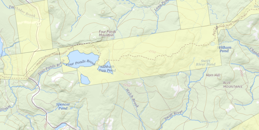
Location: Height of Land, Four Ponds Public Reserve Land, Route 17, Township E

Trail:  Appalachian Trail Northbound

Distance: 7.4 miles (Sabbathday Pond roundtrip)

Info: Maine Trail Finder

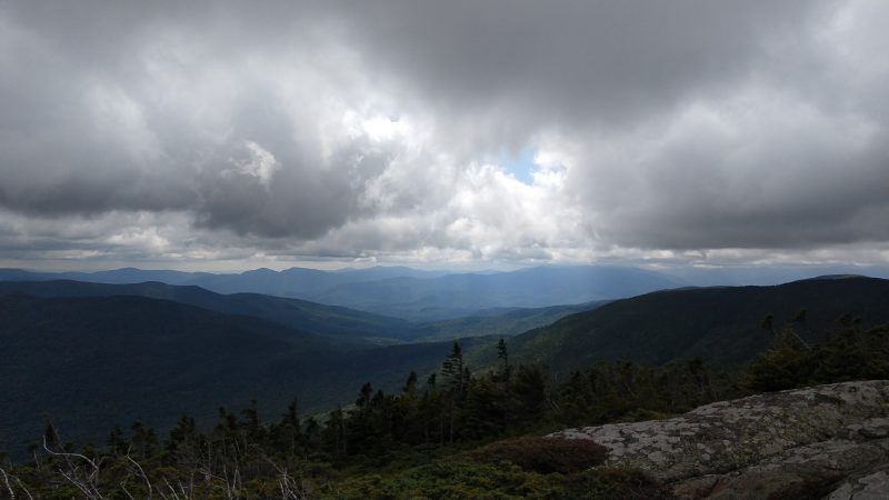
One of the hidden gems of the Appalachian Trail in Maine, the Four Ponds area is generally not well travelled in either summer or winter (except for thru-hikers).  Due to the tranquil aspect and beautiful forest scenery, the hikes in this area never fail to disappoint.  The location on a high plateau provides for some rugged terrain and the snowcover is generally deeper than other lower elevation areas, too.

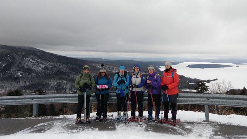
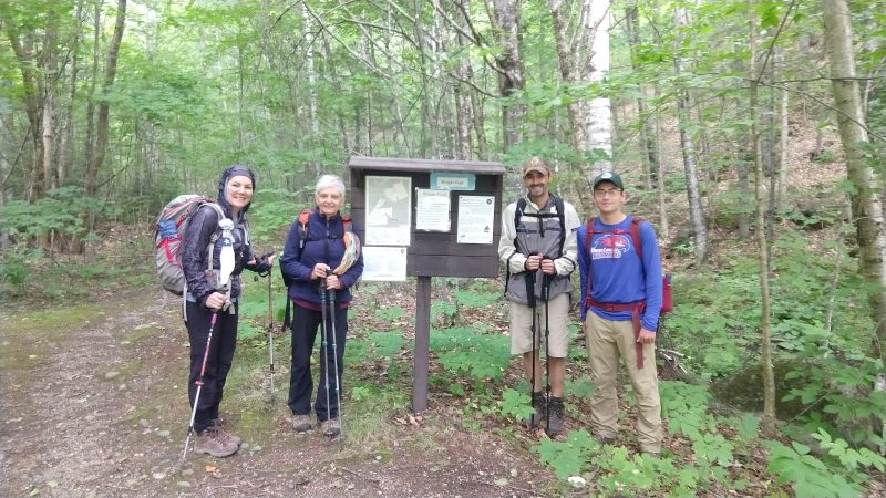
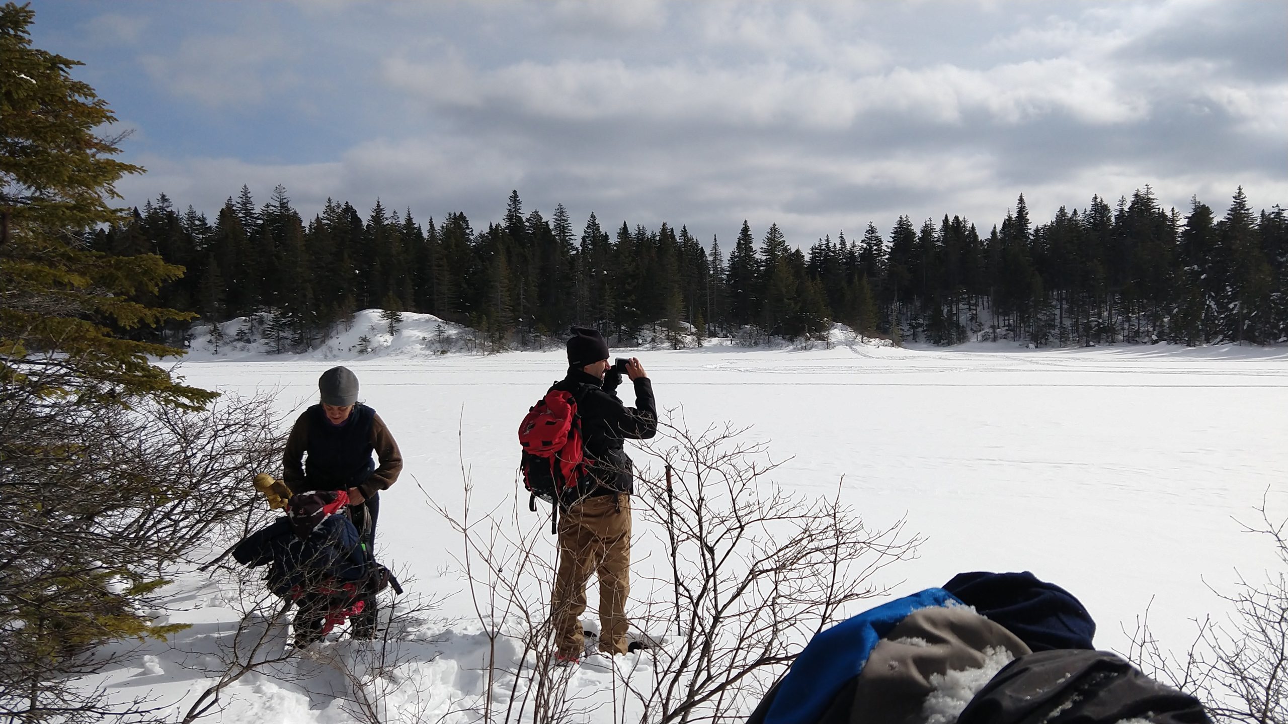
The Maine Appalachian Trail Land Trust has been guiding hikes for the public to the Four Ponds area for years, and its popularity has only increased.  The terrain is not steep like many sections of the A.T. and access to the trail here is from a public road (Route 17).  For this hike, we had four people meeting up on a Saturday morning, with the temperature hovering around zero but with light winds.

On the A.T. heading into the Four Ponds unit off Route 17.

We strongly encourage hikers to prepare for even lower temperatures than they might expect, since this tends to be a snow and cold section.  The group for this hike was experienced and well-prepared – though temperatures would rise nearly 40 degrees by the end of the day!  We set out from the Height of Land parking area on Route 17, which is the Rangeley Lakes Scenic Byway.  During the winter the parking lot – generally filled with cars during all hours summer – is not plowed, and you have to park approximately 1/4 mile north, in a snowmobile parking area on the right side of Route 17.  On this day, there was a small plowed area that fit two cars and we parked there.  Take care walking by the road!

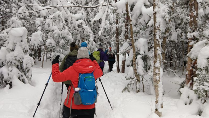
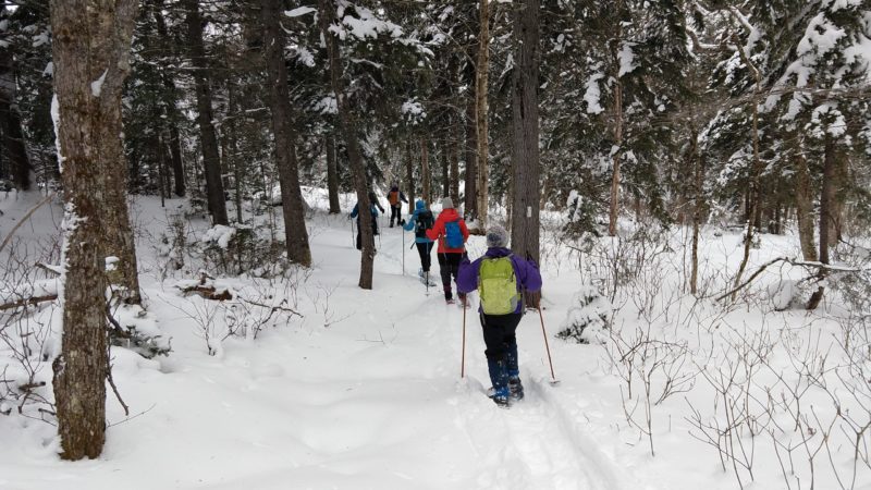
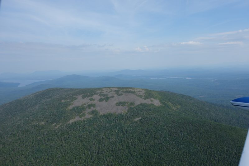
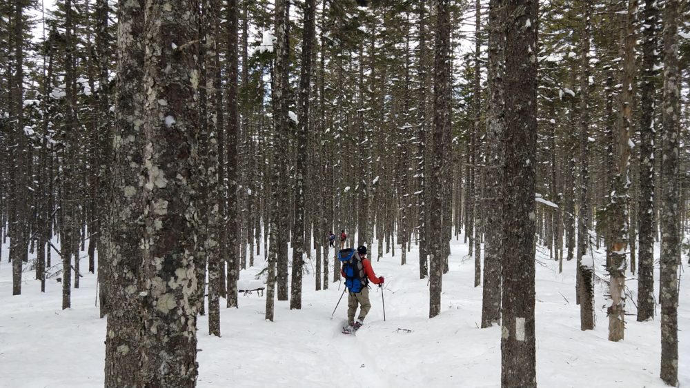
The A.T. is just south of the parking area and we entered the woods after negotiating the ice-covered rocks by the side of the road.  Four Ponds does contain named mountains like Spruce Mountain (2,530 ft) and Four Ponds Mountain (2,925 ft) but these are relatively low and there is not significant elevation gain or loss on the section of the A.T. to Sabbathday Pond.  The trail immediately off Route 17 contains the steepest portion of the hike, gaining a few hundred feet of elevation in just a few tenths of a mile, but thereafter meanders up and down over knolls and these small mountains.  There hike is initially through an open mixed spruce-hardwood forest where the A.T. can be difficult to find in winter since you can’t see the footbed of the trail.  Our group lost the trail for about fifteen minutes before pressing on anyway and finding the trail pretty quickly thereafter.

Spruce forest on the slopes of Spruce Mountain.

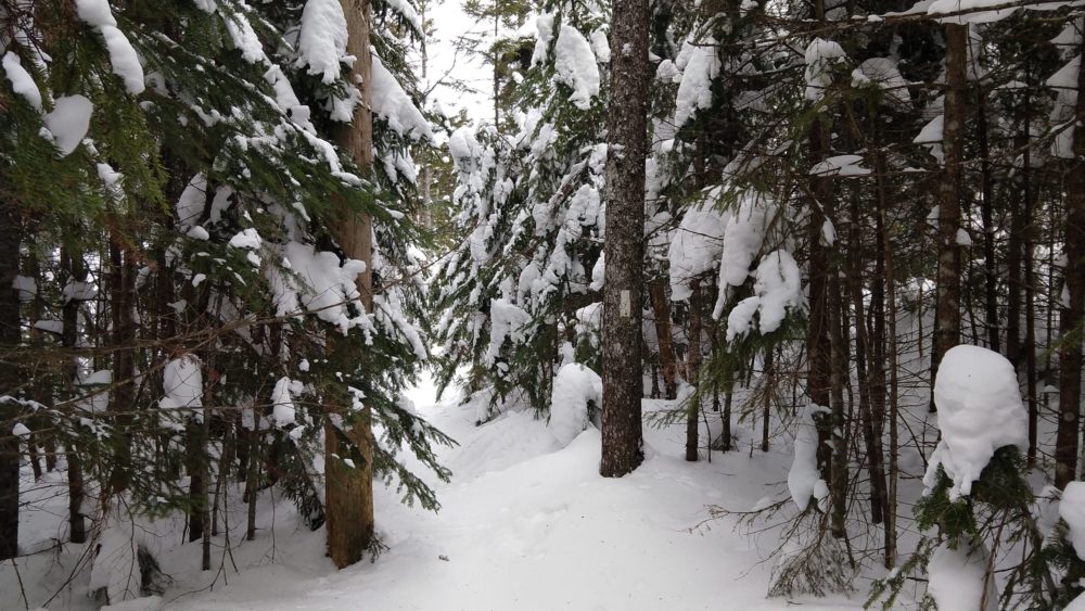
The forest type then changes to a dense spruce-fir forest that in winter is tunnel-like and very quiet.  Sounds are muffled by the deep snow and all is quiet.  Normally you can hear snowmobiles on nearby trail networks, but on this day there were none.  We proceeded on towards the first of the “four ponds” – Moxie Pond.  First, we pass through one of the sublime areas of the A.T. in Maine, a forest of great beauty that is one of the highlights of the Four Ponds trek.

Lovely forest.

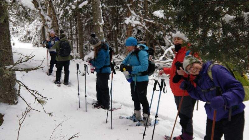
The forest surrounds Moxie Pond and Long Pond further on, which is the largest in the area, and for the third time in recent years we were treated to sets of Canada lynx tracks on the unbroken trail in front of us.  We stopped for lunch on the shore of Moxie Pond.

Moxie Pond.

At lunch, we assessed our progress and decided that we’d turn back.  Winter hikes prior to daylight savings have a short window where it’s safe to be out, and we were having a great time just taking it easy being out in the woods.  On previous winter trips we have made it to Long Pond and in the summer reaching the beach and lean-to at Sabbathday Pond is a fairly moderate hike (3.6 miles).  Having to break trail in snowshoes with four feet of snow on rugged terrain takes longer, and we were happy to turn around at about 1.8 miles.

One of the nice safety features of this hike is the fact that there’s a flat snowmobile trail bailout route (which is a woods road in warmer months that provides access to camps on the southern shore of Long Pond).  A hiker in our group was having some issues with boots causing discomfort and we decided to do him a favor and use the snowmobile trail for the portion of the return trip west of Moxie Pond.  It is easy to follow, flat and mostly downhill back to Route 17, where you have to walk along the road to get back to the parking area.  We chatted with a few passing snowmobilers on the way out, and were back at the cars by 2:30pm.

Join us for our next hike on March 21st to Little Bigelow Mountain!

Four Ponds Ladies Adventure Club Hike!

Trudging on.
Snow is always deep in the Four Ponds unit.
Hi
Heading out!

By Alicia Heyburn, Ladies Adventure Club

“Meet at Marginal Way at 6:40am for a ride to the trailhead with Simon Rucker, Executive Director of Maine A.T. Land Trust. He is great, save some gas, and you won’t have to worry with directions!”

That notice filled Simon’s truck pretty quickly with three members of the Ladies Adventure Club, an outing club for women in Maine. Three others met Simon’s crew at the trailhead off Route 17, to snowshoe into the Four Ponds Public Reserve Land by the Height of Land scenic view point. We made space in the lot for the snowmobiles; we were the only hikers, and after a group photo at the vista over Mooselookmeguntic Lake – Bemis Mountain was shrouded in clouds – we jabbed the claws of our snowshoes into the ice, and moved from the roadside into the wind-protected Appalachian Trail. 10:00am.

Temperatures were significantly more mild than when Simon led this trip for the Ladies Adventure Club last year. We had fresh light snow, but not as deep as last year. No one fell in a tree well and needed to be rescued, at least, as happened last year.

We saw lots of animal tracks including Canada lynx and snowshoe hare.  The trail conditions were quite good, and the majority of the group was able to move right along, despite some slippery spots. We stopped at the first pond, Moxie Pond, for lunch. We could hear snowmobiles in the distance.

On the way home Simon took the fear out of the steep descents by having us sit down, legs out and elevated, to slide over the roots and ice flows. It was fun! We felt like otters. Much better than gingerly working our way down and worrying about falling.

We were back to the parking lot by 2:45.  Great day out on the A.T. in deep winter!

Until Next Year

What a view!
Flagstaff Lake
The crew.

By Louise Jensen

The last Maine A.T. Land Trust Community Hike of the season and of the year was on Saturday, October 19th to Little Bigelow in the Bigelow Preserve. As mentioned in our Cranberry Peak hike in August, the Bigelow Preserve is in western Maine, just east of the village of Stratton. The 36,000-acre Preserve was established in 1976 by public referendum, and is managed by the Maine Bureau of Parks and Recreation.  The Bigelow Mountain Range with its six high peaks is found entirely within the Preserve. Little Bigelow is the eastern-most peak at 3040 feet. The parking lot and the trailhead are located off East Flagstaff Road.

You can tell that cold and flu season has arrived early this year as a few hikers dropped out due to illness leaving only 4 healthy participants. We met at the Tindall’s Country Store where we grabbed some coffee and necessary snacks, used the “facilities” and then all 4 piled into one car and headed to the trailhead. It took about 30 minutes to get there so we took advantage of the time to get acquainted or re-acquainted as the case may be.

The weather forecast called for partly sunny skies but initially some cloud cover greeted us at the trailhead. Heading southbound on the leaf-covered Appalachian Trail, we climbed steadily through a dense mixed hardwood forest following a swift moving brook. About a mile or so in we took the short side trail that leads to the Little Bigelow Lean-to campsite where we visited a section of cascading and pooled water called “The Tubs”. We all remarked how nice it would to be here on a nice hot summer day!

Continuing on, we started climbing more steeply over ledges with open views of Flagstaff Lake. By this time the sun came out and provided just the right amount of warmth to counterbalance the chilly fall air.  Arriving at the summit, we found the wind was blowing quite steadily so we layered up to eat lunch and admire the views. We could see the peaks of Sugarloaf, Spaulding, the Crockers, Redington, and the Bigelows and despite the fact that prime fall foliage had passed – the views were amazing.

With the sun still shining, we headed back down, taking our time, chatting with one another and with other hikers we encountered along the way (no thru-hikes today). Towards the end of our hike, one of the group remarked, “this is such a comfortable hiking group” – and indeed it was.

Stay tuned for our winter hiking schedule to be posted on our website towards the end of the year!

Summer Is Still Here

Heading out
The Horns.
Flagstaff Lake
Photobomb!

By Louise Jensen

Our most recent community hike was to Cranberry Peak, part of the Bigelow Range located in the Bigelow Preserve in western Maine, just east of the village of Stratton.  The 36,000-acre Preserve was established in 1976 by public referendum, and is managed by the Maine Bureau of Parks and Recreation. The Bigelow Mountain Range with its six high peaks is found entirely within the Preserve. Cranberry Peak is the Westernmost of those peaks, topping out at around 3,194 feet.

We had ideal weather for hiking: warm late-summer temperatures and beautiful, blue-bird skies. The summits were in the clouds as we traveled to the trailhead but weather forecasts predicted blue skies on the high peaks and that is exactly what we got. Four hikers came out this day, all the singing praises of the weather gods. We made an up-and-back trek on the blue-blazed Bigelow Range Trail totaling about 6.4 miles.

The trail starts out fairly flat but soon makes a steep climb to an area called Arnold’s Well. There is a side trail to take you to the ”Well” but we skipped that opportunity to continue on to the summit. Soon we came to another short side trail leading to “the Cave”, but we saved that for our trip back down. The trail continues steeply, much of it over open ledges and finally reaches the summit. 360 views of Flagstaff Lake and the major peaks awaited us there. It was cool and breezy but not cold, and soon we sat down for lunch along with a family with 2 young kids and 2 Norwegian Elk Hounds. The 5 year old just made her first “big peak” hiking debut and was clearly on her way to becoming a lifelong hiker along with her older brother. We initially met this family in the parking lot and then encountered them on our way up as they were turning back thinking they either missed a trail or the summit was just too far ahead. We assured them they did not have far to go and that they would
be rewarded with magnificent views when they got there. Just like us, they were not disappointed by the vistas from Cranberry and were grateful we encouraged them to continue on.

After about 45 minutes or so we headed back down, with 3 of us making the 200-foot side trip to “the Cave”. The Cave is a large overhanging slab of rock that you can easily climb up into. After a few goofy photos, we rejoined our other hiking companions and completed our trek down. Another day well spent in Maine’s High Peaks!

And Then There Were Five…

Let’s go!
Getting ledgy.
Bogs on A.T. towards Mahoosuc Notch.
Summit!
North Peak, showing A.T. thruhiker.
Sun’s out!

By Louise Jensen

Goose Eye Mountain with its two peaks, in the Mahoosuc Range is one of the Maine A.T. Land Trust’s most popular community hikes, and one of the most strenuous. Five of the original ten sign-ups chose to ignore the weather forecast of 40% chance of rain, and head to the hills. The group gathered at the Wright Trail trailhead, a scenic trail that begins off Bull Branch Road in Ketchum that is located on a branch of the Sunday River. Bull Branch Road is also home to a popular swimming area called Frenchmen’s Hole.

The day started off cloudy, chilly and even a bit humid, but luckily for us, the rain held off, although leftover clouds from the edges of hurricane Dorian threatened from time to time. We traveled along the trail where it follows the Goose Eye Brook, passes a designated campsite at about 2.5 miles and then crosses the brook. The trail continues to ascend with some very steep and rough up-and-down sections and eventually takes you onto open ledges. Even with the clouds and mist that dogged us most of the day, we still had some pretty amazing views, especially on our return trek.

We eventually summited on to the West Peak (the main summit) where it was cool, damp and breezy so we layered-up before hunkering down to eat lunch. Despite the clouds overhead, we were still awarded great panoramic views of the Presidentials and the surrounding peaks in the Mahoosuc Range.  We did not linger to long as the sun continued to elude us although we could see it shining in the distance. As we made our way back, the skies started to clear and we were treated to some clearer views of Mahoosuc Notch and the surrounding landscape. Back at the trailhead, the sun came out and the temperatures warmed up but no one lamented the fact that we had less than perfect weather; we were all completely delighted to have the opportunity to hike one of Maine’s amazing mountain peaks.

White Brook Trail Reroute

The Maine A.T. Land Trust is pleased to announce that the State of Maine and the Maine Appalachian Trail Club have tentatively approved a reroute of the White Brook Trail to the summit of White Cap Mountain!  White Cap is the highest mountain in the 100 Mile Wilderness (3,654 feet).  The White Brook Trail is the most direct route but access has been difficult in recent years, and to get there you had to walk on an old logging road.  No more!  With the completion of the Gulf Hagas Whitecap project everybody has been looking to improve access to recreation in the area, and we have been able to work with landowner in order to get the trail off the road and into the woods, while creating a designated area for parking on a much-improved road.

White Cap Mountain.

The proposed reroute of the White Brook Trail will likely take place starting in the fall and in the spring.  Thank you to ExtremeTerrain for providing funds through the Clean Trail Grant program to go towards construction of the new route and some goodies for volunteers who come out to help!  We are currently raising the balance needed so please, please consider making a donation today!

Rangeley Trail Town Festival!

Twister!!!
Vendors and amusements.
Ice cream eating contest!

The 8th Annual Rangeley Trail Town Festival was another great success for the trail community and the Town of Rangeley!  The A.T. Communities program is now up to over 40 towns that are assets for the A.T. and help with the Appalachian Trail!  In Maine there are four A.T. communities (Monson, Millinocket, Rangeley and Kingfield).

The Rangeley Trail Town Festival was a great day of food, fun and music right on Haley Pond in downtown Rangeley.  The Maine A.T. Land Trust had a table alongside our A.T. partners, the Maine Appalachian Trail Club and Appalachian Trail Conservancy.  We gave out hundreds of the new Maine High Peaks Map and Guide which shows the trail section in the Rangeley vicinity, with day hikes broken out for easy access.  There was also an ice cream eating contest!

Visual Resources Inventory: Enjoy the View (Part I)

Pond on the way to The Horn (in rear).
Sunny but cold day – strong winds above 4,000 feet.
The review crew.
All views require photos and data logging.

“Why are you assessing views?” 

This was the most frequently asked question we heard during the recent Visual Resources Inventory pilot the Maine Appalachian Trail Land Trust took part in, but examining views on the ridge of Saddleback Mountain from the Berry Picker’s Trail to The Horn.  The National Park Service has been working on a program called Enjoy the View and the Appalachian National Scenic Trail was chosen as a test site to deploy the methodology of assessing views.  The Maine Appalachian Trail Land Trust works in many of the areas directly in view from many of Maine’s most scenic viewpoints, and we have a longstanding relationship with the National Park Service, Appalachian Trail Conservancy and the Maine Appalachian Trail Club (all of whom are running the pilot).

But why are we assessing views?

When conservation organizations determine which lands need protection, we rely on data: mostly geospatial data, or GIS.  We have GIS data on all kinds of values that are important for the Appalachian Trail: climate resilience, rare/threatened species habitat, trails, water quality, ecological community types, soils, etc.  There is data on what you can see from the Appalachian Trail, but the data is very broad and is not accurate enough to help us plan for A.T. land protection in Maine.  However, this is the mission of the National Park Service:

The National Park Service preserves unimpaired the natural and cultural resources and values of the National Park System for the enjoyment, education, and inspiration of this and future generations. The Park Service cooperates with partners to extend the benefits of natural and cultural resource conservation and outdoor recreation throughout this country and the world.

One of, if not the, most important resources of the Appalachian Trail is the scenic beauty.  Up to now, we have not really had a way to “assess” this resource.  The other values we look to are quantifiable: acres of habitat, miles of trails, categories of ecological communities.  With the creation of this Visual Resources Inventory, it is hoped that we now have a way to measure the scenic beauty of different spots along the A.T. in Maine, so that they most important can be protected for all of us to enjoy.

Note: We will have a follow-up article on this program next month!


Puzzle Mountain Trip Report!

Guess who didn’t sign a release form!
She did not actually take off…this time.
Limited views, unlimited fun.
Sun’s out!

By Louise Jensen

Saturday’s weather forecast was an iffy one at best, but 5 hikers and one excited dog decided to toss caution to the wind and meet at the trailhead for Puzzle Mountain in Grafton Notch. To reach the summit of Puzzle, you climb up the eastern section of the Grafton Loop trail. There are several ledges along the way that ordinarily have very fine views of the Sunday River ski resort, Old Speck and the Baldpates, but on this day they were far and few between. No matter, the trail was lush and green, it never rained and everyone was happy to be out. Along the way there were still plenty of wild blueberries that did not escape notice and our taste buds.

The summit was in the clouds when we arrived, so there were no panoramic views where you may see Mount Washington and Sugarloaf Mountain on a clear day. Layering up a bit as it was cool and damp, we chatted and ate lunch, took the obligatory summit photos, including shots of other hikers also not deterred by the weather, and soon headed down. Normally, on a clear warm day we would hang out on top for a while enjoying the views, but not today. Upon our descent, the clouds did open up a bit for a decent view of Grafton Notch where we had a few more photo opts. As there was very little lingering, we were back down in the parking lot before 3 pm. Everyone agreed, despite the less than ideal weather conditions, that this was a thoroughly enjoyable hike!

Mount Abraham Trip Report!

Success
Nice views heading down.
Abraham ridgeline

By Mark Cheever

On Saturday July 27th we gathered at Tranten’s in Kingfield to carpool to head up Mount Abraham. The weather forecast has been threatening with potential thunderstorms but it was a clear, blue sky with temperatures in the high 70’s. Great hiking weather.  While a small hiking group (just four of us, plus one very good dog), we were efficient and ready to go. We wasted no time at the trailhead and made great time up to the campsite, just over an hour. After a quick snack break we were on the ascent again, tackling the steep elevation gain over the last mile and a half to the summit.  The trail up Abraham was in great condition, thanks to the incredible work of the local MATC trail maintainer. Some parts of the trail had been relocated to avoid water buildup and erosion and these new sections were smooth and worked with the landscape. The trail meanders as it goes up the mountain, and we were treated to classic Maine Woods views with birch at lower elevations giving way to pine further up.

Abraham is one of Maine’s best hikes, thanks in large part to great views from a large alpine zone. The elevation gain is significant, but once you clear the tree line it is nothing short of spectacular. We took a short break to enjoy the views, and then began the last bit up to the summit through a giant boulder/scree field and between various outcroppings of Krumholz.  The group reached the summit just three and a half hours after departing from the trailhead – great time for a casual group hike. Views were enjoyed, as were snacks, and a group shot taken thanks to another hiker present.  The descent was fast-paced and steady, with a stop at the campsite for a bathroom break and a water refill. After three hours we were back at the trailhead with another 4,000′ crossed off and an appreciation for the beauty of Maine’s High Peaks.

Happy Trails!