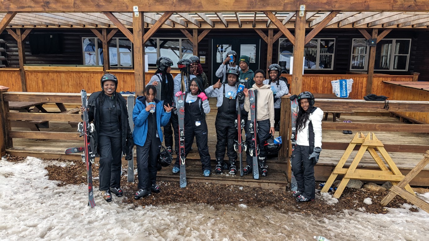
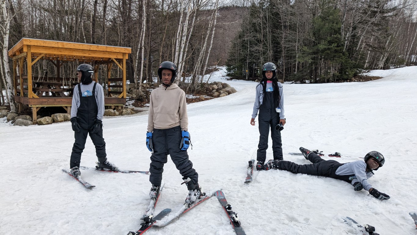
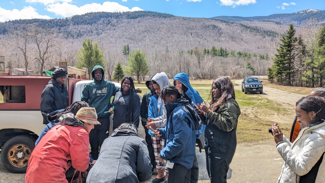
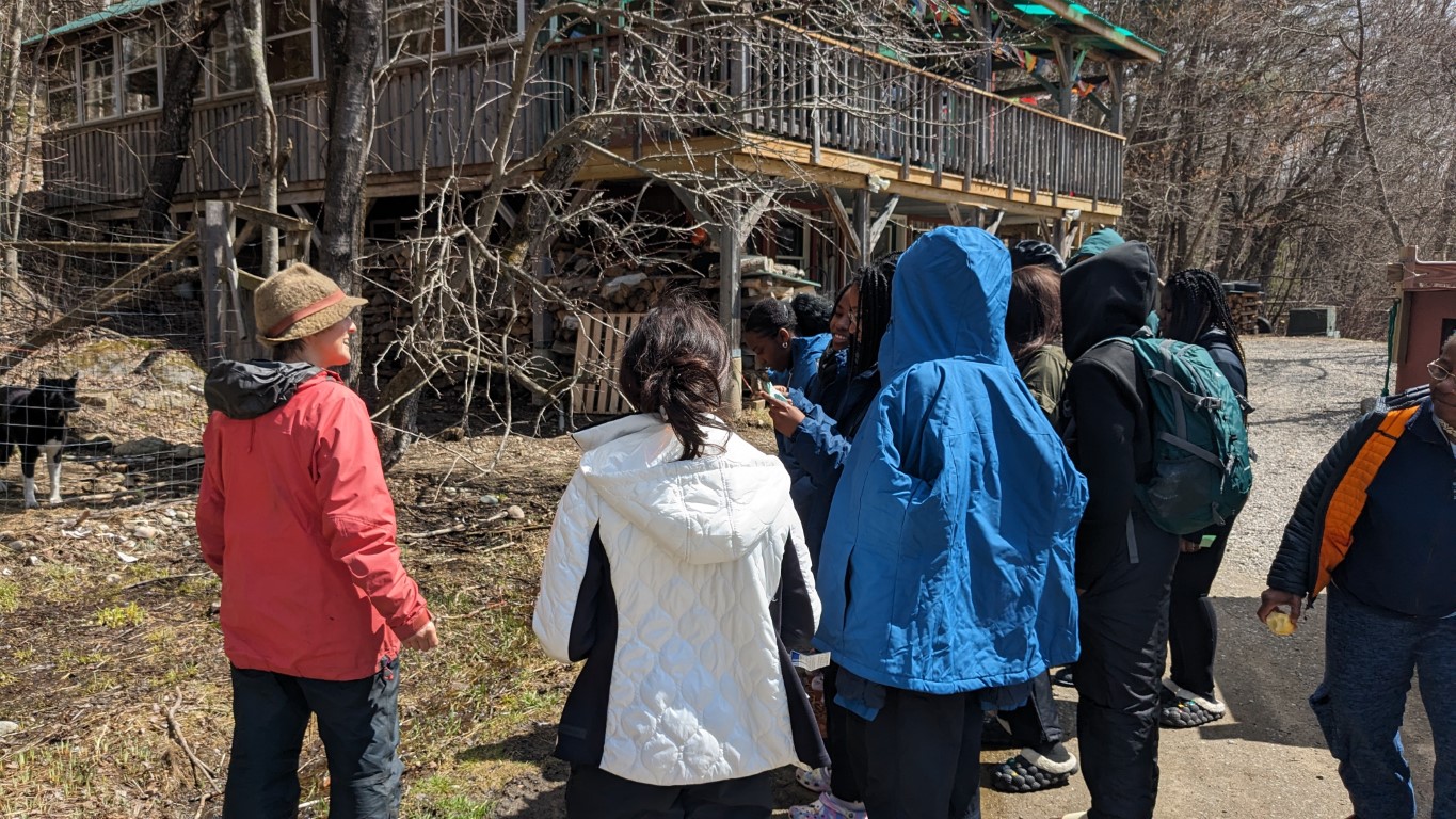
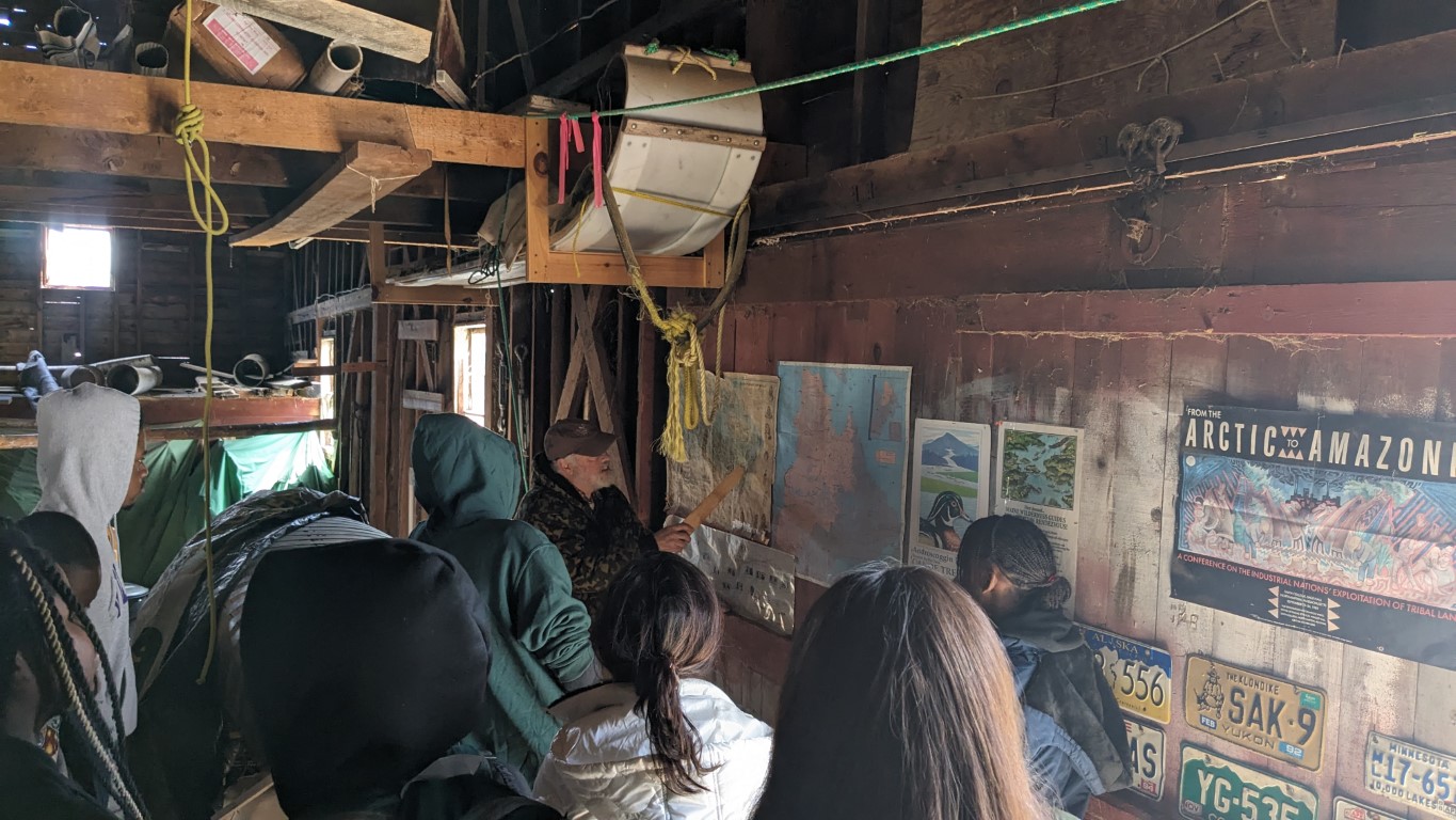
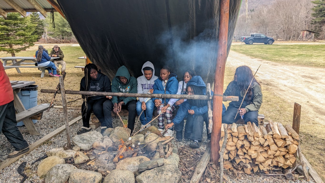
Baldpates Hike Trip Report

East Baldpate
West Baldpate
VICTORY
The bog in question…

By Louise Jensen

The Maine Appalachian Trail Land Trust hosted its first community hike of the season to Baldpate Mountain in Grafton Notch. There are two summits: the somewhat wooded West Peak at 3,662 feet and the wide-open and beautiful bald East peak at 3,780. This rugged hike, complete with bog planks, ladders and open bald ledges starts on the east side of ME Route 26 and follows along on the Appalachian Trail heading northbound.

Five hikers participated this day, two who had not hiked the Baldpates before and were promised a bit of a wow factor. It was a warm, slightly muggy and a little-bit-buggy day but the skies were clear and really, it was an almost perfect day to be on a hike in the Maine mountains. We started out around 9:25 or so, stopping briefly from time to time to sip water, have a quick snack or sometimes chat with AT thru hikers, many of whom are finally heading through Maine. Along the way we took the .2 mile detour to visit the Baldpate lean-to.

We soon arrived at the West peak and sat down just beyond the summit to eat lunch and admire the views looking Northeastward toward the East peak. After lunch, we gathered our things, took some pictures and headed off to the East peak.

No hike can be complete without a minor mishap or two and this day was no different. There is a small boggy area below the summit of the East peak where the bog planking has long since disintegrated. Over the bog are some scrawny tree branches serving as some pretty anemic plank substitutes. Two of our hikers took a nice step into bog while trying to negotiate the “planks”. One ended up with a soggy and completely mud- covered boot, but a dry sock and a plastic bread bag (hiker hack to keep the foot dry from the inside of a wet boot) saved the day.

Up the East peak we went and the wow factor kicked in. The views as you climb up or down from the East peak never disappoint, especially on a clear day like we had. We hung out on top of the open summit with its 360° views and after awhile reluctantly headed back down. The descent was uneventful – no bog mishaps – and we reached the parking lot safe
and sound and quite satisfied with our day’s hike.

LightHawk Flight Over Maine’s Mountains

Spaulding and Sugarloaf Mountains.
Old Blue, Elephant and Bemis Mountains
The Rapid Stream valley between Abraham and Sugarloaf.
Mount Abraham, showing recovery from a forest fire in 2016.

The Maine Appalachian Trail Land Trust has been fortunate enough to complete several projects in the past few years in collaboration with several conservation partners.  Gulf Hagas Whitecap, Redington Forest, Orbeton Stream and Crocker Mountain have all been protected in the past six years.  More projects are in the pipeline, as the Appalachian Trail landscape is seen more and more as one of the last great open spaces in the east.

But with the completion of these projects come obligations to care for the lands.  Some of these conservation lands are now in the care of the State of Maine, but others are either owned by the Maine A.T. Land Trust or protected with conservation easements which require great attention and monitoring.  That’s where LightHawk comes in: their mission is to accelerate conservation success through the powerful perspective of flight.

We’ve used LightHawk several times over the past few years in order to get this aerial perspective of Maine’s A.T. lands.  Getting out by foot always a great way to see the landscape, but you can’t assess large-scale changes and impacts from the ground, or get an overall view of a 10,000-acre parcel.  For this latest flight, we had the services of a professional photographer to help us gather visual documentation of a large conservation easement, take great images for our next round of conservation projects on Maine’s A.T., and check on some other areas that are either difficult to access or at a very large scale.  How has vegetation recovered on the summit of Mt. Abraham?  How is reforestation in the Rapid Stream Valley progressing?  Check out the photos above!

A hearty thanks to LightHawk and our photographer for helping us protect the A.T. landscape in Maine!

Old A.T. Lean-to Found on Conservation Property

On a recent site visit to the White Brook Trail up White Cap Mountain in the 100 Mile Wilderness, staff, State of Maine personnel and the district overseer for the Maine Appalachian Trail Club of the Maine A.T. Land Trust were treated to a rare find: a now-disused lean-to that remains sitting alone in the woods on the former route of the A.T. in Maine.  As you can see from the image, the shelter is in pretty good shape!  Dave Field, Overseer of Lands for MATC, notes:

This is the White Brook Lean-to, built in 1954 in record time from July 31-August 26 by Louis Chorzempa, Donald Chorzempa, Jean Stephenson, Seymour Smith, Manford Knowles, Bert Knowles, Dana Knowles, Douglas Knowles, and Adin Green.  It was abandoned by the White Cap – Gulf Hagas Relocation in 1975.
As you can see from this map, the relocation has taken the A.T. miles from its former route which was almost due north to White Cap Mountain.
Today, the route is located to the west at Gulf Hagas, then traverses the White Cap range from west to east.  The White Brook Lean-to is in decent shape and still contains graffiti from the 1950’s to 1970’s and even beyond, when outdoor activities in the KI-Jo Mary Forest led hikers, hunters and campers down this route.  Logging in the area has opened up the woods so that the location is now close to a road.  This are is a working forest conservation easement that was part of the Gulf Hagas Whitecap project.  It still takes so work finding it, so be careful and be prepared (as always) when you are in the woods!
Thank you to Seth Roope and SDR Logging for showing us this site.

Maine A.T. 2020 Program Receives Grant from the Onion Foundation

The Maine Appalachian Trail Land Trust is pleased to announce that is has received a grant from The Onion Foundation for the Maine A.T. 2020 program!  The program, aimed at empowering Maine’s A.T. stakeholders, local communities, kids, the public and more through outreach and an ecological report, highlights the Appalachian Trail area is the last great wild space in the entire Eastern United States. The portion running through Maine is the most significant – for ecological value, as a climate corridor, as a refugia for
species adapting to climate change, as a recreational destination, and as the last wild place east of the Rockies.

By giving local communities here in Maine the tools they need to leverage this landscape, we are looking towards outcomes of local economic development based on a recreation resource, revitalization of communities around Maine’s A.T., increased health of people and landscape in era of changing climate, and a fostering of a culture of stewardship and environmental awareness which Maine’s A.T. landscape needs.

The Onion Foundation is a private philanthropic foundation based in Maine with a mission is to encourage conservation and stewardship of the natural environment and to promote music and the arts in the state of Maine.

The Maine A.T. Land Trust is excited to unveil this program with the help of The Onion Foundation.  This landscape of the Maine North Woods is recognized as of international importance but until recently, the A.T. was considered just a trail for long-distance hikers. It was not looked at as a conservation corridor, or as a contiguous wild greenway, or as an area where local economic development initiatives could take root and increase opportunity and prosperity for communities nearby, based on the outdoor recreation economy.

The Maine Appalachian Trail landscape is now under threat from multiple sectors: real estate development, climate change, energy transmission infrastructure, over-exploitation of natural resources, loss of public access, diminished natural resource quality, decline in water quality, fragmentation of the landscape, loss of species habitat, loss of biodiversity, loss of the great natural beauty and sense of remoteness that embodies the forests of Maine.  The Maine A.T. 2020 Wild East campaign comes at a critical moment and with grants like this one from The Onion Foundation we can help this landscape!

Portland (Maine) Area Thru-hikers Group Formed!

Are you a thru-hiker?  Do you live, work, visit or enjoy Portland, Maine?  Then head over to this page and sign up for a new group that plans to meet every once in awhile to discuss the latest on the A.T., network and enjoy some food and beverages!

There is no cost or obligation to join.  It’s a new group and some folks want to see if it takes off so sign up!

Flagstaff MH&T Hut Snowshoe Hike

On Flagstaff, Bigelow Range in the background.
Wind sculptures on the lake.
Lunch!
Wooooo

By Louise Jensen

“It’s a beautiful mornin’
I think I’ll go outside a while,
And just smile.
Just take in some clean fresh air, boy
Ain’t no sense in stayin’ inside
If the weather’s fine and you got the time.
It’s your chance to wake up and plan another brand new day.” – The Young Rascals

That pretty much summed up the start to our day: bluebird sky, no wind, late winter temps and nine happy snowshoers ready to go for what turned out to be a glorious day on the trail and at the Hut. We had the pleasure of having Savannah Steele, the Maine Huts & Trails trails manager, join us for the day. We met at the Long Falls Dam Road trailhead around 10am and soon headed out on the trail. For the most part, the trail was broken out, but due to the “lake effect” there was a lot of drifting which made navigating a little tricky. Fortunately, we had Savannah along who knows the trails like the backs of her hands and guided us in the right direction. As the lake was frozen and beautifully covered with whirls and coils of wind-blown snow, we snowshoed right on the lake where we were treated to magnificent views of the Bigelow Range, Picked Chicken Hill and Blanchard Mountain.

Although a relatively short hike of just over 2.2 miles, we still worked up an appetite and were famished by the time we arrived at the Hut. Savannah introduced us to the crew, and then chatted with us about the MH&T organization while lunch was being prepared. Food is available for purchase for day-hikers so we feasted on cheese platters, chicken soup, root vegetable bean soup and some incredible butter biscuits. After lunch, Pearl, one of the crew staff, gave us the “talk” that is routinely given to the overnight guests,
and it was very informative.

Lunchtime was leisurely as the Hut is cozy and warm, but we finally broke out of our food stupor and headed back out for the hike back. Clouds started to roll in, no doubt a harbinger of the approaching storm predicted for the next day, which gave our late afternoon vista an entirely different appearance. We took our time heading back while continuing to take in the beautiful mountain panorama. It was a beautiful day!

Louise is the Maine Appalachian Trail Land Trust’s board secretary.  In her day job, she’s the law librarian at Drummond Woodsum. She joined the Board after becoming a trip leader for MATLT. She lives in Portland with her husband and their greyhound Tulah.

Four Ponds Hike with the Ladies Adventure Club

By Meg Clews
 
On a brisk February morning, a group of intrepid women gathered in Portland to organize the carpool up to Height of Land, 30 miles north of Rumford, where out trek would begin. Also joining us was Simon Rucker from Maine Appalachian Trail Land Trust who would be one of our two guides for the day. We left Portland around 7:30 in two vehicles.  One car made a brief stop at the Lewiston Park and Ride to pick up Mark (our other guide) and his trusted canine companion Benton. After a brief pit stop in Rumford for humans and dog, we arrived at the parking area at Height of Land around 10am. Another car with 4 more LAC members joined us there, and we all headed out at 10:20. The view to the Northwest, over Mooselookmeguntic Lake and beyond was clear and beautiful!  With snowshoes on, we hiked south along Route 17 for approximately .4 miles to where the AT crosses the road. Here, we headed north on the AT.  Right away, the trail went steeply up Spruce Mountain, through deep, soft snow. Several of us took turns breaking trail, which was hard work, but served to warm us up! After the strenuous uphill, the trail leveled out, and we had to make a few detours around some blow downs. We saw moose tracks and scat along this section. The snowpack that we were on top off was at least 3 feet deep – you could tell by the white blazes on the trees that mark the AT – they were about 2 feet above the snow and these are usually just above eye level in the summer! There was another climb, and then we went down and crossed a well groomed snowmobile track. From here, we trekked along a gentle down hill, and then a level section which had very deep snow with uneven terrain. At one point while Gillian was in the lead, one of her snowshoes went in so deep she become stuck in the snow. It took two of us about 10 minutes to dig her out. There were Gray Jays at one point, and one that landed on an outstretched hand!  Eventually we arrived at the north shore of Moxie Pond and around 1:15. Here, we stopped for about 30 minutes for a standing room only lunch, and a group photo. Everyone was staying warm and dry, and there were plenty of hand and foot warmers to go around. Simon and Gillian had plenty of yummy snacks to share. 
 
The return trip was much faster than the way in – we were following a nicely packed trail and made excellent time, returning to the parked cars around 3:15pm. There was a gentle snow falling as we hiked out, and when we reached Route 17, the view was completely clouded over and a strong wind was blowing across the road. I estimate our  total mileage was around 4.5 -5 miles round trip. 
 
I went to bed that night with a perfectly drowsy and happily satisfied feeling after my first day out with The Ladies Adventure Club! 
 

West Baldpate Trip Report: The Uses of Adversity

Group shot!
Frosty John (photo courtesy of Deb Hews!)
Heading down.

Winter can be tough in Maine.  It’s cold, it’s snowy, it’s dark and all of it together can make life hard if you let it get to you.  But there’s also something wonderful about winters on the A.T. lands of Maine where just making it through can be much more meaningful than doing the same thing in the summer.

This has been the pattern so far our the Maine Appalachian Trail Land Trust’s winter hikes so far in 2019.  Unbroken trail, super cold conditions, illness, fatigue, freezing extremities – they’ve all played a role in our trips.  West Baldpate via the Appalachian Trail was similar – half the group made it to the summit, half the group did not.  Once again, the temperature was 1 degree above zero when we set out.  The wind chill was relatively low, however, the trail was broken out so conditions were pretty good.  The group as a whole made pretty good time, but was spread out along the trail.  It’s pretty steep in the upper sections of the A.T. and the conditions took their tool.  Cold toes.  Bad knees.  Fatigue.  Four made it to the top and collected the others on the way down.  No regrets.

And just look at the scenery!

Our next hike will be Sunday, January 27th to Eddy Pond and Piazza Rock.  Sign up here!  


Little Bigelow Trip Report

Scenes from the hike.
Heading up in the sun.
Selfie
Great views northward along the A.T.
Bright and cold.

Little Bigelow is such a nice hike – great terrain, awesome views, deep woods – that this latest Maine Appalachian Trail Land Trust hike was full months ago.  Then, early last week, the forecast started taking shape.  A few people decided early on to drop out and seek alternate plans.  A few days later, the forecast seemed rock solid: it would be cold, but the big issue would be the bone-chilling winds.  A few more people dropped out.  A core group of five decided to proceed with the hike and pay it by ear, knowing that the conditions would be chilly.

And they were right.  The coldest spot was probably the parking area on East Flagstaff Road when everybody was gearing up.  It was about 0 degrees and would remain there for the rest of the day.  The group was adequately covered and layered so everything went pretty smoothly in the sunny woods.  There was a fresh foot and a half of snow to be broken through, on top of a few feet that was already there, so it was not a speed hike.

At higher elevations past the junction with the A.T. shelter side trail, conditions were much colder and the winds had yet to diminish.  Despite adequate footwear and even toe warmers, feet started getting cold and not warming up.   Everybody knew at that point that we’d at least reach the open ledge below the summit of Little Bigelow, but not the peak itself.

Which was fine!  It was a great day out on the A.T. and we all had fun.  Our next hike will be on Saturday 1/19 up West Baldpate in Grafton Notch.  Still a few spots left!

SCALE UP Program Receives Grant from Maine Community Foundation

The Maine Appalachian Trail Land Trust is pleased to announce that the organization is the recipient of a Maine Community Foundation Fund for Maine Land Conservation grant for 2019!  The SCALE UP program aims to engage MATLT’s corporate members by directly connecting these companies and their employees, officers and partners to the A.T. landscape in Maine.  We’ve had great success with the program so far, in its first year, and we’re hoping to continue it beyond 2019!

The Maine Community Foundation, now in its 35th year, works with donors and other partners to improve the quality of life for all Maine people. The community foundation is committed to serve all of Maine; demonstrate respect for people and places; achieve quality and integrity in everything we do; and remain nonpartisan. MaineCF is committed to equality, diversity, and inclusion, and ensuring Maine is a safe, welcoming, and accepting place for everyone.  The Fund for Maine Land Conservation supports projects that advance land conservation.